Heading east out of Reykjavik on Route 1 on the south coast takes you past volcanoes, waterfalls, nature reserves, glaciers, black sand beaches and a truly dramatic coastline. There are coach excursions from Reykjavik to the waterfalls and Black Sand Beach but I would recommend hiring a car if you can. The drive from Reykjavik to Jokulsarlon, [The Glacial lagoon] takes about 5 hours and that is non stop- and assuming you are driving you will want to stop- alot! So I would recommend a stop over [or two], Vik is a good option.
| We have driven along this route a few times now, the last time was part of our road trip around Iceland on the Ring Road [Route 1] when we focused on visiting sites that we had not seen before and are not included on this page. For more info and more photos click HERE. |
Waterfalls
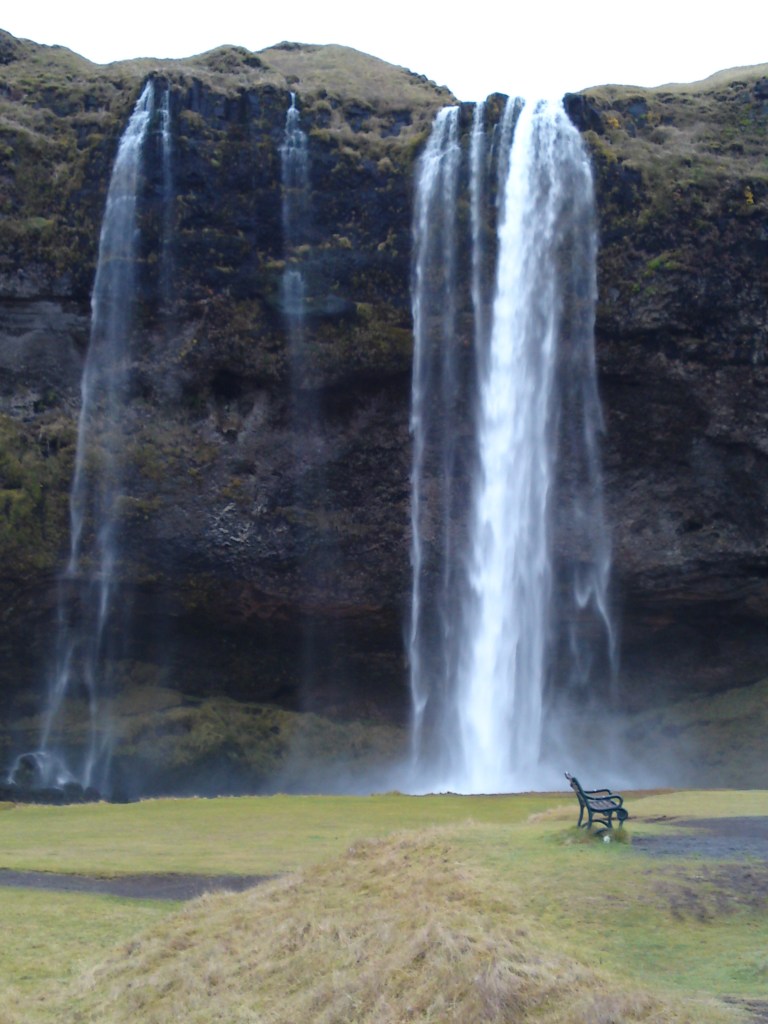
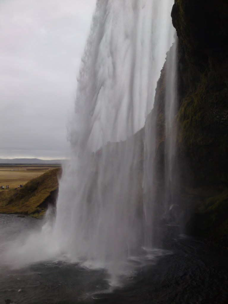
You can see the dramatic waterfall of Seljandsfoss on your left from the main road and there is free parking. There is a very slippery and wet path which takes you behind the falls.
Not far away is Gljufuarbui which tumbles into a hidden crevice in the rocks.

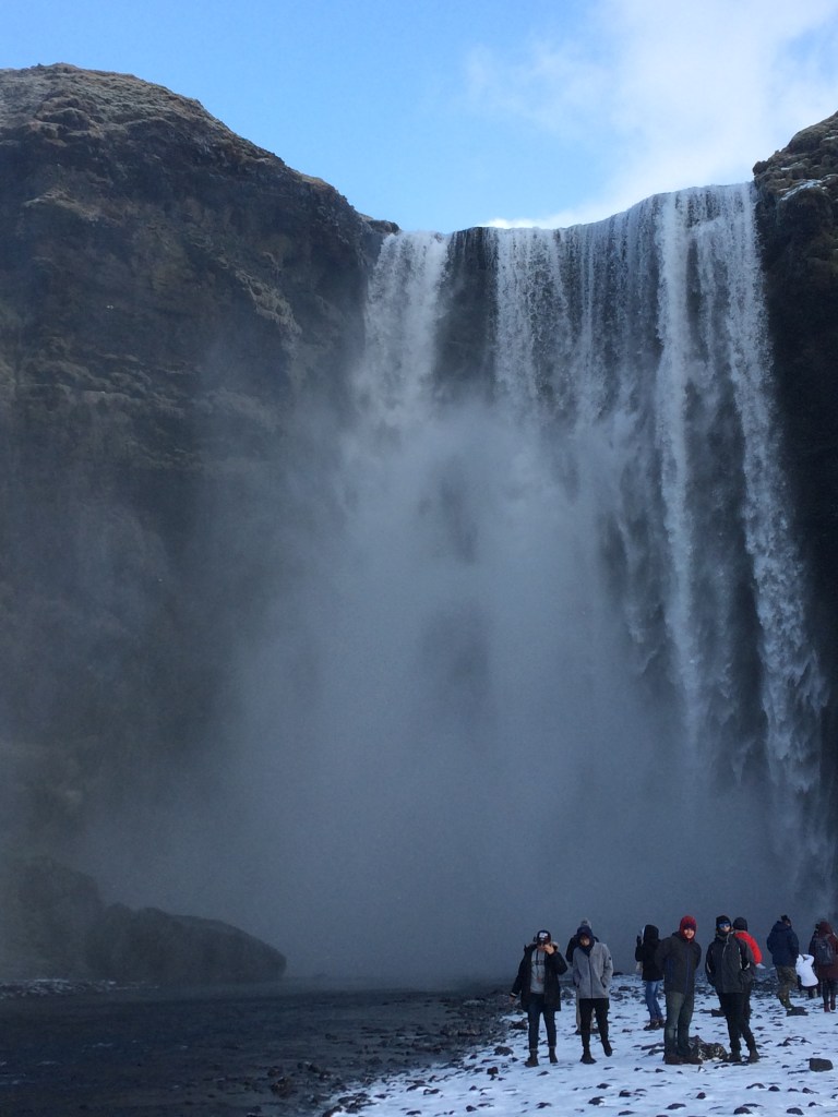
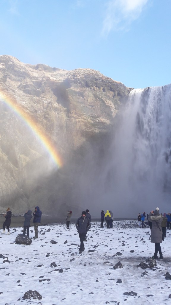
Skogarfoss, a few miles further east is just as dramatic and there is a steep path to the top where you can take in the views.
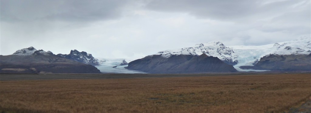
Sólheimajökull Glacier.
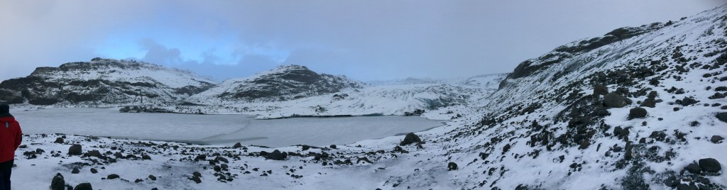
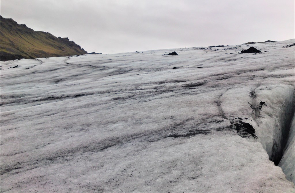
This is one of the most accessible glaciers and is part of the larger Myrdalsjokull ice cap which covers the volcano Katla. You can drive quite close to it and then there is a short slippery walk from the car park. In 2009 there was a dirt track off Route 1 that led to the car park. We were able to carefully walk on the glacier, but it was not safe to stray far.
Sólheimajökull in 2009
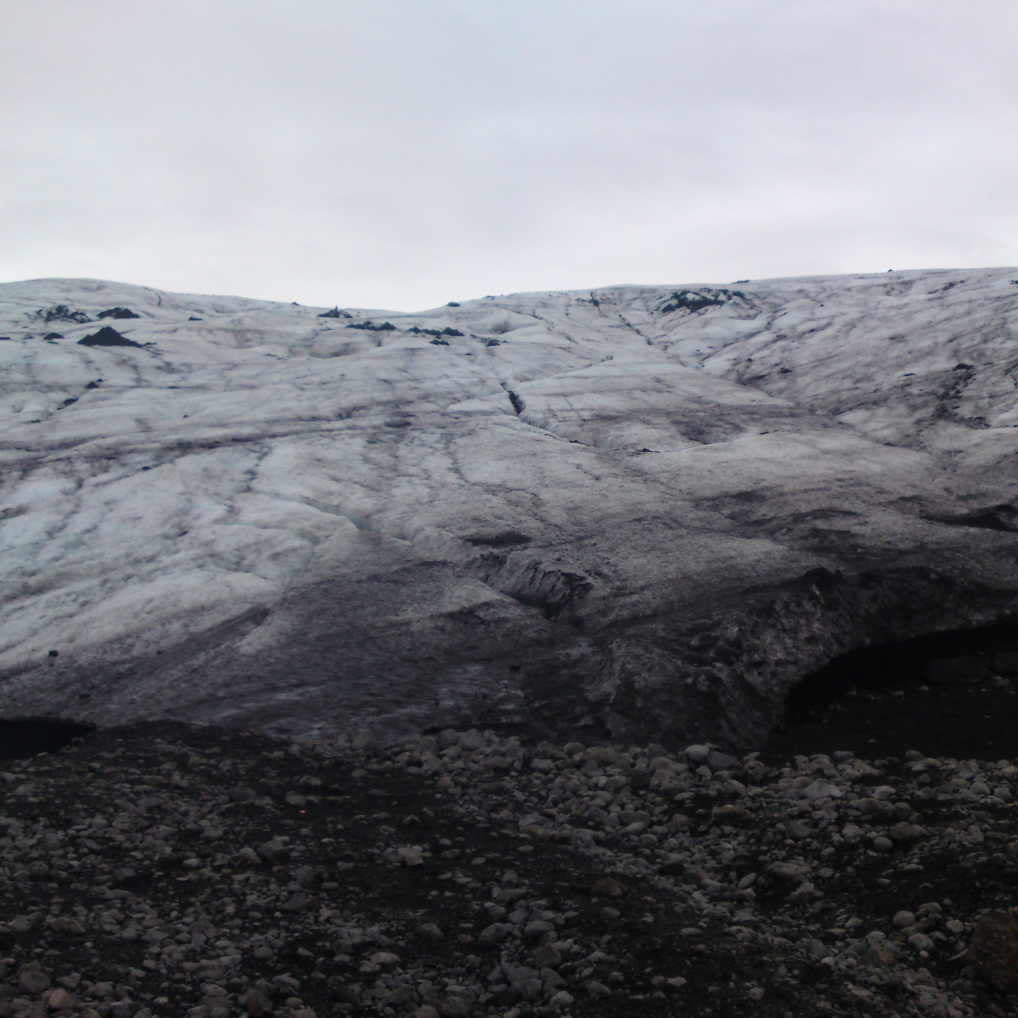
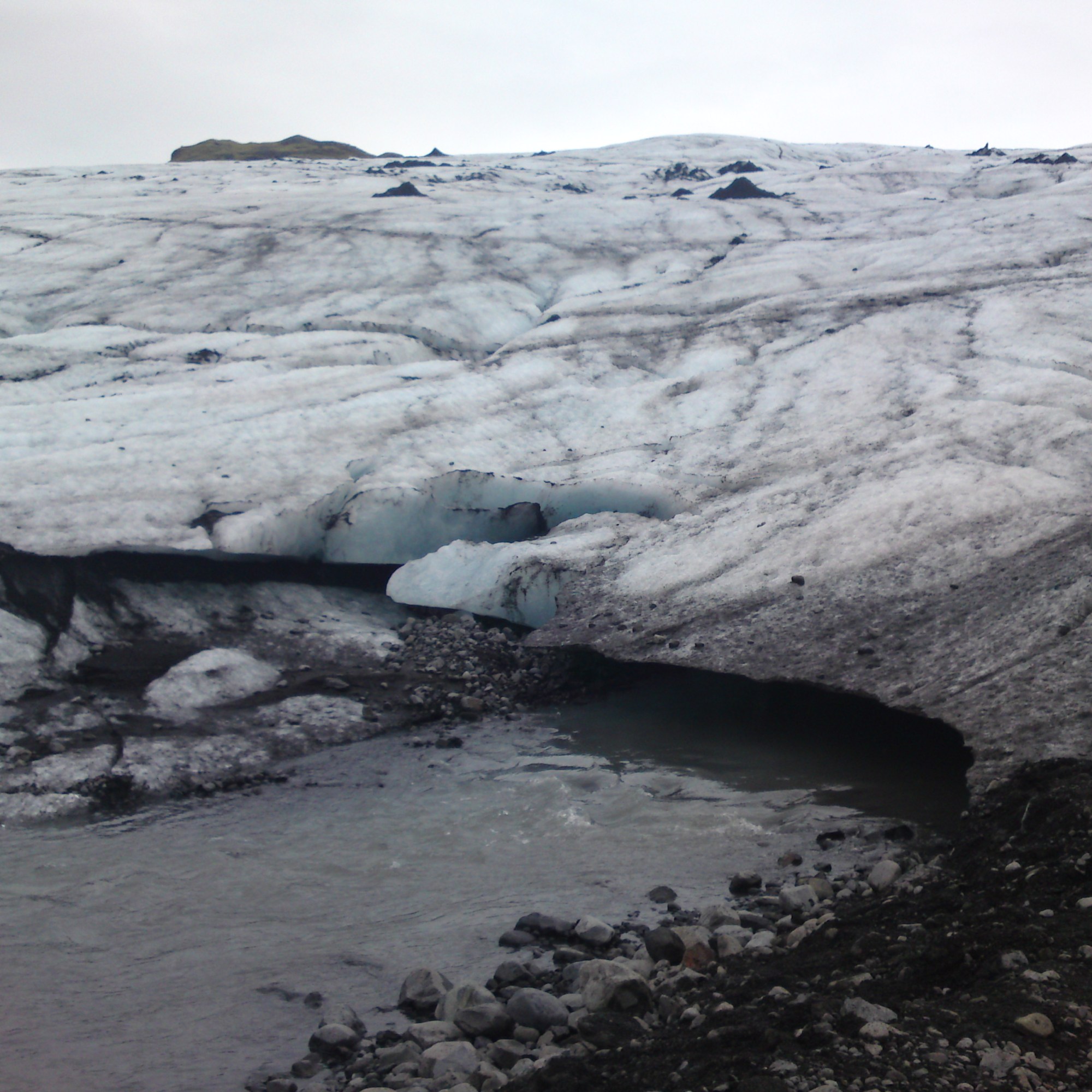
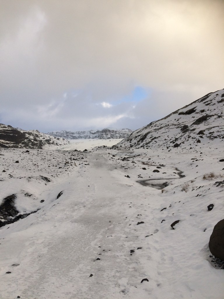
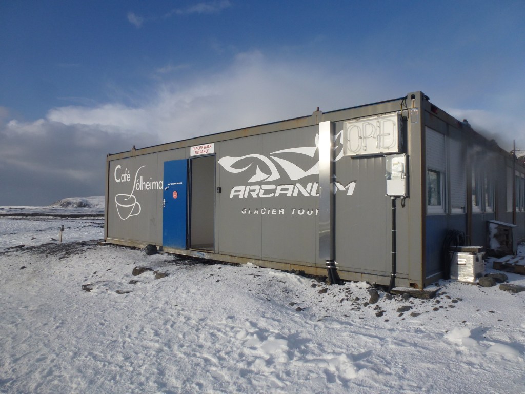
When we revisted in 2017 this road had been tarmacked and there is now a basic but welcome cafe with toilets in a shipping container by the car park. The glacier had retreated several hundered metres since our last visit which was a bit of a shock. Even though the walk to the glacier was not far, the day we visited the weather was pretty extreme and the path was very icy. It was hard work to stay on your feet and it was so cold our faces hurt. Walking on the glacier was a complete no-no this time as it was too dangerous due to calving.
Sólheimajökull in 2017
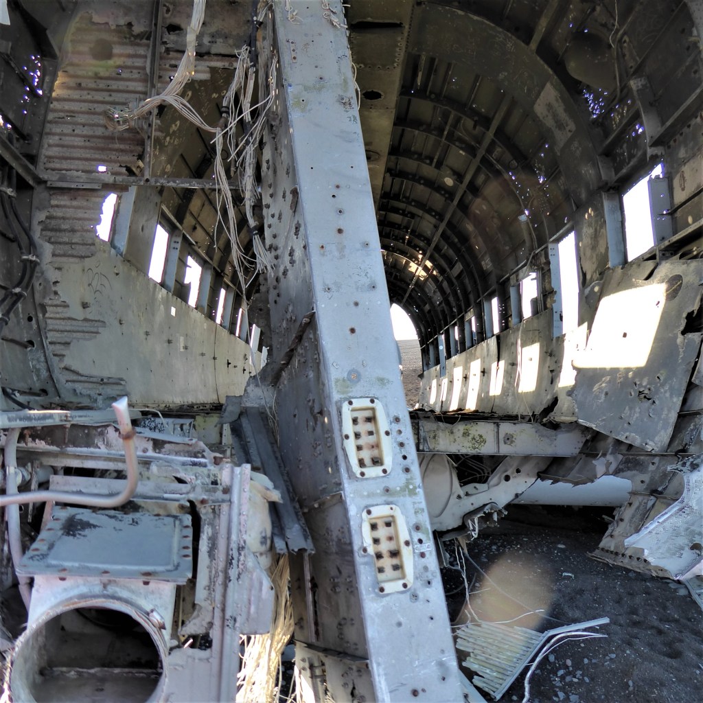
Plane wreck at Sólheimasandur
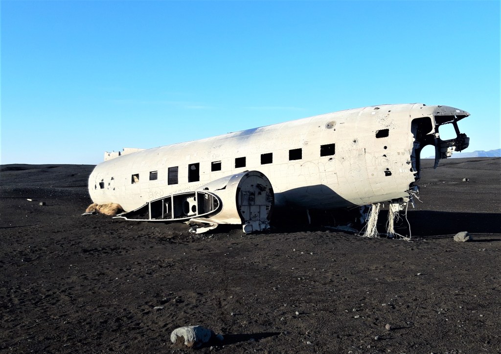
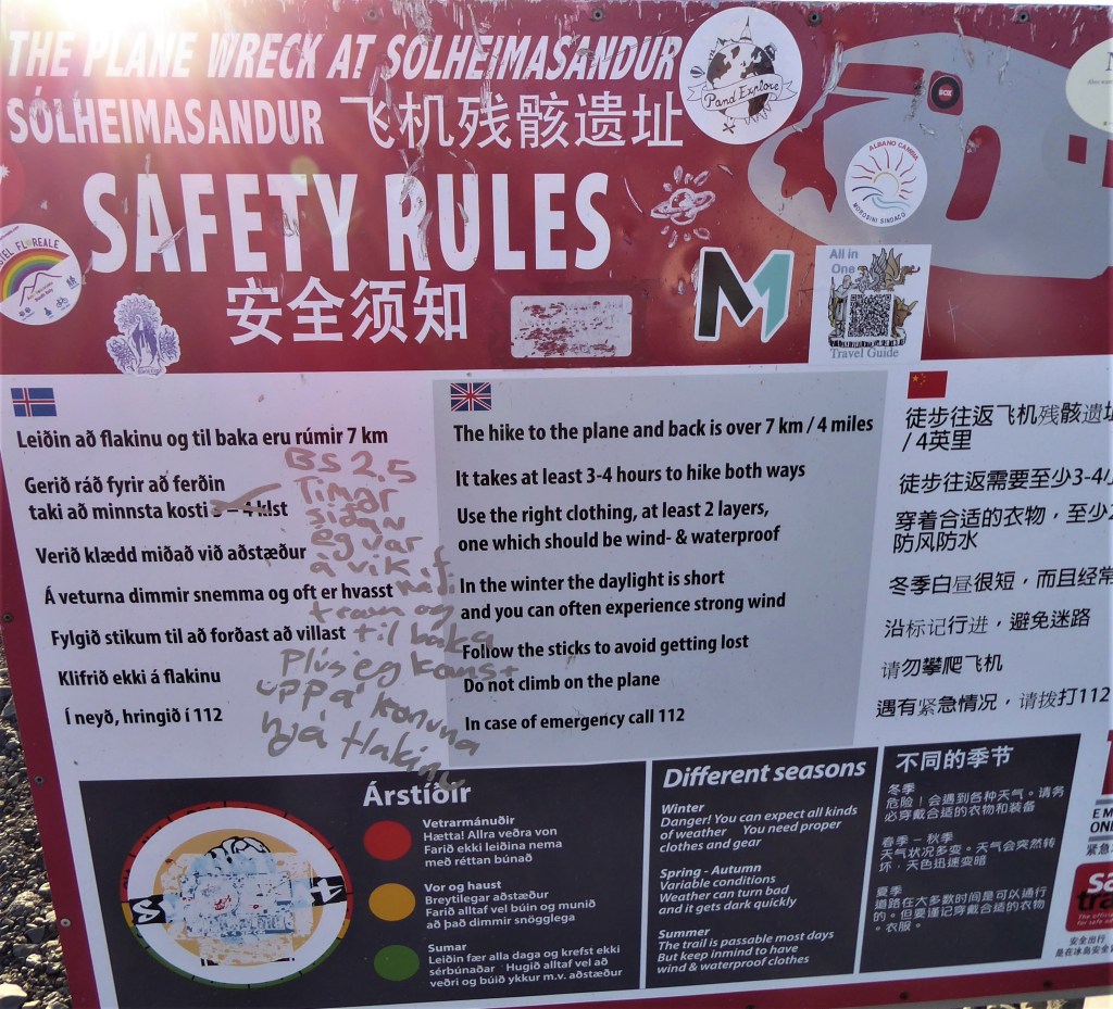
Not far from the Sólheimajökull glacier is this evocative wreck of a DC-3 which crashed in 1973 [everyone survived]. The plane is just a shell now but it’s been used as a backdrop in several films and I have wanted to visit this site for ages! The walk there from the car park takes about 40 minutes although a sign by the car park warns it could take 3-4 hours there and back. Although the path is flat it is a bleak trek. We had the sun in our eyes on the way to the plane and could not look ahead, we then had an icy wind blowing in from Katla on our return to the car and it was painful to look up!
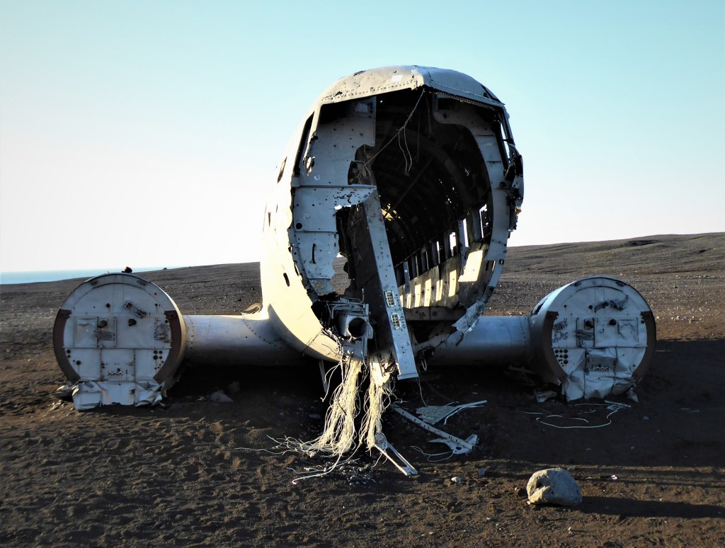
In 2020 two tourists became lost in a blizzard and died of exposure visiting the crash site, so do not attempt this journey in adverse conditions. You are not meant to climb onto the wreck itself and Leashia and I did not feel the urge, unlike Justin Bieber who for some reason decided to skateboard on it in one of his forgettable music videos.
Dyrhólaey
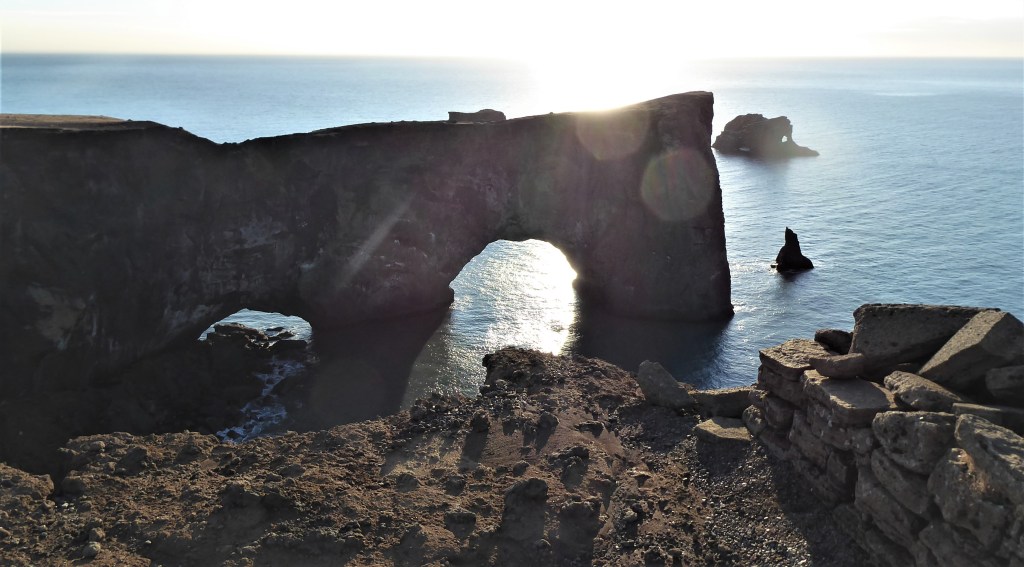
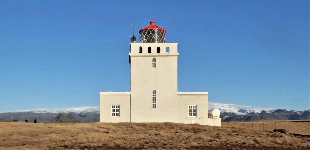
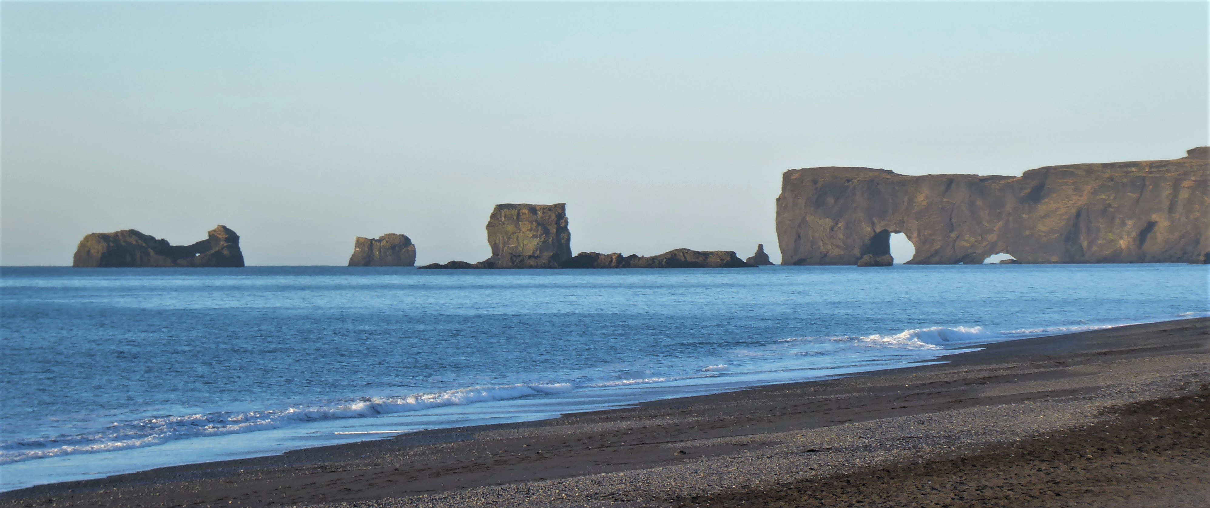
Just beyond Sólheimajökull to the west of Vik is Dyrhólaey, which is the southernmost tip of Iceland. It is a nature reserve and in the summer is home for an abundance of nesting puffins and many other species of birdies. It’s also well known for a rather impressive sea arch. You can look down on to the sea arch from near the lighthouse, but the best views are from the Black Sand Beach at Vik.


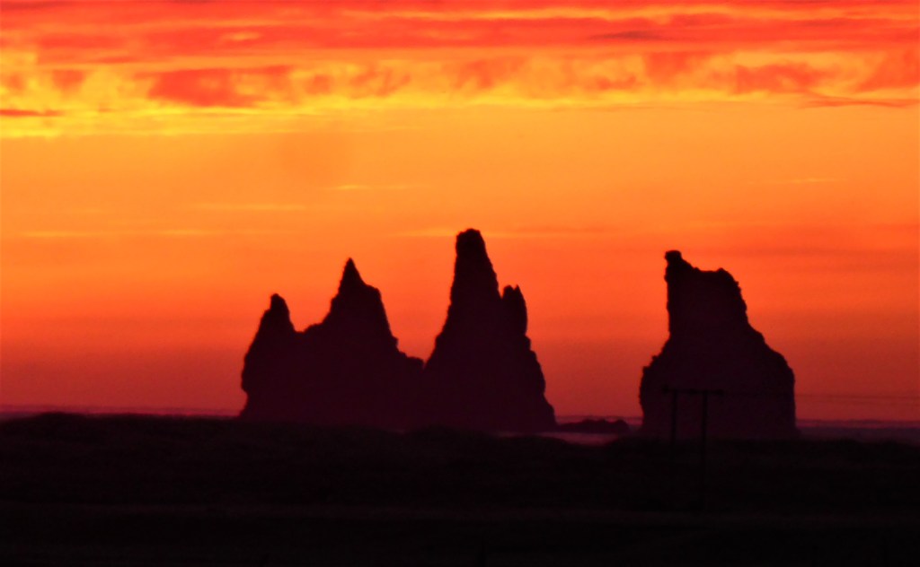
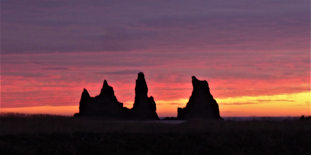
Black Sand Beach [Reynisfjara]
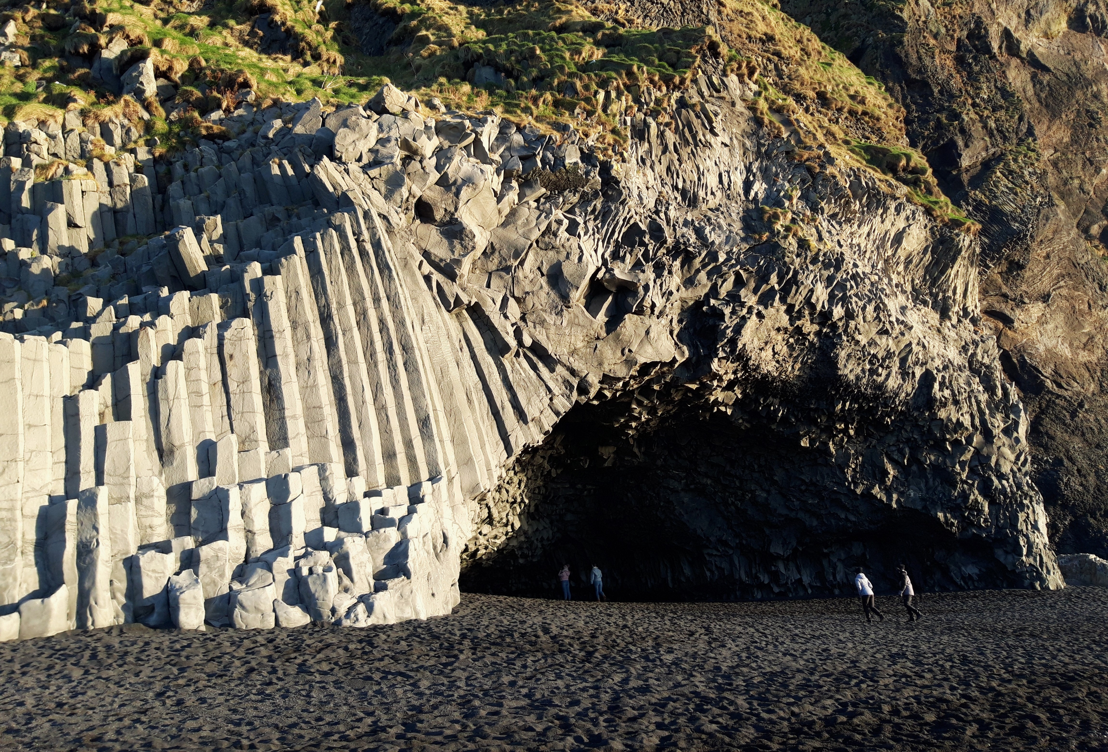
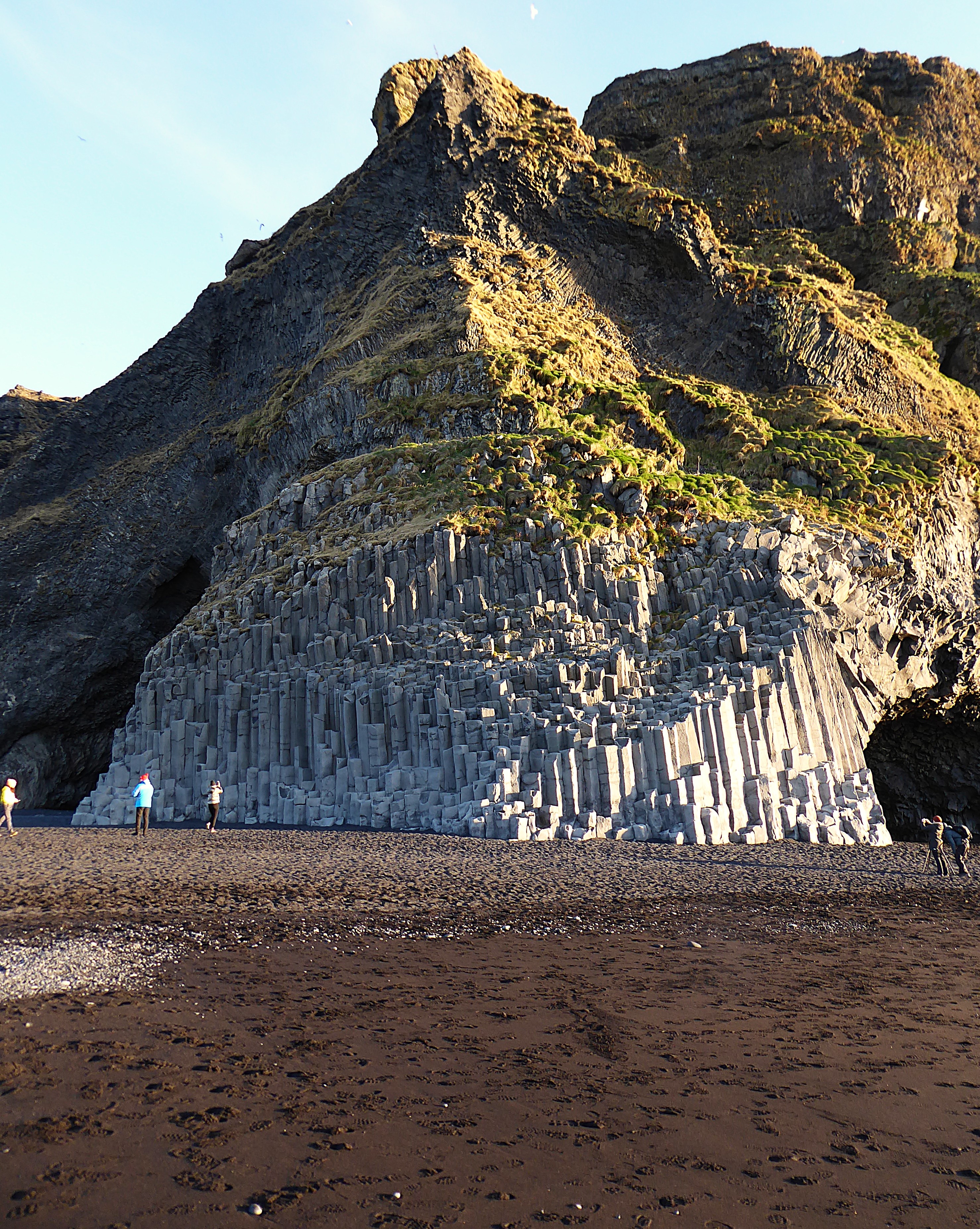
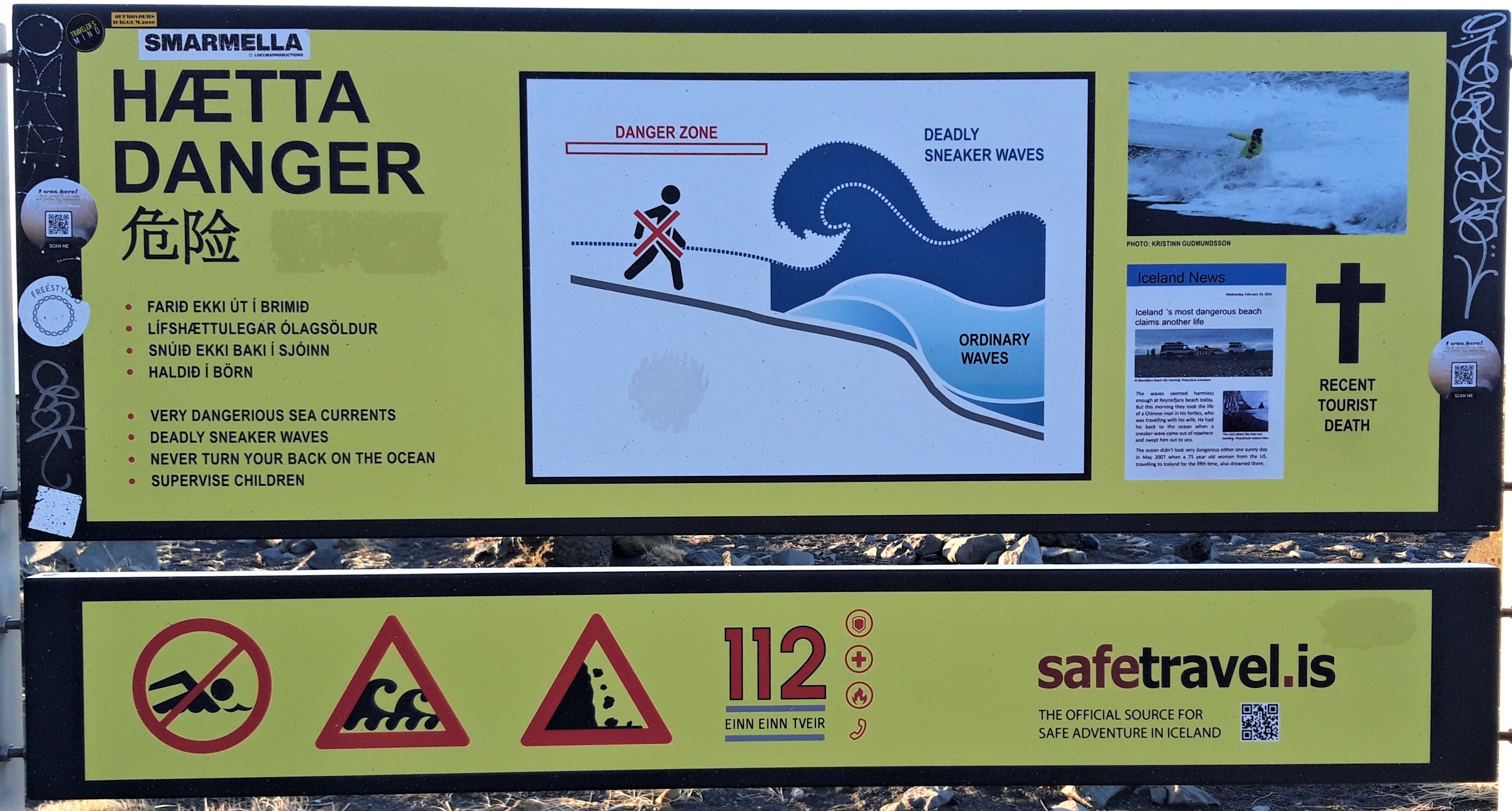
The sea stacks and the beautiful basalt columns are to be found on Reynisfjara beach near Vik. There are also wonderful views of the Dyrhólaey sea arch to the west. A word of caution – the sea here is very dangerous and sneaker waves can catch you unawares. Only a week after our visit a tourist was swept out to sea and drowned. Several people have drowned here since I last visited including a nine year old girl. PLEASE HEED THE WARNINGS !
Vik
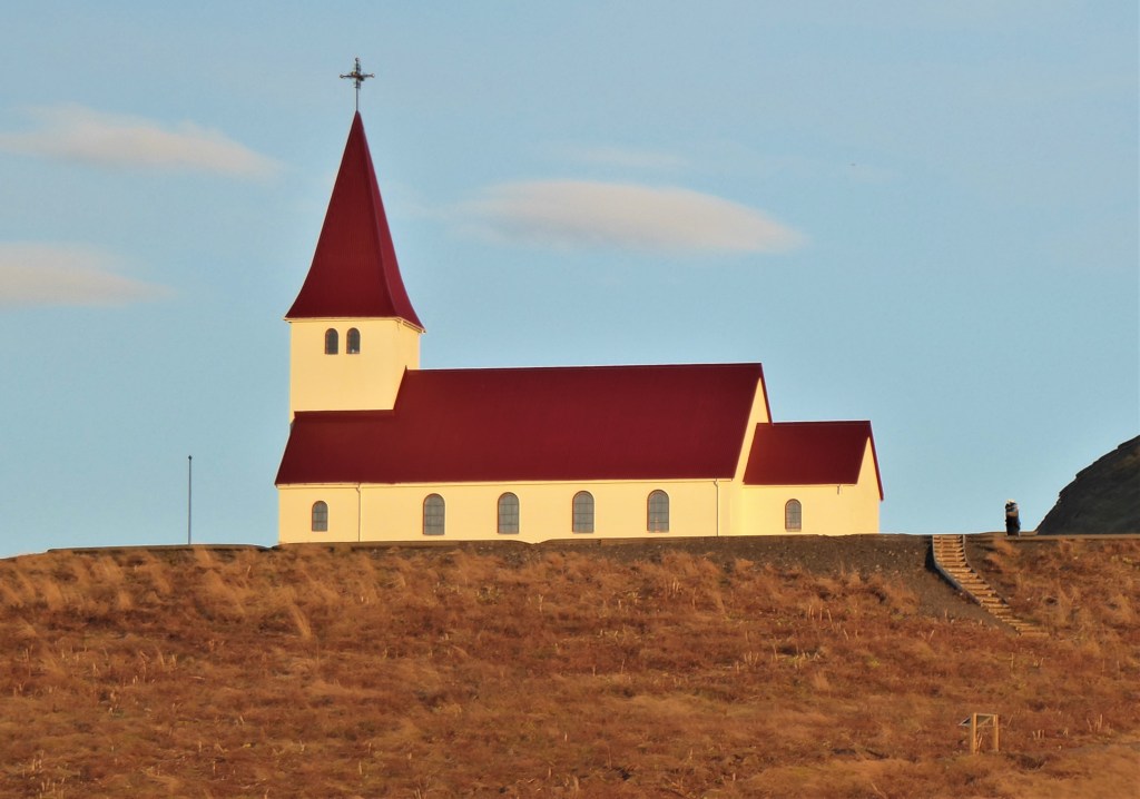


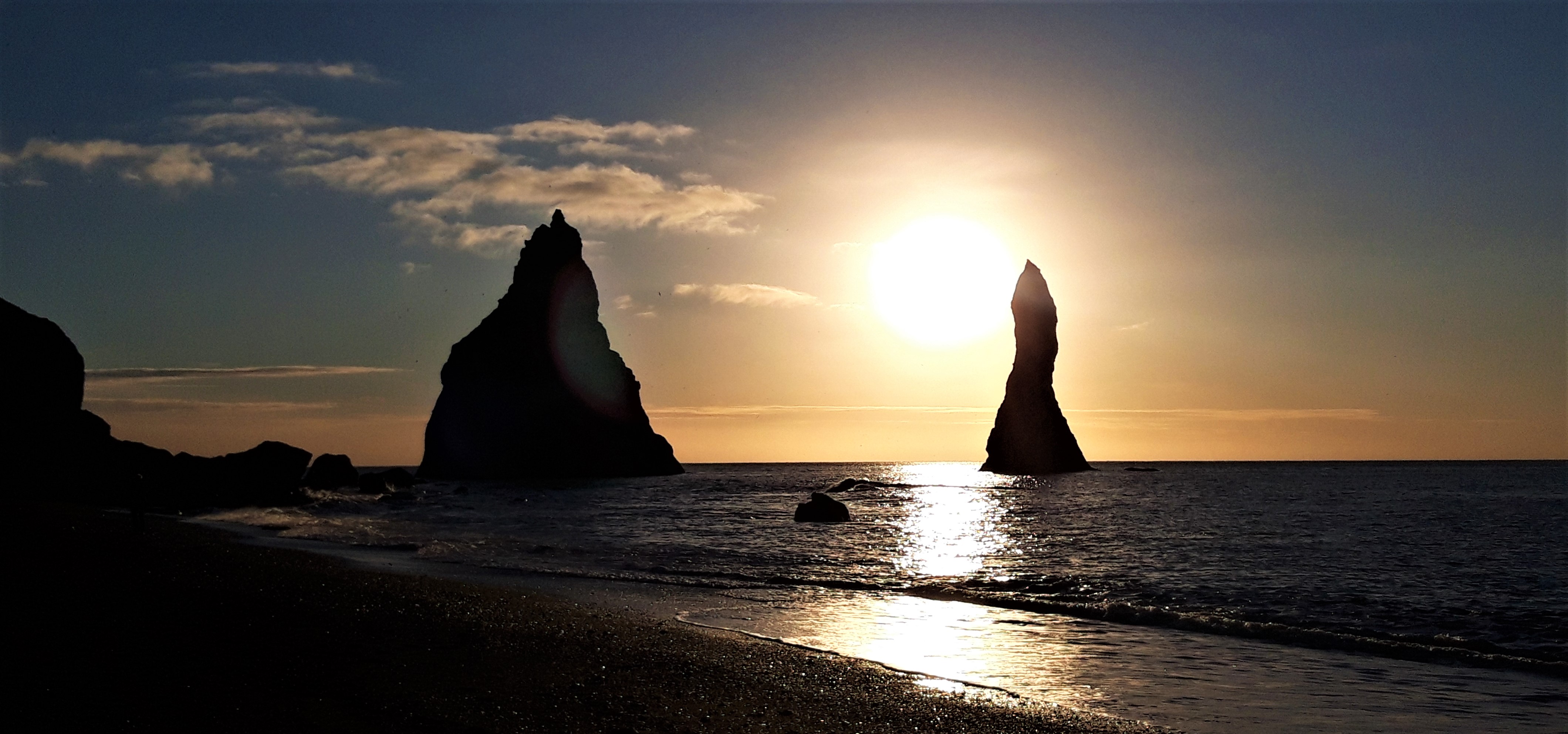
We stayed at Vik for one night in 2021 and it was the perfect base for seeing all of the sights on this page. The town is overlooked by a red roofed church and the Reynisfjall Ridge. We arrived in the early evening from the west and were greeted by a wonderful sunset over the sea stacks. There are a few bars and restaurants [we liked the Strondin Pub] and a range of accomodation to choose from but it’s advisable to book in advance.
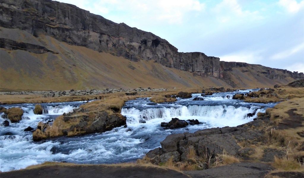
Fjaðrárgljúfur Canyon

This beautiful canyon may not be the hidden treasure of old but it is well worth the short detour off R1. The canyon was carved out by the Fjaðrá river and there’s a path along the side of the canyon to some viewing points. The path to the viewpoints takes around half an hour.
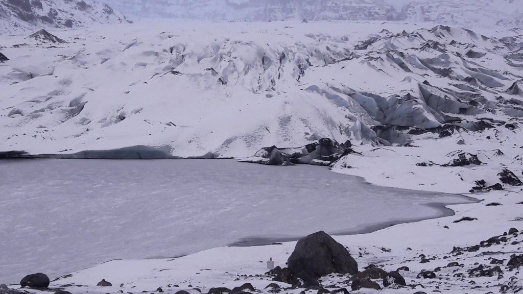
Fjallsárlón

Just a few minutes drive before you get to the very well known Jökulsárlón is a smaller and lesser known [and less busy] glacial lagoon. You can’t see it from the road but it’s only a short walk from the car park and the view of the lagoon in front of the Fjallsjökull glacial tongue is stunning. The restaurant Frost is by the car park if you are feeling peckish.
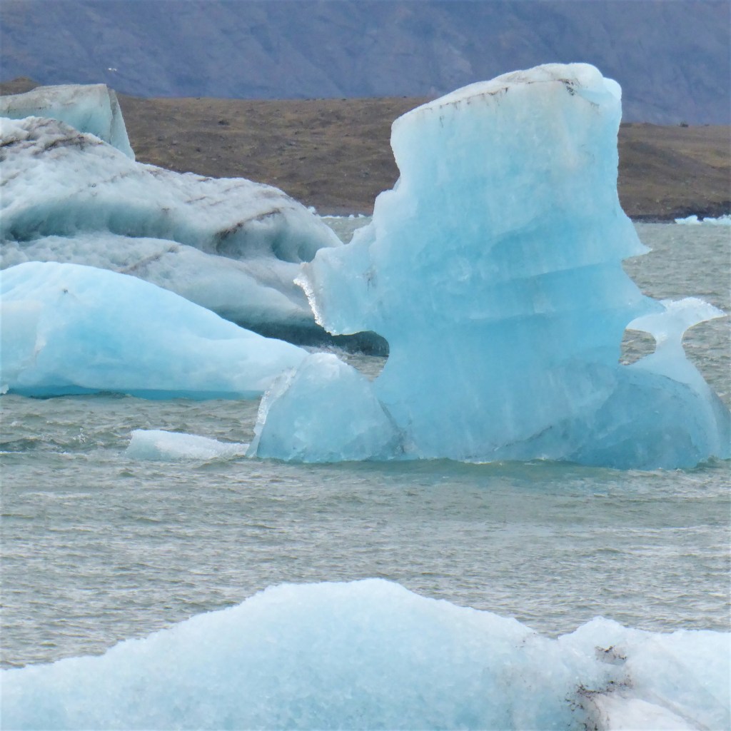
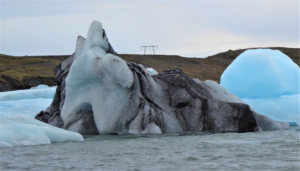
Jokulsarlon
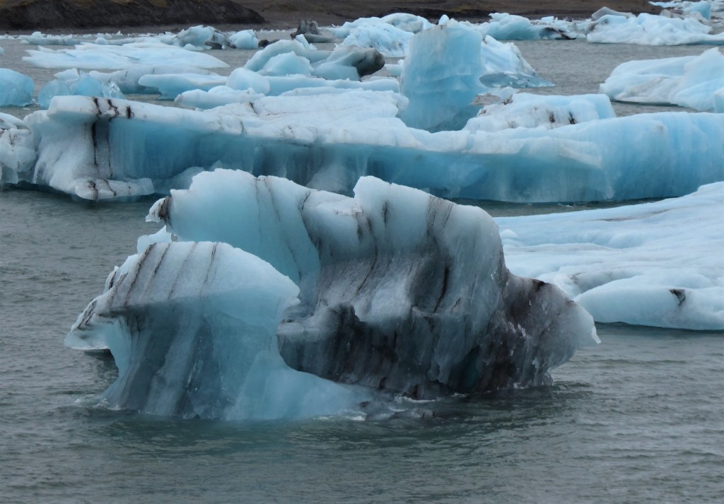
A further two and half hour drive east of Vik is Jokulsarlon, the Glacial Lagoon. It’s just by the main road and is absolutely amazing! Coach excursions from Reykjavik do visit here but be prepared for a long 14 hour return trip. The lagoon has been created by the retreating Breiðamerkurjökull Glacier so sadly it is another sign of climate change.
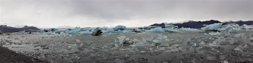
The lake is increasing in size every year and is the deepest in Iceland. Watching the Icebergs is just mesmerising and a magical experience. I have so many beautiful photographs of Jokulsarlon that I now have a Pinterest board dedicated to the Glacial Lagoon.
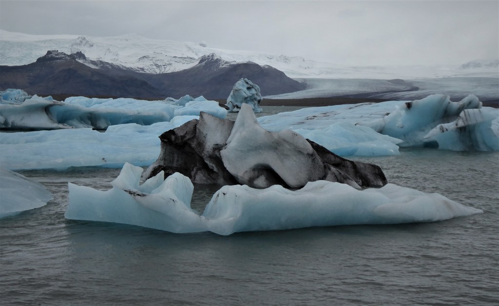
The main car park is over the bridge and there is a cafe and free toilets- yay! You can go on a boat ride on the lake if you want but Leashia and I were more than happy walking along the shore marvelling at the colours and form of the glaciers and looking for seals.
I would also recommend parking before the bridge as you can stroll along the quieter west side of the lake where you can get another perspective.

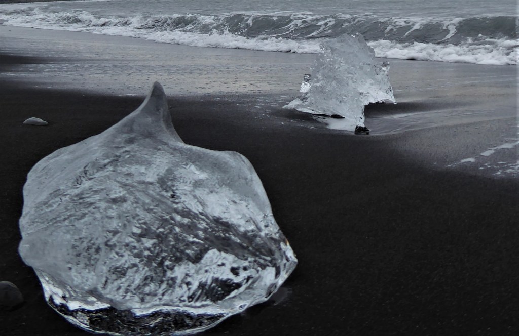
On the other side of the road from the main car park is another car park for Diamond Beach where you can see the glaciers in their final resting place before they disappear forever.

Quick Links:
