This page covers the final leg of our road trip, days 13 to 16 of our journey from Höfn to Keflavik including Jökulsárlón, Fjaðrárgljúfur Canyon, Heimaey and Landmannalaugar.
| We chose not to revisit many of the wonderful sights near the Ring Road on the south coast- such as the waterfalls, Black Sand Beach, The Golden Circle and Reykjavik because we have seen them before [more than once] and I have written about them on my website of course For more information click HERE |
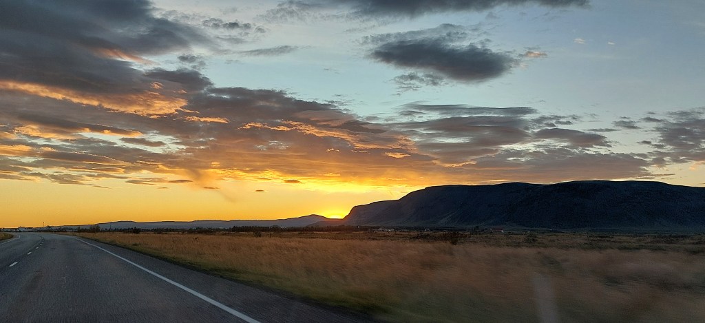
Day 13. The road to Vik
We left Höfn by mid-morning for our next destination: Diamond Beach which we had visited a few years previously. On that occasion the ‘diamonds’ on the beach were not too impressive so we hoped for a better display this time around. We didn’t have to worry!
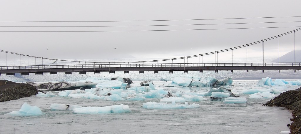
Route 1 crosses the Jökulsá river on a narrow bridge next to Diamond Beach and Jokulsarlon and you can see the bergs from the road.
Diamond Beach
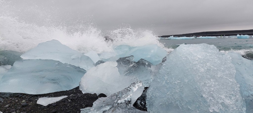
Diamond Beach is where glaciers from Jökulsárlón go to die! The black sand beaches are either side of the Jökulsá estuary and we visited both sides. The shapes and forms of the bergs on the beach appeared truly magical and although it was a wonderful experience walking amongst them it was also a sombre reminder of our changing climate.

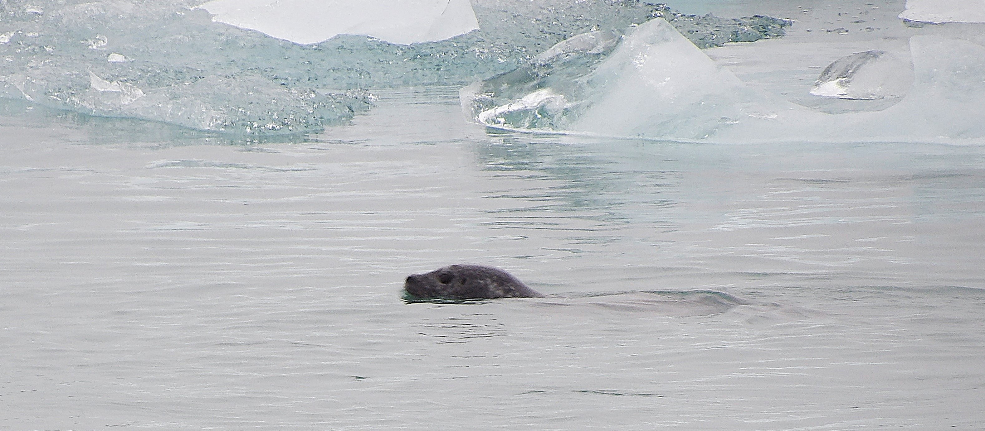
Jökulsárlón
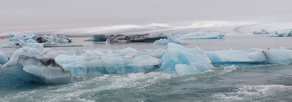
The Jökulsárlón lagoon on the other side of the road to Diamond Beach is just as magical. This was our second visit and as soon as we left we wanted to return! The icebergs are from the Breiðamerkurjökull glacier that is just behind the lagoon. We had our lunch in the car as it was drizzly but we didn’t care, we had been so lucky with the weather on this trip! Jokulsarlon did not disappoint, we spent ages watching the shifting colourful icebergs crashing into each other and looking out for seals. There’s a cafe and toilets on site in case you are hungry and you need spend a penny!

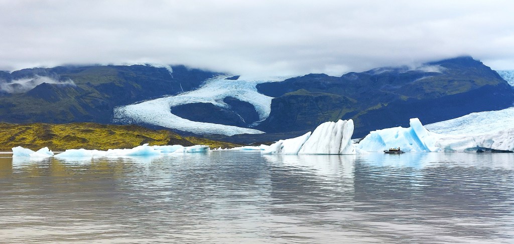
Fjallsárlón

Just a few minutes drive west of Jökulsárlón is a smaller and lesser known [and less busy] glacial lagoon. You can’t see it from the road but it’s only a short walk from the car park and the view of the lagoon in front of the Fjallsjökull glacial tongue is stunning. The restaurant Frost is by the car park if you are feeling peckish.
Skeiðará Bridge Monument

We had passed by this monument a few years ago but foolishly didn’t stop. This time we got out of the car to have a look. The monument is made from the twisted remains of the Skeiðará bridge which was destroyed in 1996 by a huge deluge of floodwater and icebergs that smashed into it after the Vatnajökull eruption. The bridge was once the longest in Iceland. The girders here are all that now remain.
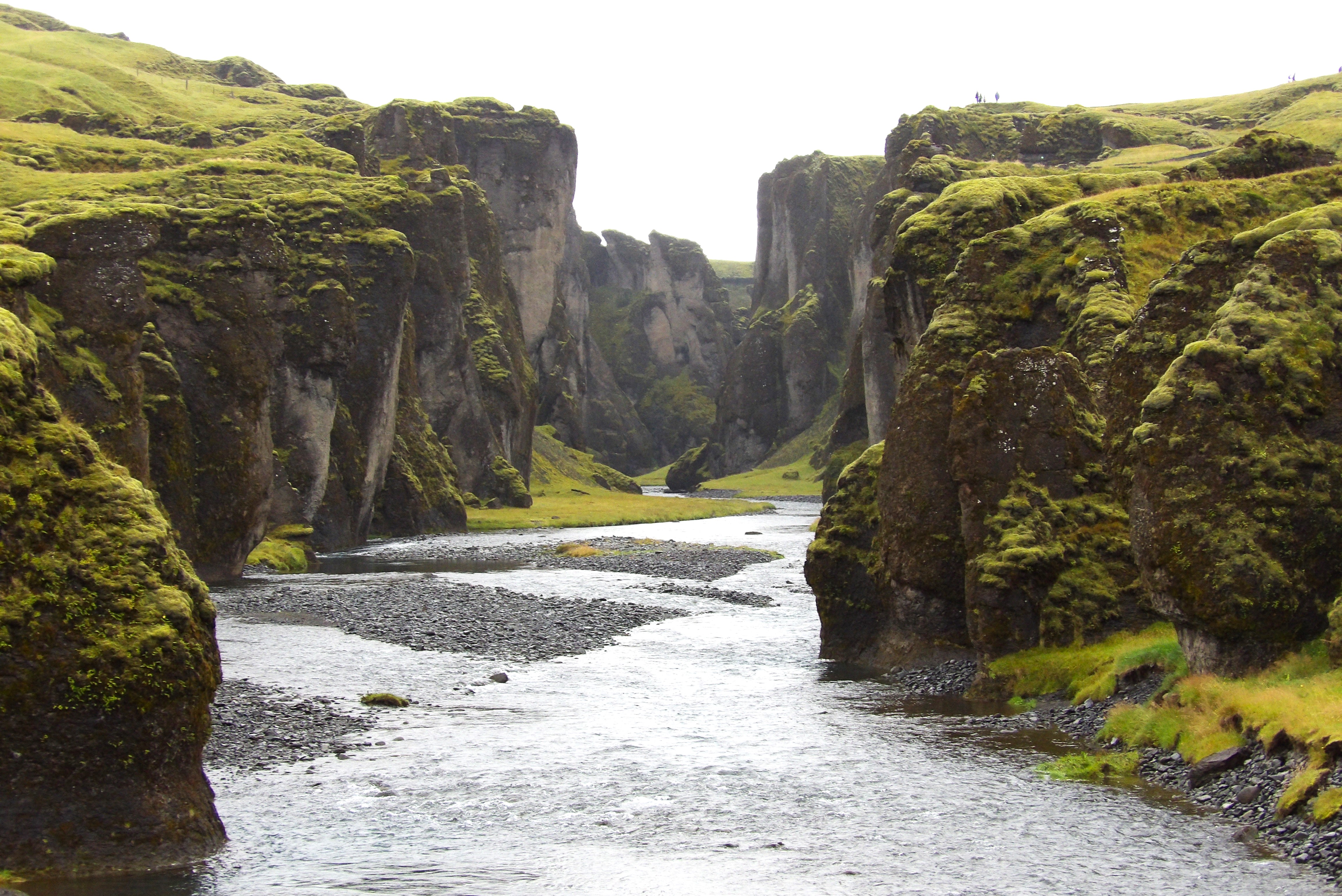
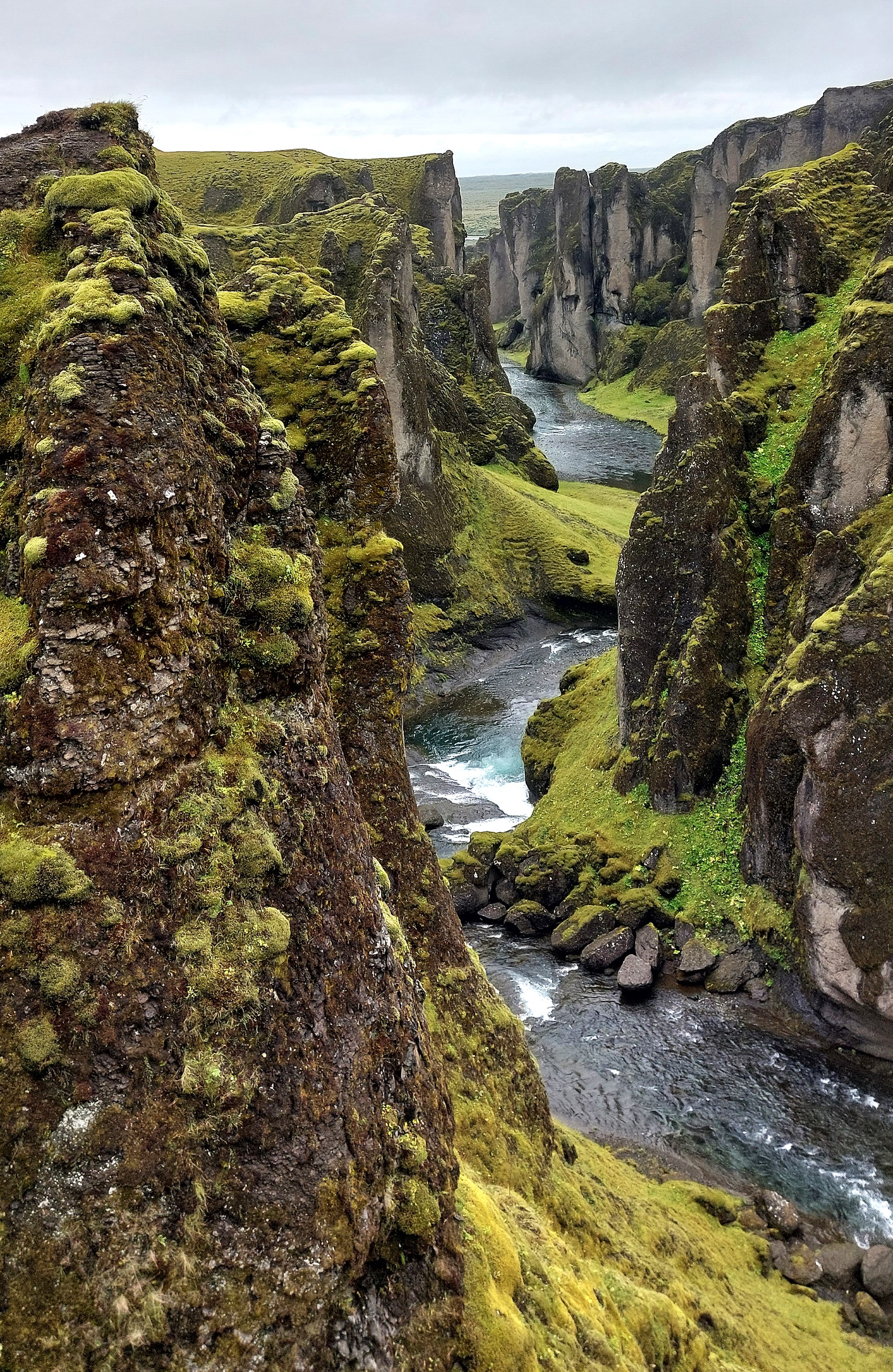
Fjaðrárgljúfur Canyon

This beautiful canyon may not be the hidden treasure of old but it is well worth the short detour off R1. The canyon was carved out by the Fjaðrá river and there’s a path along the side of the canyon to some viewing points. The path to the viewpoints takes around half an hour.

Yoda Cave [Gigjagja]

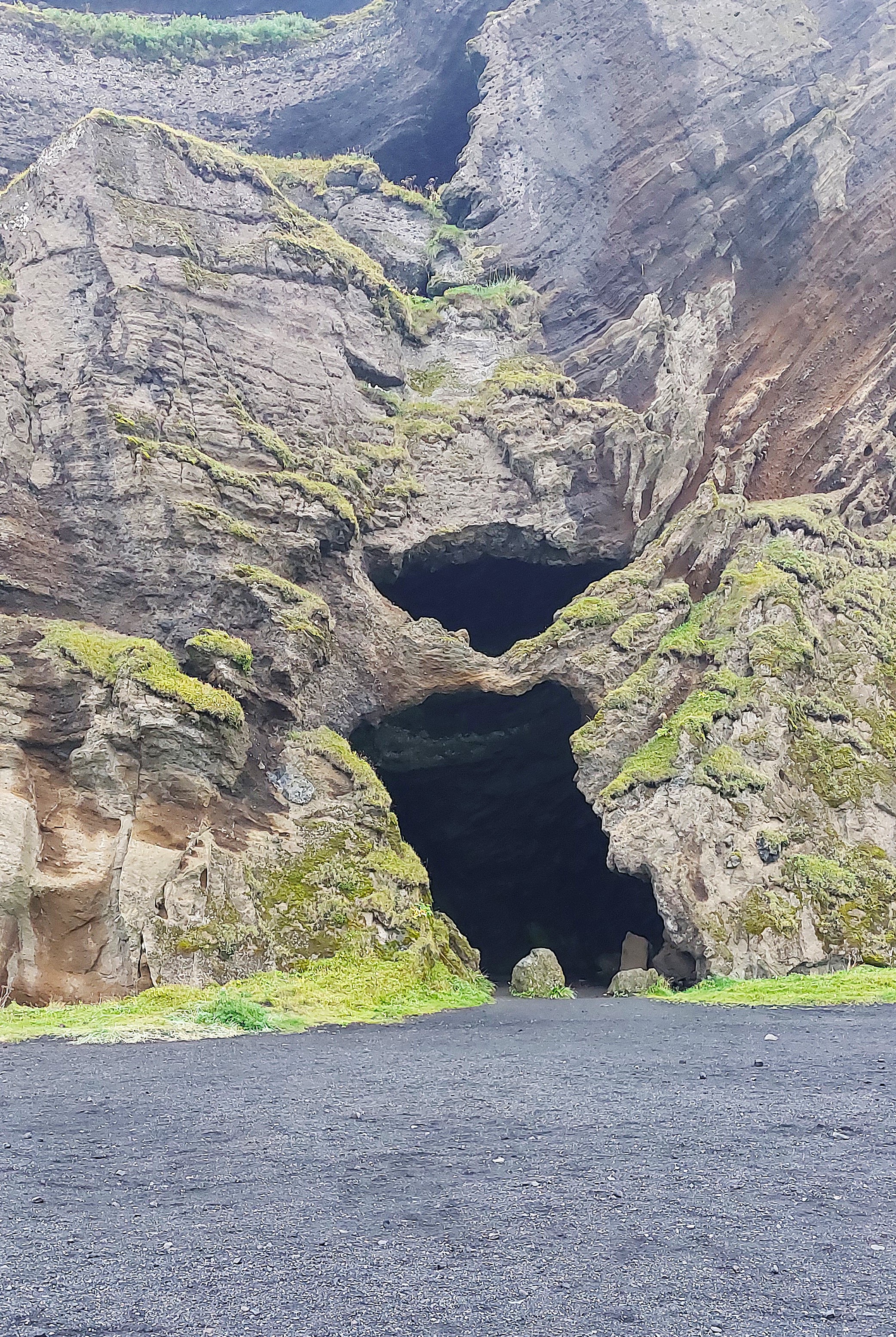
We decided to visit Yoda Cave, a few miles east of Vik, photos of which have been plastered all over social media for some time. There is a charge for the privilege of parking on private land but we thought it was worth it. I mean it looks just like Yoda – nearly!
PS – don’t bother if you don’t know anything about Star Wars!
| Vik, Black Sand Beach and the nature reserve are all well worth visiting, we had visited them before so missed them out entirely on this trip. For more info click HERE. |
Sólheimahjáleiga Guesthouse
Although I was booking up accommodation about 10 months ahead of this trip I struggled to find anything in Vik suitable or affordable.
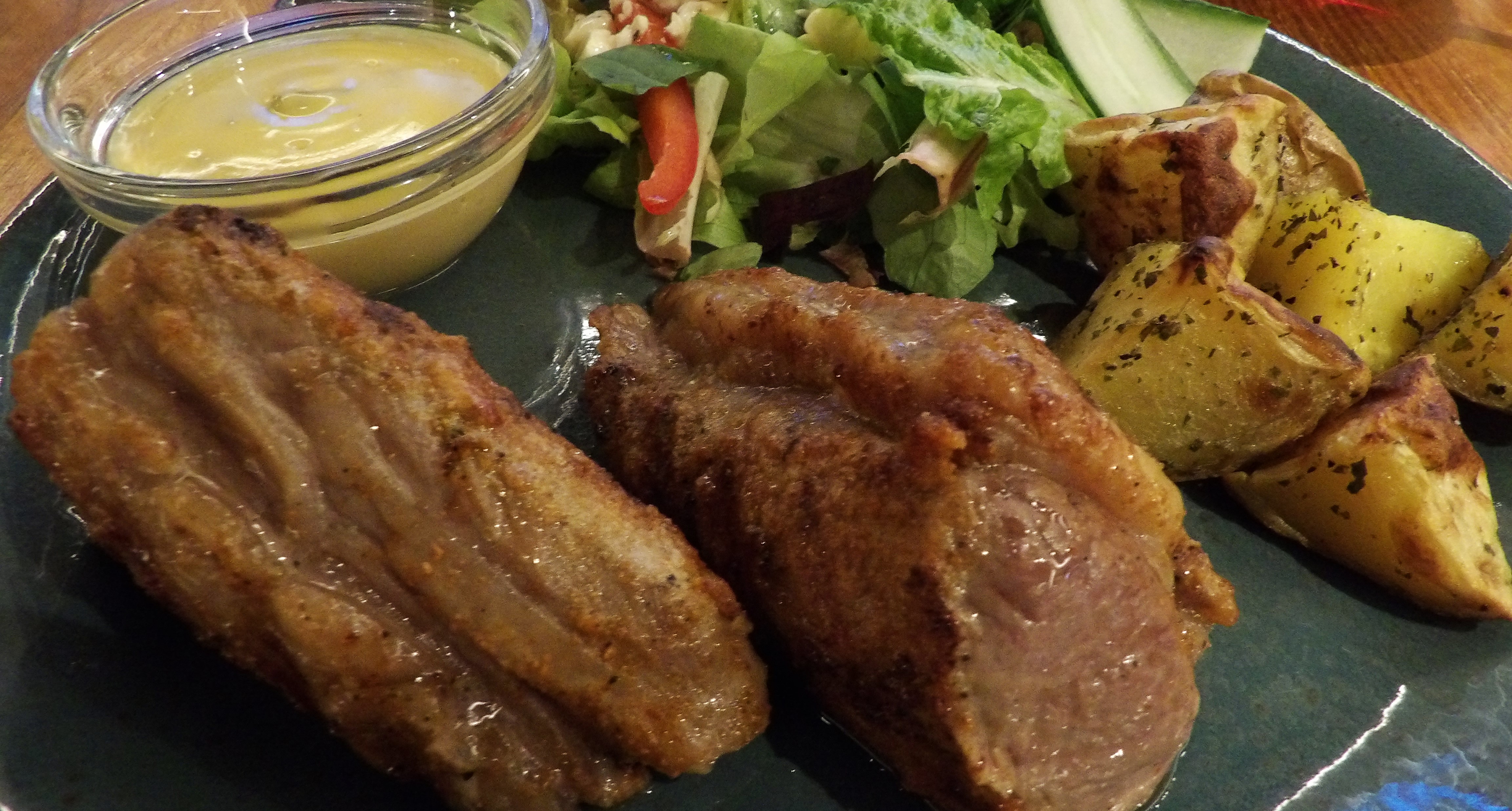
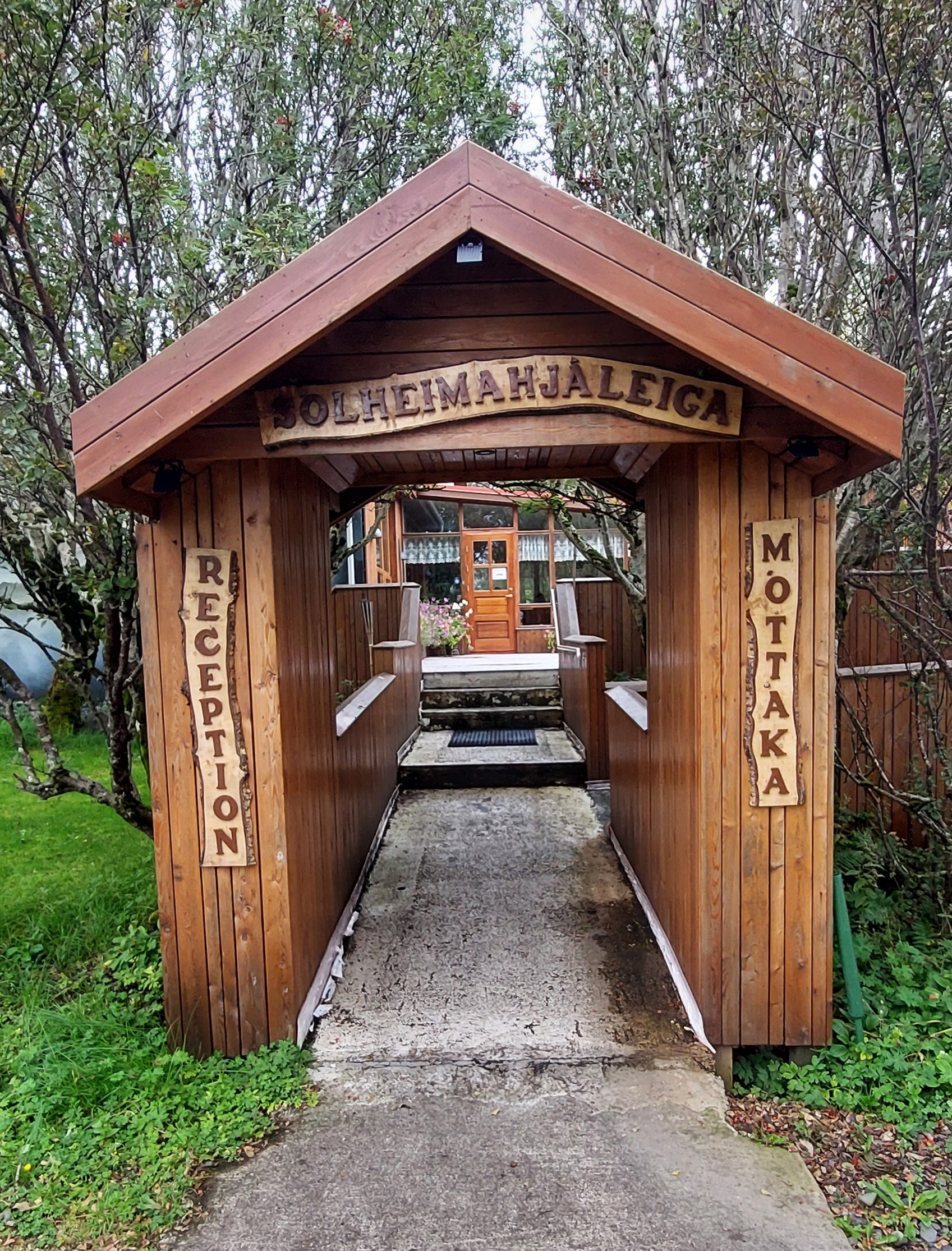
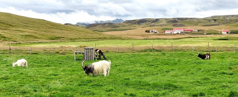
We had stayed in Vik and explored much of the surrounding area a few years ago so this time we opted to stay in a guesthouse outside of the town, about 25km west of Vik and not far from the Solheimasandur Plane Wreck. The guesthouse was an absolute delight, our lamb dinner was incredible and our room was very comfortable. We also liked our goaty friends as a neighbours.
Day 14. Heimaey [and some bras !]
After an excellent breakfast at Sólheimahjáleiga we said goodbye to our goats and set off on our 45 minute drive to the port of Landeyjahöfn. We had pre-booked the ferry from Landeyjahöfn to Heimaey, one of the Westman Islands [Vestmannaeyjar] and we needed to get to the port by 10am for a 10.45am departure. So we didn’t have to get up too early which was lovely, in fact we were so relaxed we forgot to keep an eye out for the bra fence on the way!
The Fence of Bras
Luckily it was hard to miss – hundreds of colourful bras of all shapes and sizes attached to a wire fence by the side of the road.
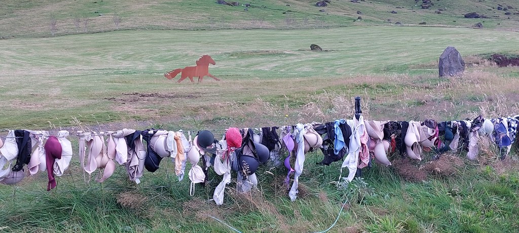
There’s a small layby where we parked to have a look. I think I may have been more enthusiastic than Mrs Lyons, but I could see she was impressed! Despite my powers of persuasion Leashia refused to part with her bra!
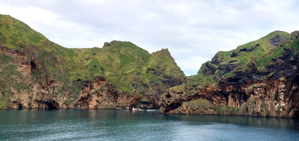
The ferry to Heimaey
There’s not much to do at Landeyjahöfn which is just a ferry terminal. I knew there was a shipwreck on the beach nearby but we did not have the time to have a butchers.
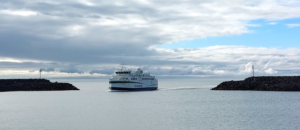
The boat journey takes about 30 minutes and the ferry was lovely, really clean and comfortable with a great cafe. We went to the outer deck to take in the views. Heimaey looked even more inviting as we approached.
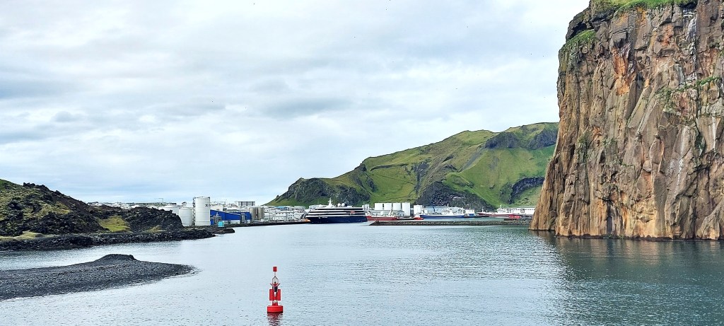
Heimaey is the only inhabited Westman island and it has just the one small town of the same name. The island’s history is dominated by, and is still affected by the devastating volcanic eruption of 1973. The island is a compact 5.2 sq miles in size and it’s easy to get around. It may be small but it has a lot to offer.

Heimaey
As soon as we got to shore we started to explore. Well, we popped into Krónan first to grab our lunch, then we went exploring. One can’t explore on an empty tummy.
Skansinn Fort
The fort on the edge of the town to the east is the oldest building on Heimaey although there is not much left to see now due to the 1973 eruption. Some of the walls have been rebuilt and it was a pleasant place to have our picnic lunch.
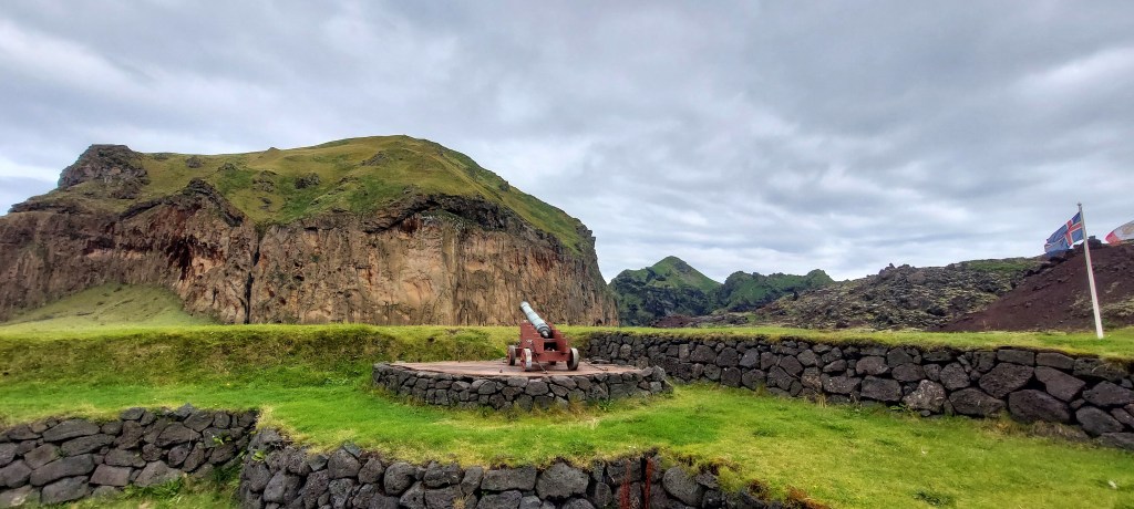
Next to the fort are some watertanks that were destroyed by the lava and nearby is a memorial to those who were involved in the effort to cool the lava flow.

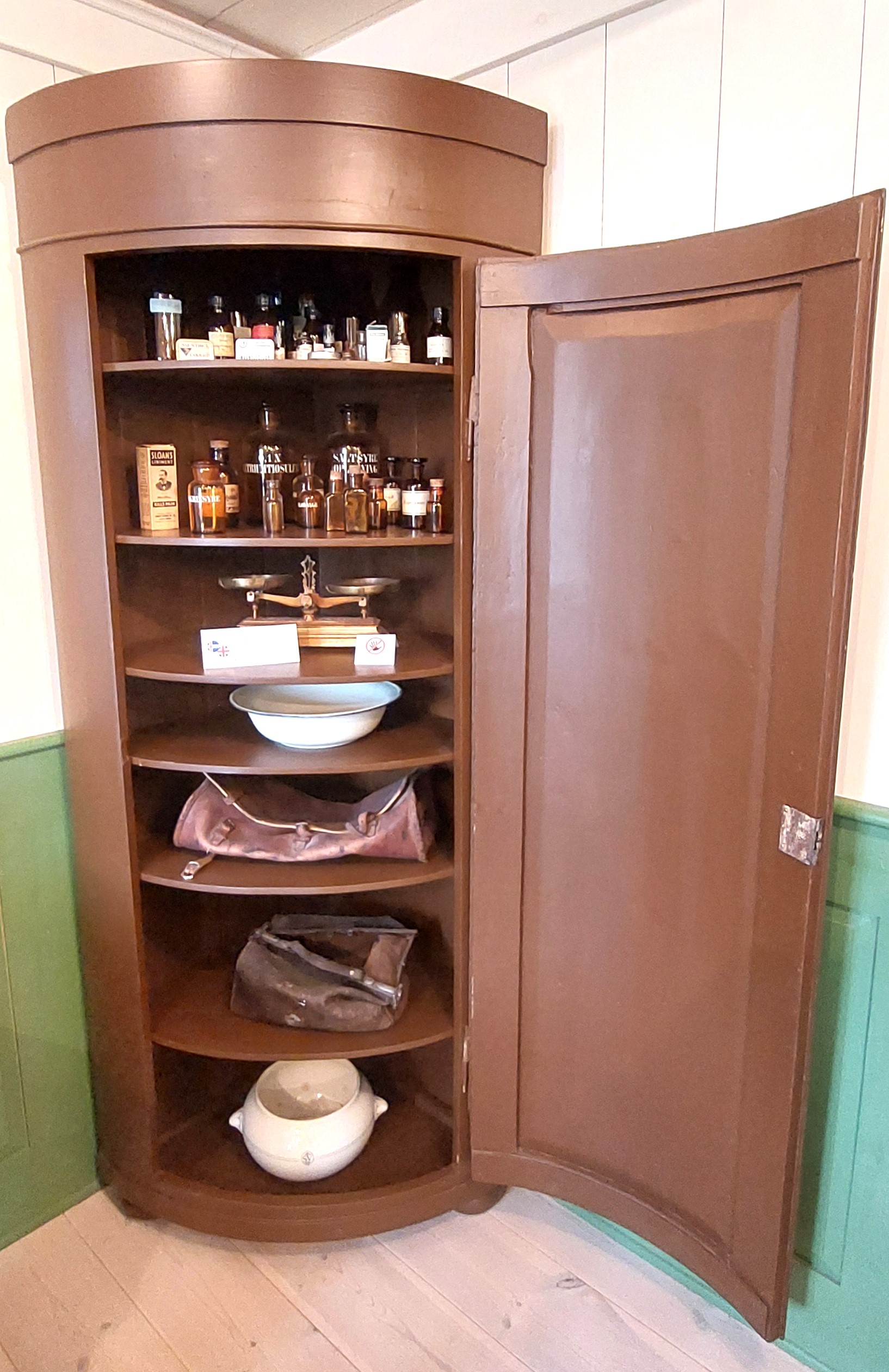
Landlyst
Next to the fort is Landlyst, the old maternity hospital. A very small building which is now a medical museum. The displays tell the story of Sólveig Pálsdóttir [not the crime writer!] who trained to be a midwife in the 1840’s and her efforts to treat babies at a time when mortality was shockingly high due to water deficiency and soil contamination. The exhibition is free.

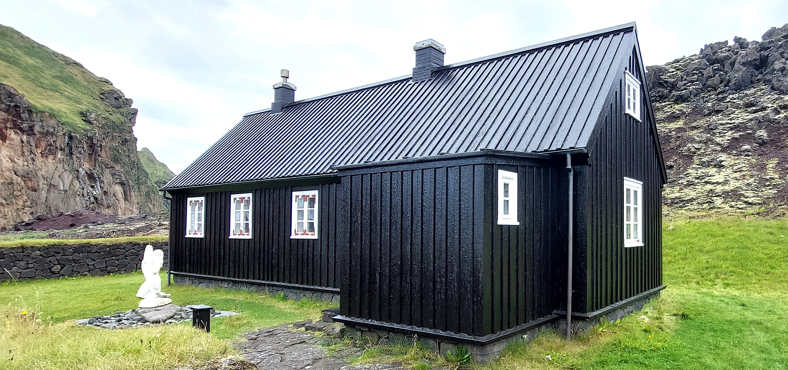
Stafkirkjan
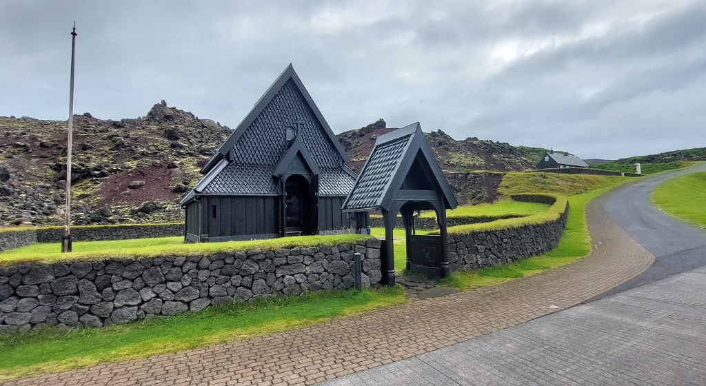
The small Stave Church next to Landlyst is a reconstruction of Haltdalen, a small church in Trondheim in Norway and was a gift from Norway in the year 2000 to commemorate Iceland’s 1000th anniversary of converting to Christianity. The outer gallery around the church was added as extra protection from the extreme weather.
Gaujulundur Lava Garden

Just outside of the town on the hill above the fort is a wonderful hidden treasure. A garden created in 1988 by the people of the Westman Islands which is cared for by volunteers. A real fairy garden! There’s a sign for it on Eldfellsdvegur road.
Urðaviti Lighthouse

We carried on around the headland to the lighthouse to take in the views across the sea before heading back into the town to visit Eldheimar Museum.

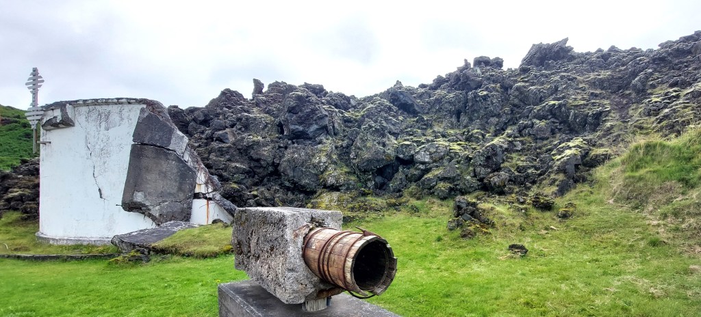
On the way to the museum, by the side of the road we saw remnants of some of the machinery that was used in the attempt to harness the heat from the eruption to heat the local houses, bank and hospital. There’s a place to park and information boards on the site. There’s also information on how seawater was used to cool the approaching lava with powerful pumps brought in from the USA.
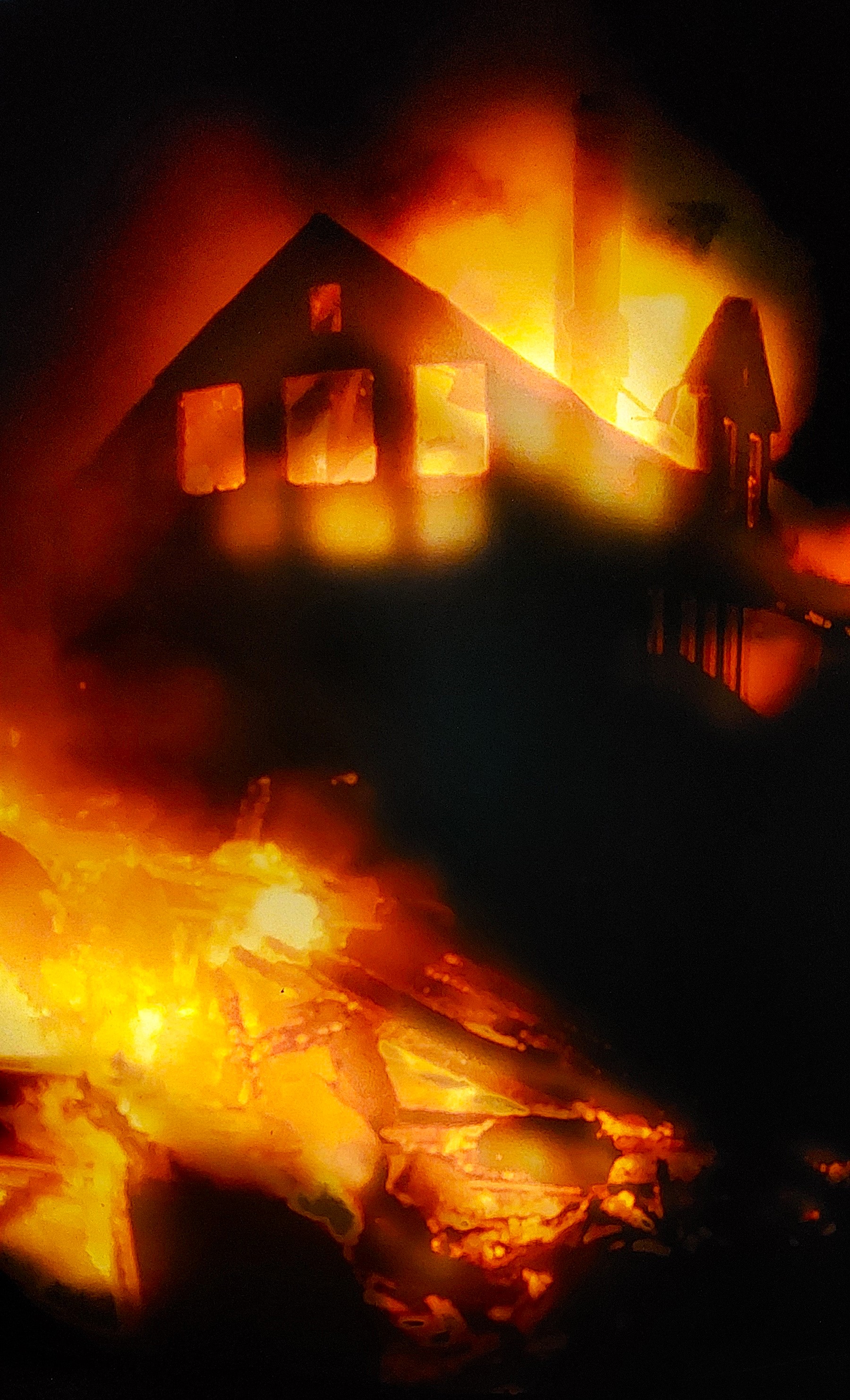
Eldheimar may not look like much from the outside but it is an incredible museum documenting the 1973 eruption of the volcano Eldfell and the audio guide provided is informative. The museum is built over an excavated home that was buried in the eruption. You can’t fail to be moved by documentary about the homeowner Gerður Sigurðardóttir recalling the eruption and revisiting her house after it was dug out from the ashes. About 400 homes were buried by the eruption and outside the museum on the right hand side you can see the remains of a partially buried house.


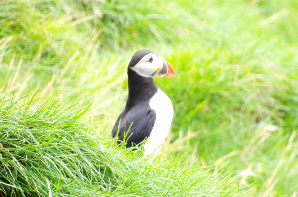
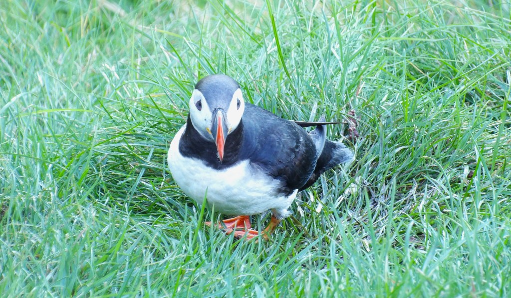
Puffins!
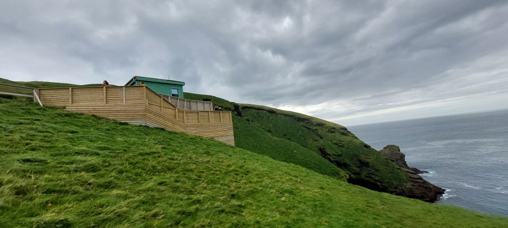
The date was 30th August and we thought we were too late in the season to see puffins but we were wrong! There were still loads of puffin babies [pufflings] hanging around trying to get brave enough to fly. We headed to Stórhöfði where there is a hide and a lookout point to see the puffins. We loved it here and spent ages watching the puffins posing, crash landing and cooing.
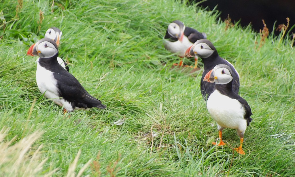
We also watched some locals puffin throwing which is an Icelandic tradition of launching rescued pufflings into the air in order to encourage them to fly.
Eldfell

We next headed to Eldfell that looms over the town. The volcano that erupted in January 1973 has since settled down and it was an easy walk half an hour walk to the summit from the car park. The views of Helgafell, a volcano that last erupted 5000 years ago, and over Heimaey and beyond were incredible.


Elephant Rock
By the time we got back to the car it was about 5pm so we still had time to do a bit more exploring. We decided to have a look at Elephant Rock which is next to the golf course. We knew that the best views of the rock were from a boat out at sea which was not an option for us. It was a lovely day so we thought it was worthy of a look from the land.
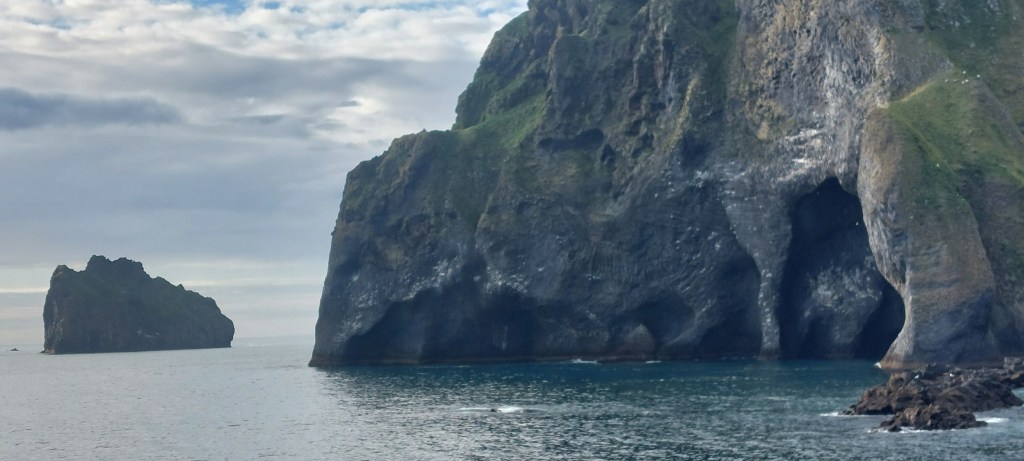
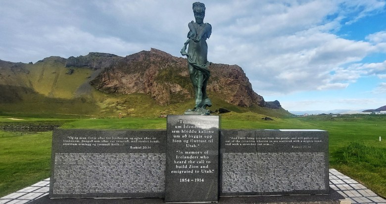
We followed the path around and through the golf course but we noticed other peeps were not so considerate and were shouted at by irate golfers. The rock did indeed look like an elephant taking a drink through its trunk and we were pleased to have made the effort. There’s an unusual monument called The Messenger on the golf course on the site where baptisms were performed by Icelandic Mormons who subsequently emigrated to Utah.
Heimaey
It had been an amazing day, we had achieved so much as the island was so small and everywhere was easily accessable by car.

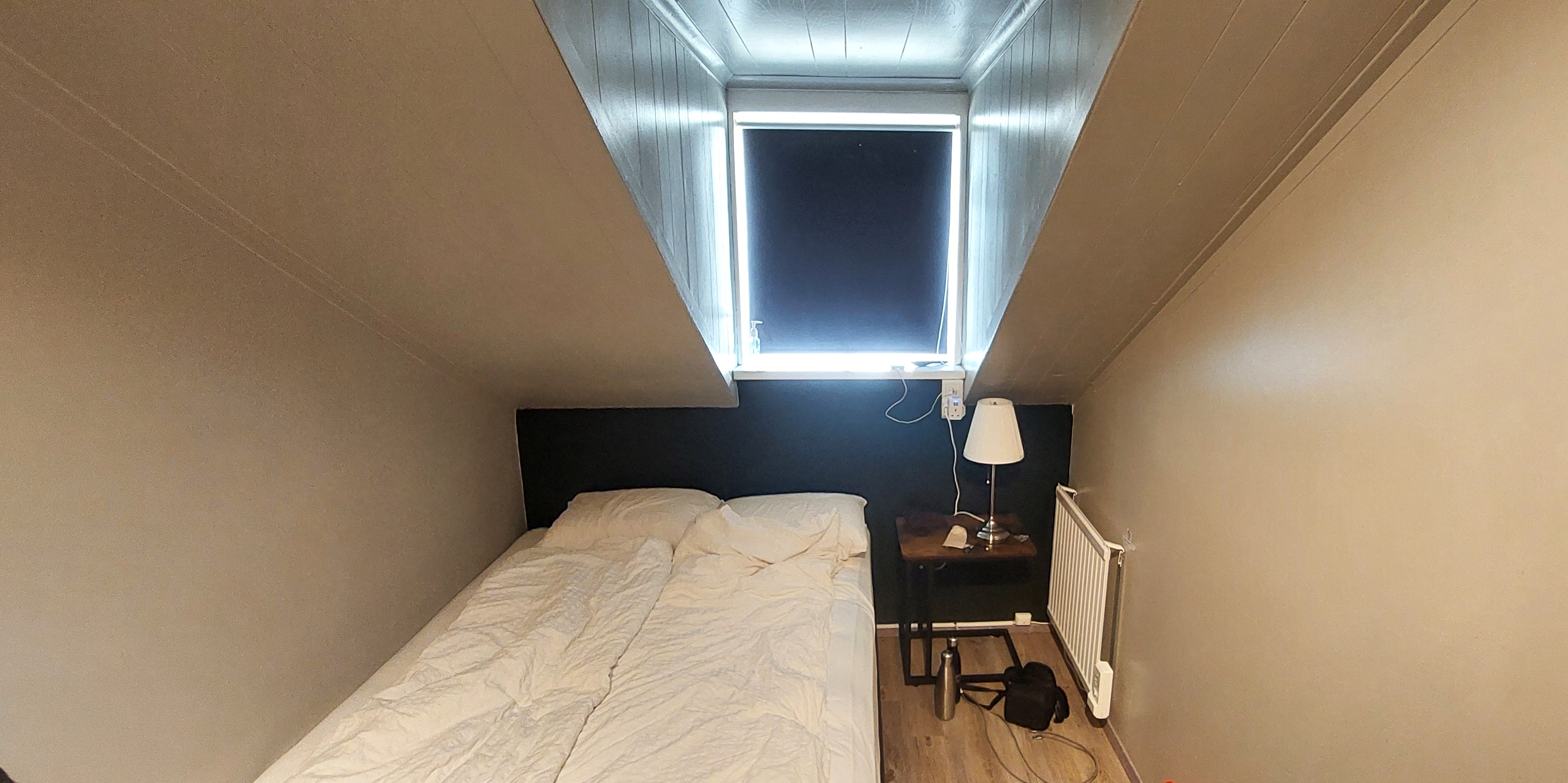
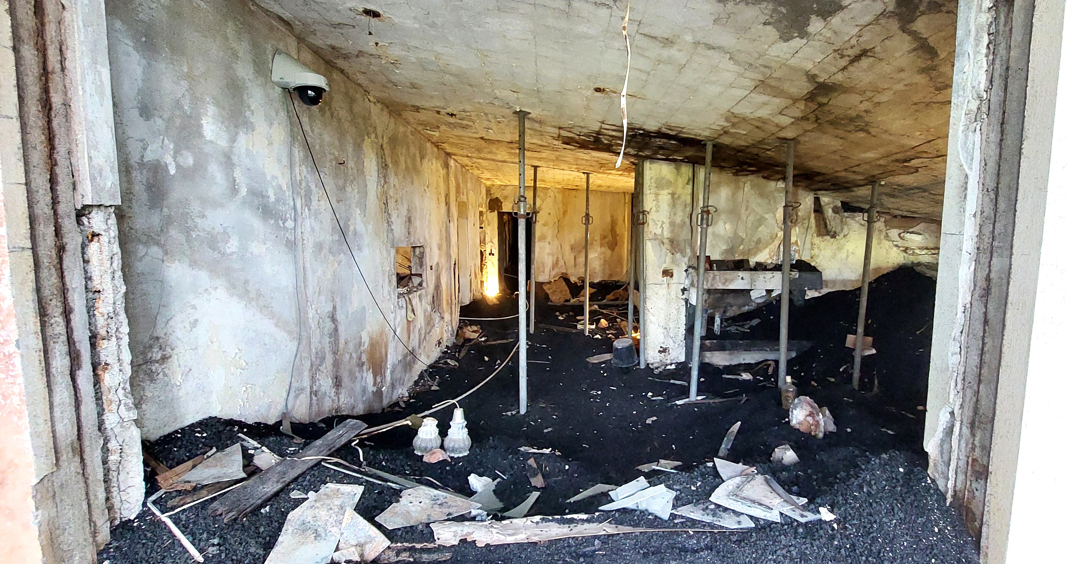
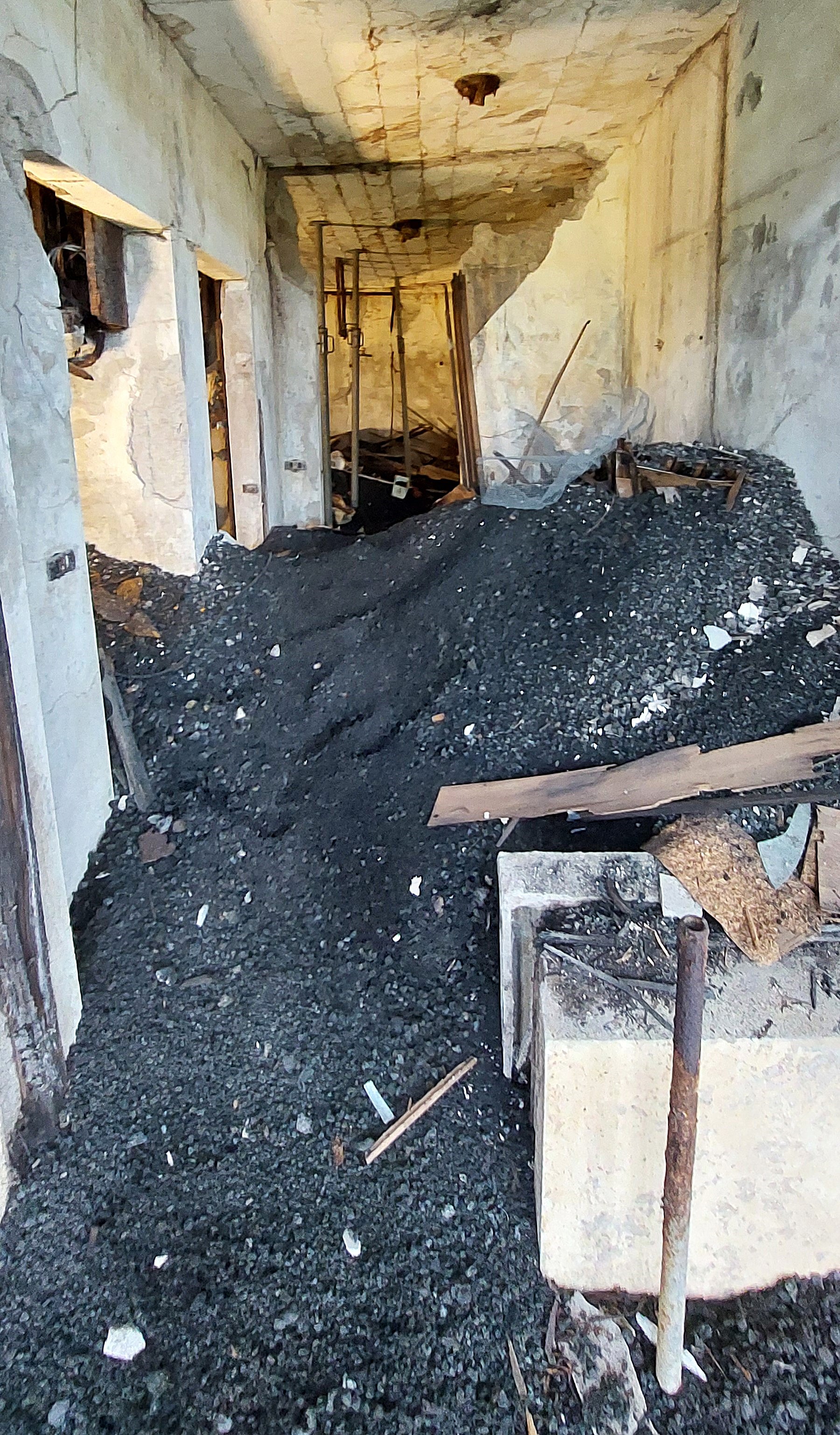
Our home for the night was Lava Guesthouse in the centre of the town, which was fine apart from our bedroom which was tiny and I kept bumping my head on the ceiling, maybe it would knock some sense into me! [see photo above].


We still had time for a mooch around the town before heading to the harbour for a lovely dinner at Tanginn. We also accidentally had an icecream from Iceguys on our way back to our guesthouse.


Day 15. Landmannalaugur and then to Selfoss on the mainland.
Waaa! It was our last full day of our road trip! Our ferry back to the mainland was due to depart at noon leaving a couple of hours to continue exploring Heimaey.
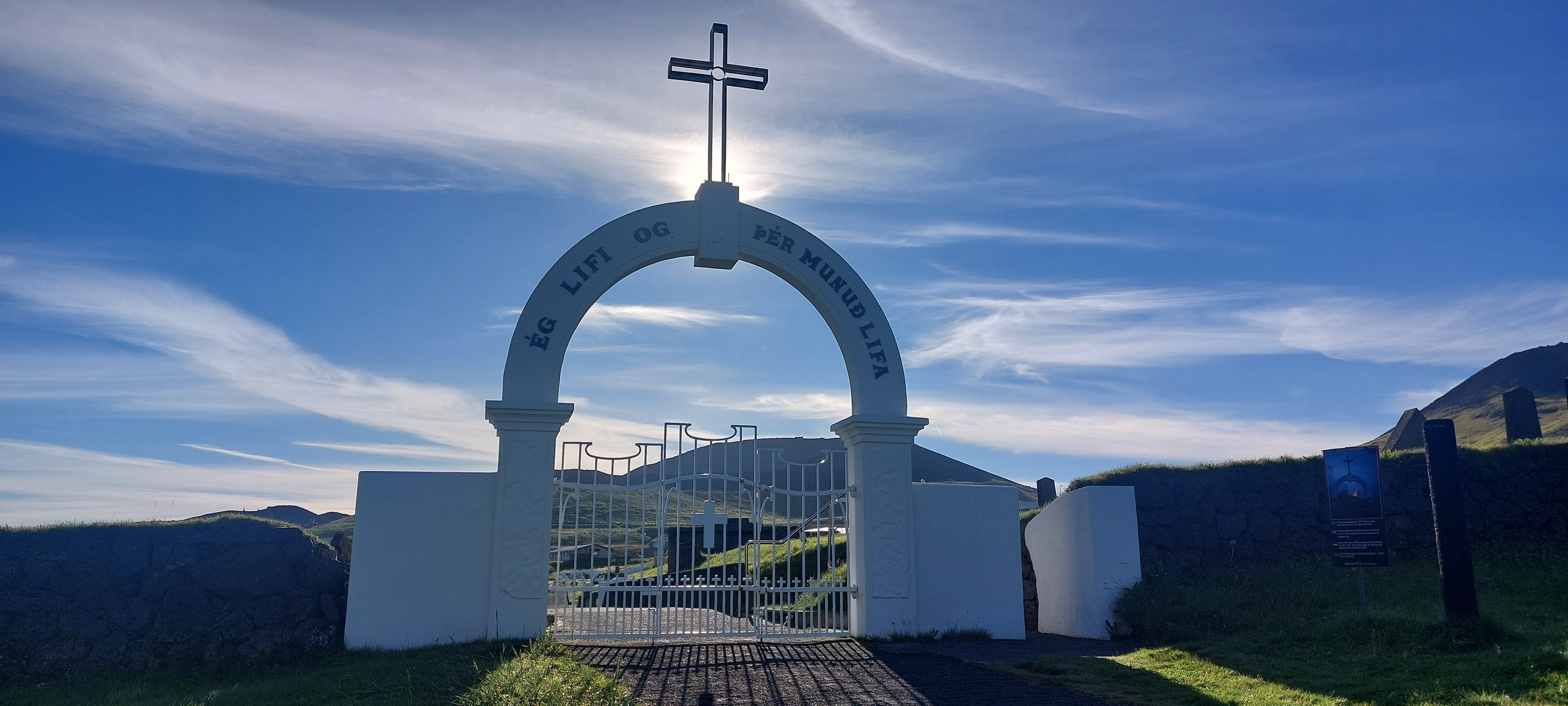
Landakirkja, Heimaey

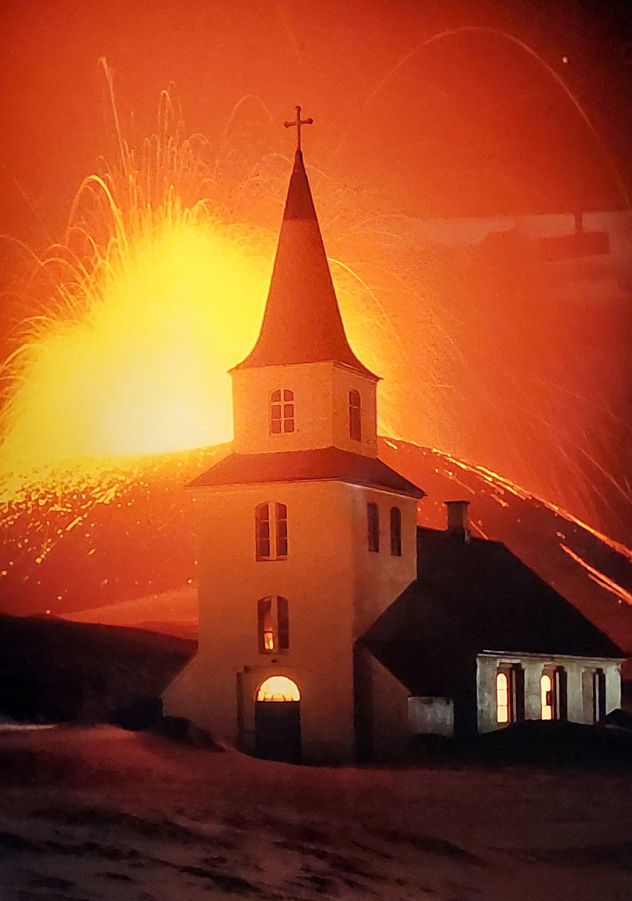

The iconic church on the edge of the town was built in the 1870’s and survived the eruption. We had already seen dramatic photos of Landakirkja in the Eldheimar museum, [see above]. The graveyard is over the road from the church. It was still only 9.30am so there was time to revisit the puffins – yay!
More puffins
We returned to the hide and lookout at Stórhöfði and spent another blissfull hour watching the puffins, they were so mesmerising and there seemed to be more of them strutting around this morning. It was hard to pull ourselves away but we had a ferry to catch and a very busy last day ahead of us.
Back on the mainland
We knew we had a lot to cram in today and I feared it was a bit optimistic but we gave it a good go. We planned to go off the Ring Road to a couple of waterfalls as well as dipping into Landmannalaugur.
Háifoss and Grannifoss
It was a two hour drive from Landeyjahöfn on the mainland to visit these incredible waterfalls which lie to the north of the ring road. The last part of the journey is on a very rough road although it was not classified as an F road, it may as well be!
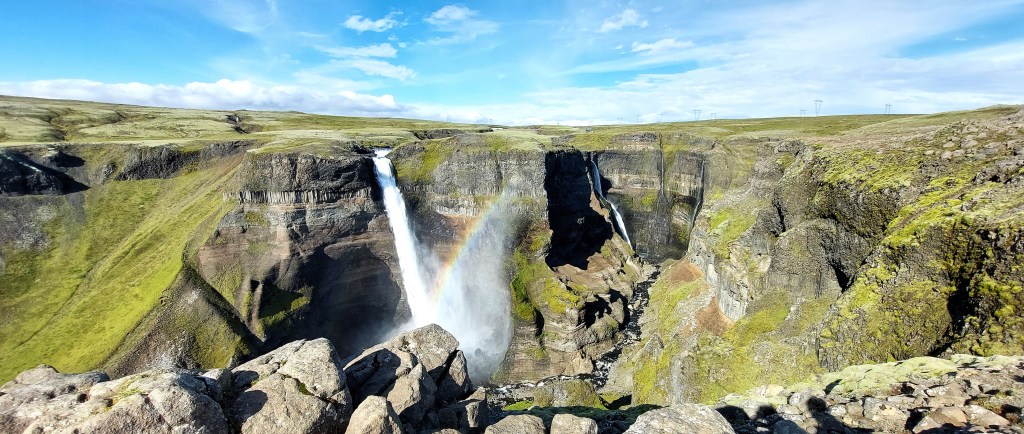
The experience of looking out onto Háifoss with its drop of over 125 metres is hard to put into words. The wind was ferocious [and very loud] and it was very hairy trying to get a closer view next to the precipice. The rock columns by the falls were formed by lava over 2 million years ago. The smaller waterfall in the background is Grannifoss.
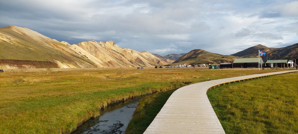
Landmannalaugur
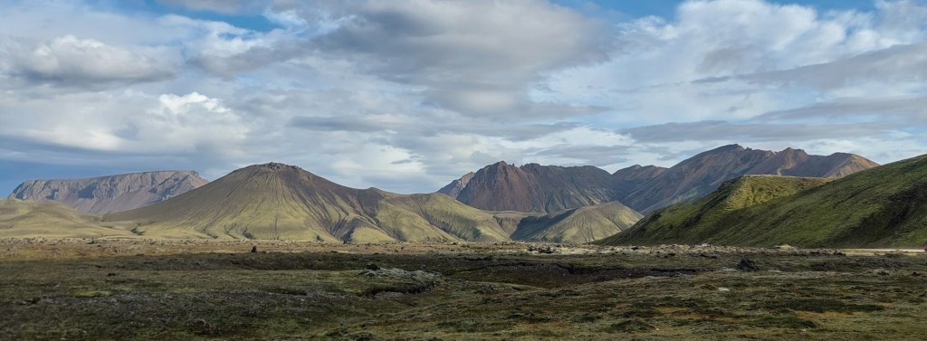
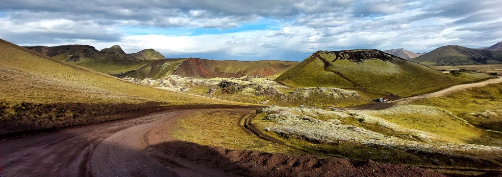
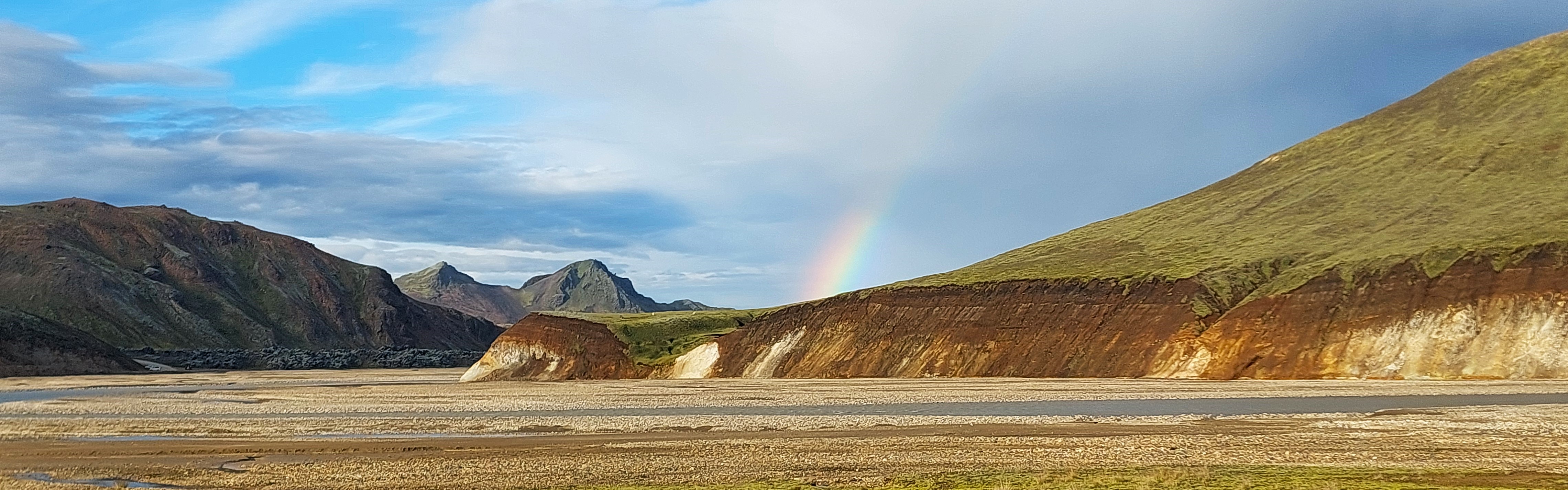
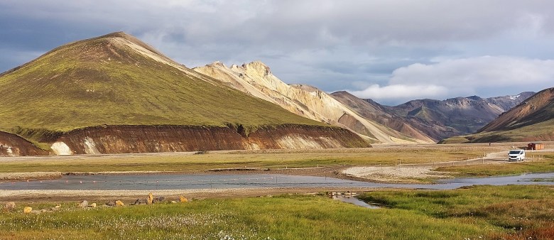
The drive to Landmannalaugur took over 2 hours, much of the road is unpaved and very dodgy in parts so it was slow going, but views along the way were amazing. The area is known for its beautiful multicoloured landscapes and is part of the Fjallabak Nature Reserve.
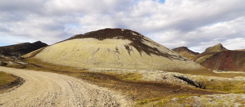
Landmannalaugur may be off the beaten track but it’s possibly the most incredible of all of the incredible landscapes in Iceland. There is a campsite and numerous trails and, as we expected, we clearly needed a lot longer here to fully appreciate its beauty.
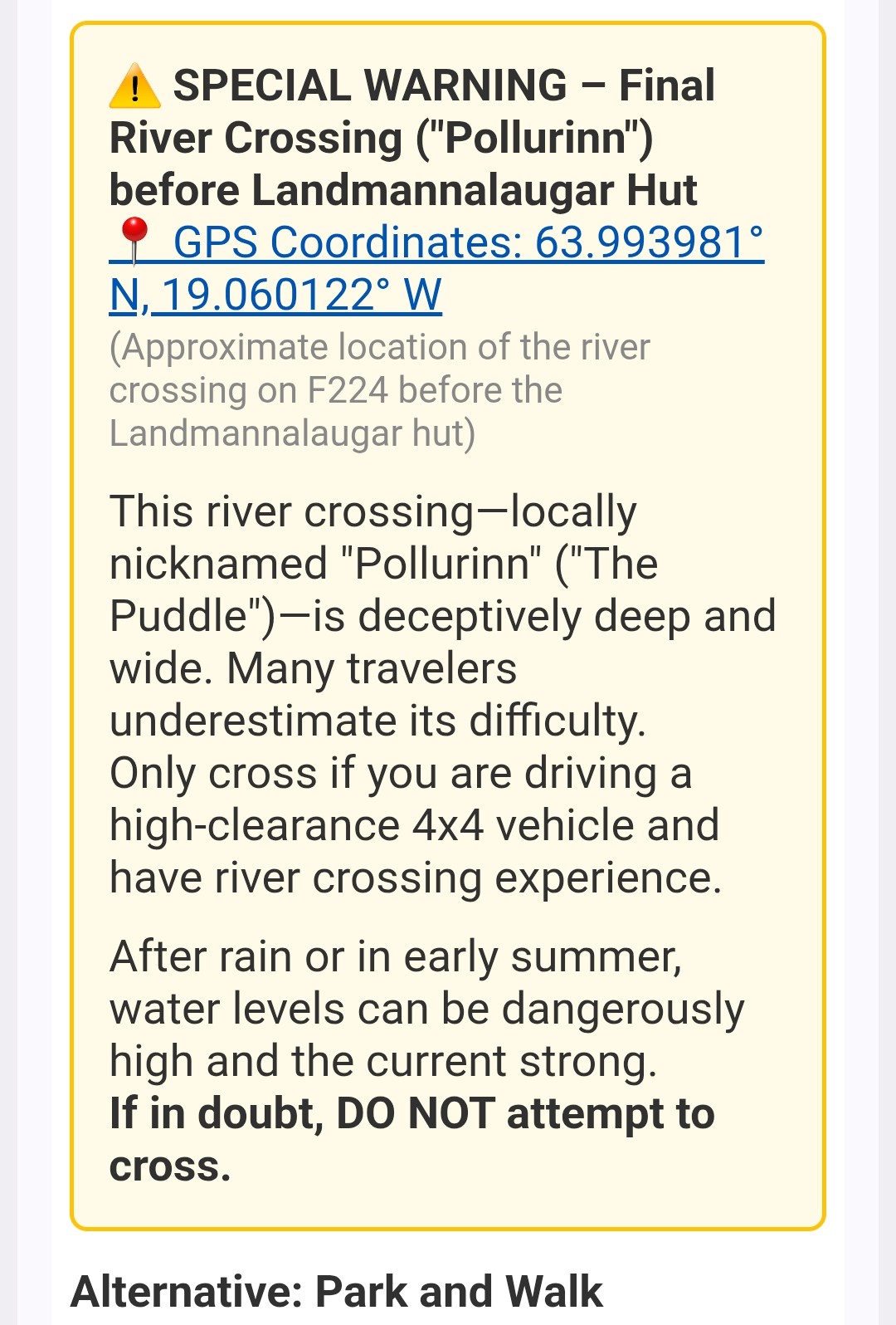

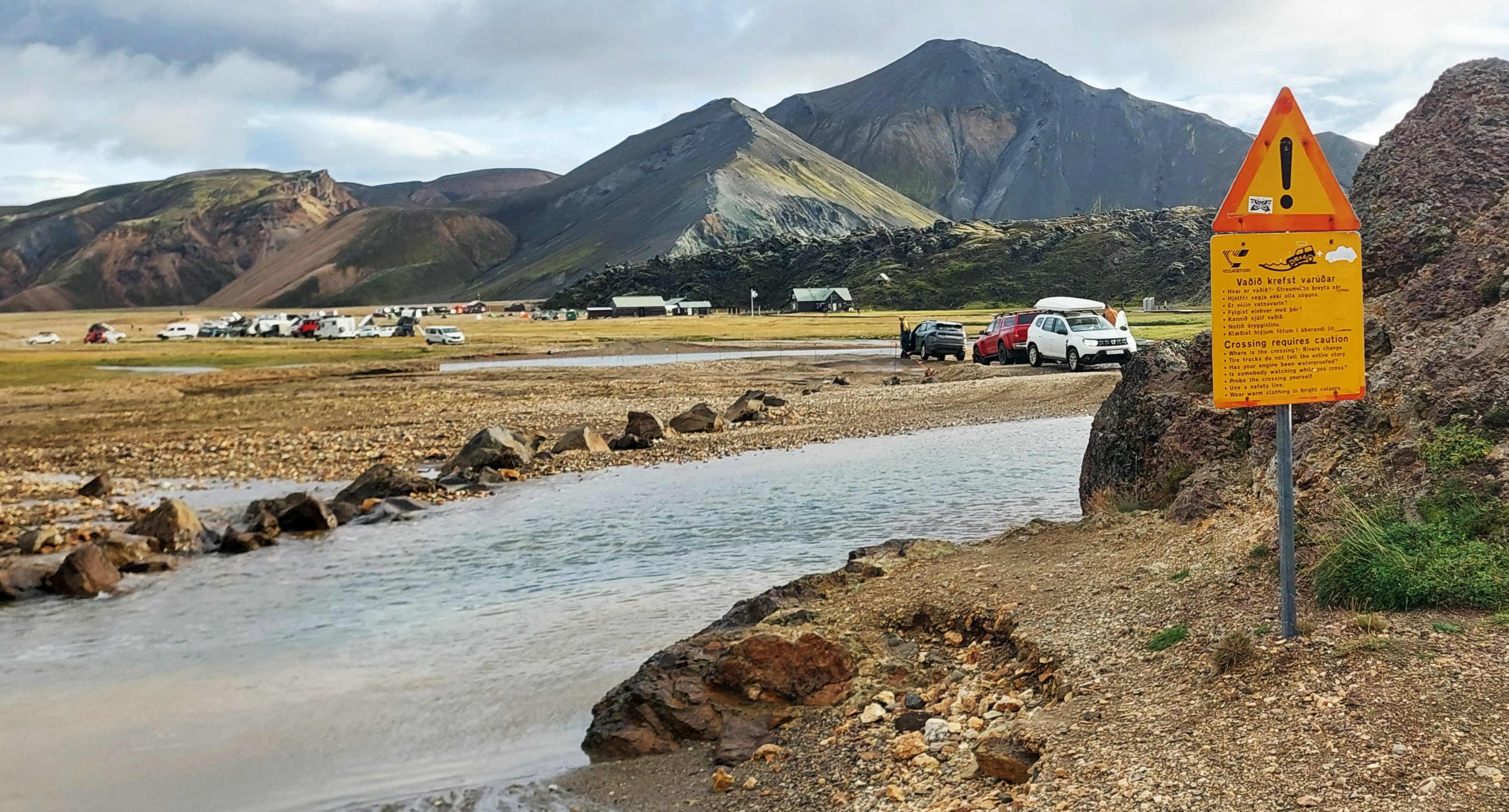
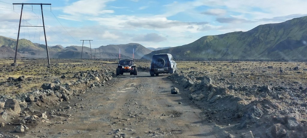
As we approached the end of the road we had the choice of driving through a rather daunting river or to park up and walk towards the campsite on the wooden boards by the hot stream. We opted for the latter.
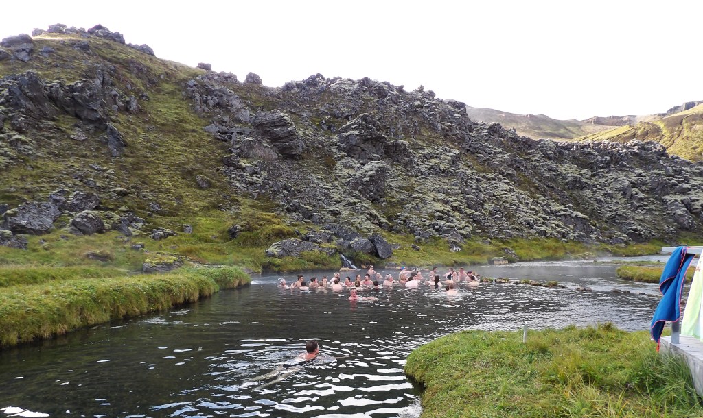
My phone pinged and I received an email from Blue Car Hire suggesting that attempting a crossing of the river here may not be a good idea ! This message was reinforced in a timely fashion as we watched a car being pulled out of the river. Sadly we didn’t have time to take a dip in the stream, but we will when we visit again.

We walked around the campsite and gawped at the vivid colours of the mountains. However, we had no choice but to drag ourselves away as it was about a two and half hour drive to Selfoss for our last night. WE WILL RETURN !
It was an uneventful [but miserable] drive into the sunset to Selfoss .
Selfoss
We had a reservation at Mar, a lovely looking fish restaurant that had caught our eye at the very start of this trip, to look forward to. When checking in to Hotel Selfoss we were informed that our room had been upgraded – Yay! We then dashed over the road to Mar, we were starving! However, the restaurant was in the dark and it was very closed. Gah! We settled for a Flatey pizza in the Foodhall, which was fine but it was not the grand send off that we were hoping for.
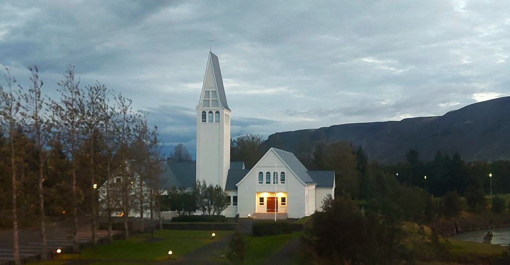
Day 16. Going home
It was an early start for the drive to Keflavik for our flight to Gatwick. We had a final look at the church from our hotel window and then headed to airport. The journey from Selfoss to the airport took around one hour and twenty minutes. Google Maps decided to have a complete meltdown and the suggested route showed a long detour due to an alleged road closure. We were glad that we ignored this as there were some road works but no closures. We will forgive Google on this occasion as it was the first time on our trip that it had freaked out.
Back home in Worthing [England] we started to plan our return. We still have to explore the Westfjords and spend more time at Landmannalaugur and Reykjanes. We are returning to Reykjavik this year [2025] for New Years Eve [again] and next year we are planning to go to Iceland Airwaves in Reykjavik for the third time, the list goes on…...
Quick Links:
