This page covers days 6 to 11 of our Iceland road trip including Akureyri, Húsavík, Krafla and Mývatn [The Diamond Circle] and Jökulsárgljúfur Canyon.
Day 6 – Stykkishólmur to Akureyri
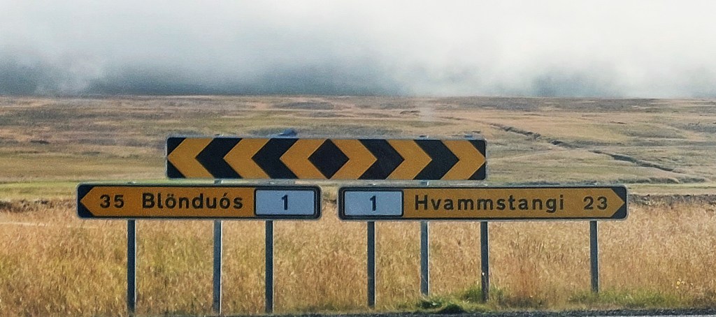
The drive from Stykkishólmur to Akureyri was long but wonderful and we were blessed with another glorious day of sunshine. The road turned to gravel soon after leaving Stykki and we saw very little traffic. It took us around 3 hours to get to our first destination: Hvítserkur, which is also known as Rhino Rock or Iceland’s Troll Rock.
Rhino Rock [Hvítserkur]

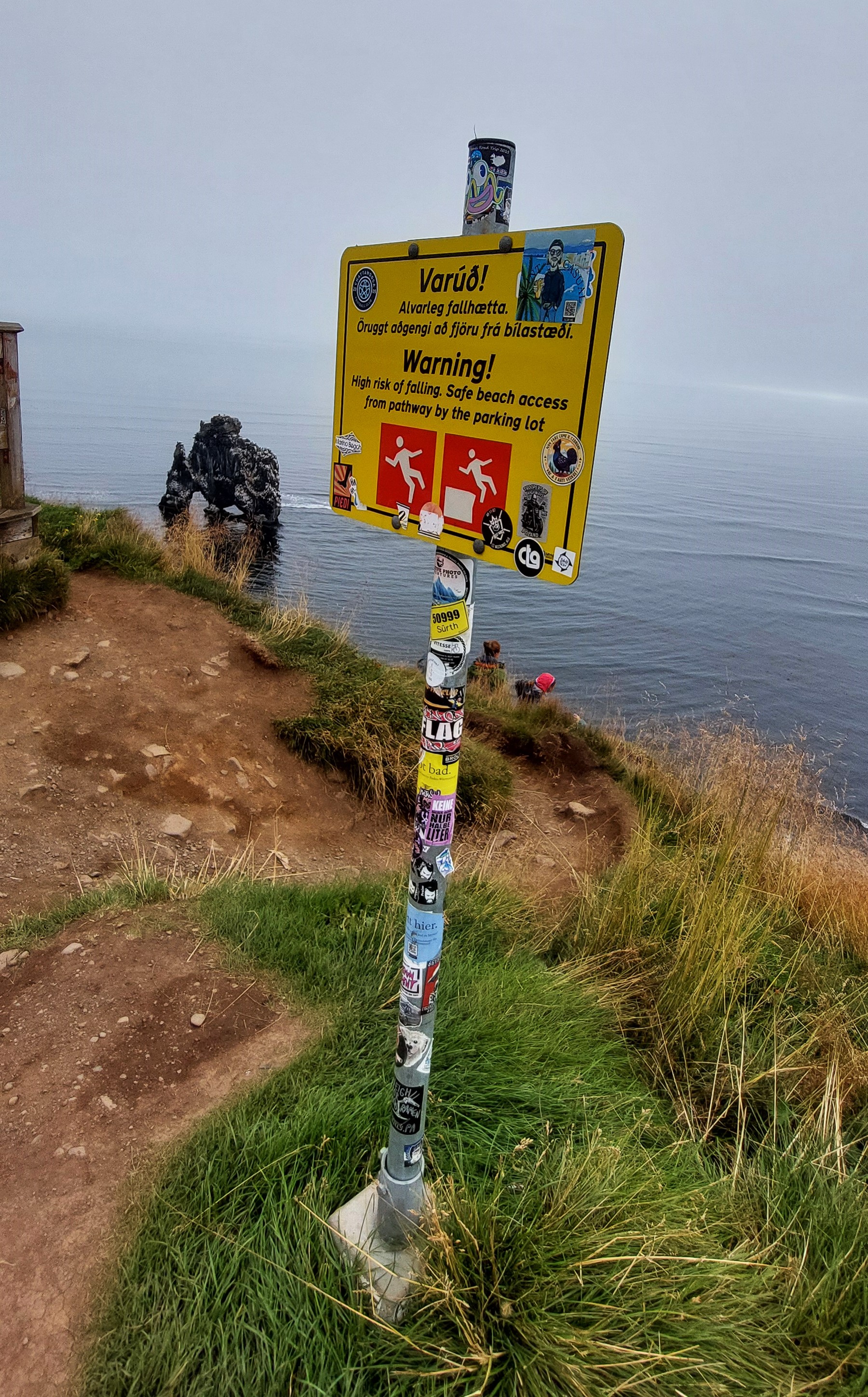
The sea stack was a 30km detour from the Ring Road but it was worth it and it was only a five minute walk from the car park. Leashia contented herself looking down upon the sea stack, which stands at just under 50′ tall from the viewing platform. I ignored the warning sign and scrambled down the dodgy steep path to the beach to get up close, [so brave/ stupid, take your pick!]. FYI – Hvítserkur translates as white long shirt, a subtle reference to the amount of white bird shit found on the rock, so now you know!]
Þrístapar
We stumbled across this site by accident. We were looking for somewhere to stop for our picnic lunch and saw a car park by the side of the road on our way to Akureyri, about 40 minutes drive from Rhino Rock. We pulled over and ate our lunch in the car as it was a bit drizzly and then went to have a look at why the car park was here in the first place.
The sign explained all – Þrístapar was the sight of the last execution in Iceland in 1830! We ventured into the site and the story of the double beheading of Agnes Magnúsdóttir and Friðrik Sigurðsson was told on the placards along the side of the path. We also had an audio guide beamed to us by magic to our phones, there’s a QR code to scan for this at the entrance. It’s a harrowing tale which is explained in full here.
We headed to the tiny hamlet of Hofsós which was another detour off the ring road. Hofsós may only have a population of around one hundred and fifty but it boasts a lovely [near] infinity pool which blends into it’s surroundings. We were again blessed with glorious weather and were able to enjoy the stunning views over the fjord. There is only the one pool and one hot tub but it was worth the diversion.

Next to the pool are majestic basalt columns facing the fjord known as Staðarbjargavík and there is a pretty church with a blue roof just over the road.
Grafakirkja
We had passed by Grafakirkja, the oldest turf church in Iceland on our way to Hofsós and stopped to have a look after our dip in the pool. It’s just outside of Hofsós and looked intriguing.
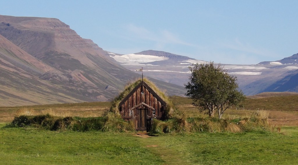
Parts of the church date back to the 17th century and it was restored in 1953. The setting is glorious and the circular graveyard is unique. The church is kept locked to preserve it which is a shame as it would have been lovely to see inside. You can see what it looks like on the inside here. Akureyri was still another hour and a half drive, the final stretch through the valleys of Hörgársveit were beautiful.
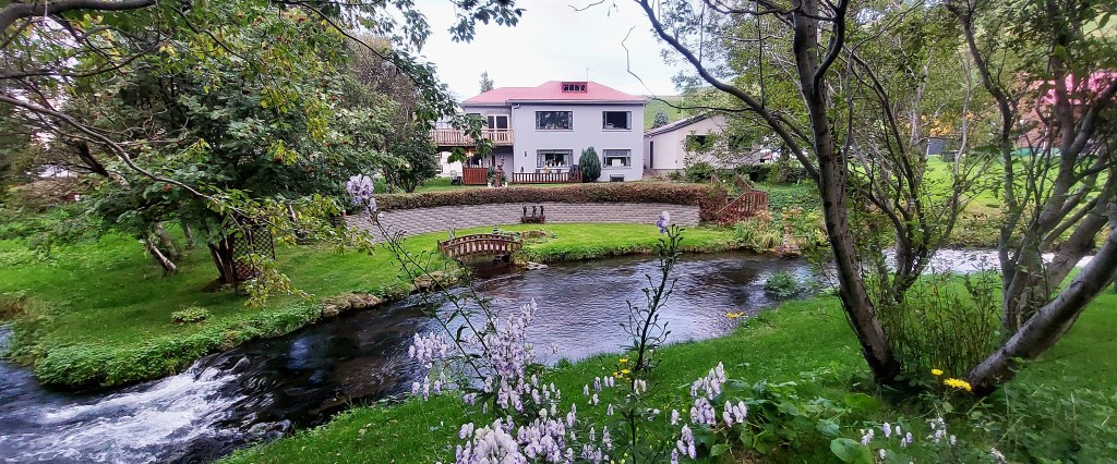
Akureyri
It was early evening when we pulled into Akureyri. We had booked a private room for three nights in a hostel which was handily right next to a Bónus supermarket. So we popped in and bought some food for dinner and used the well equipped kitchen at our hostel to conjure up our dinner washed down with a bottle of red wine. We went to bed exaustified!

Day 7 Akureyri [and a few waterfalls]
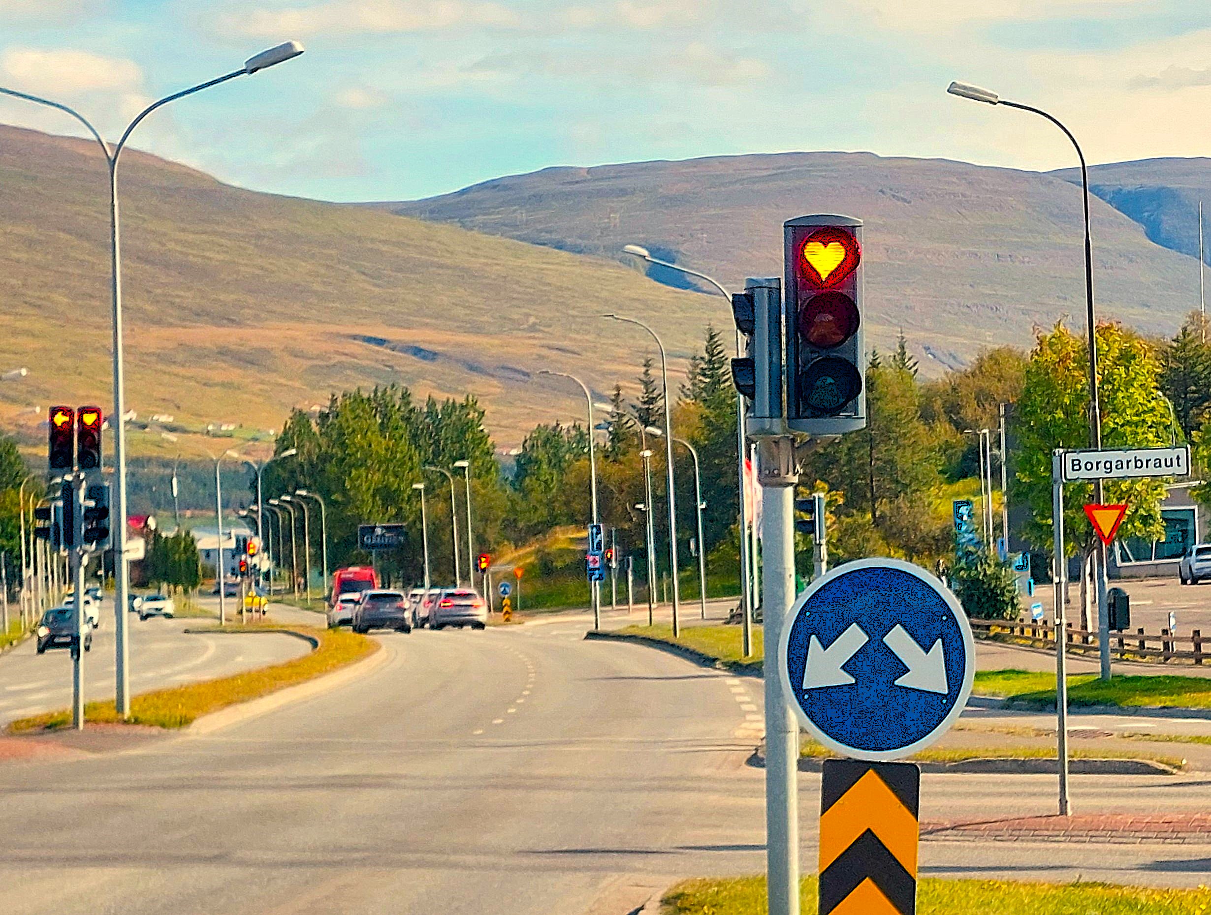
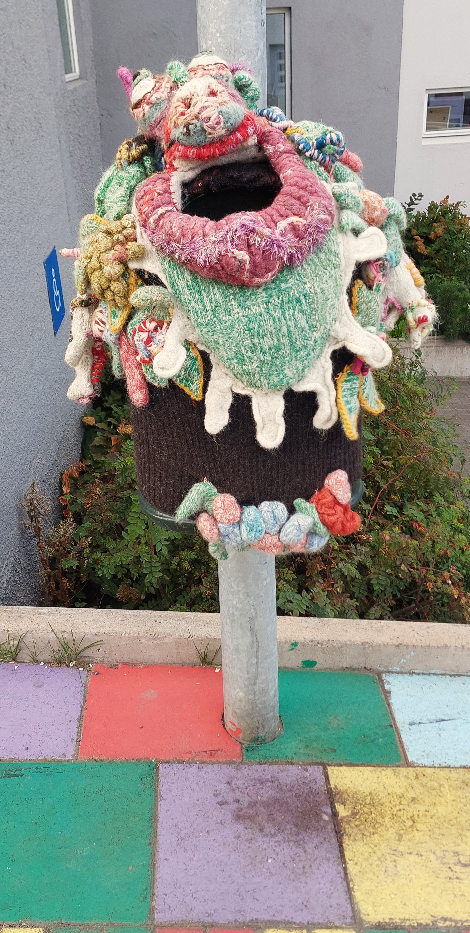

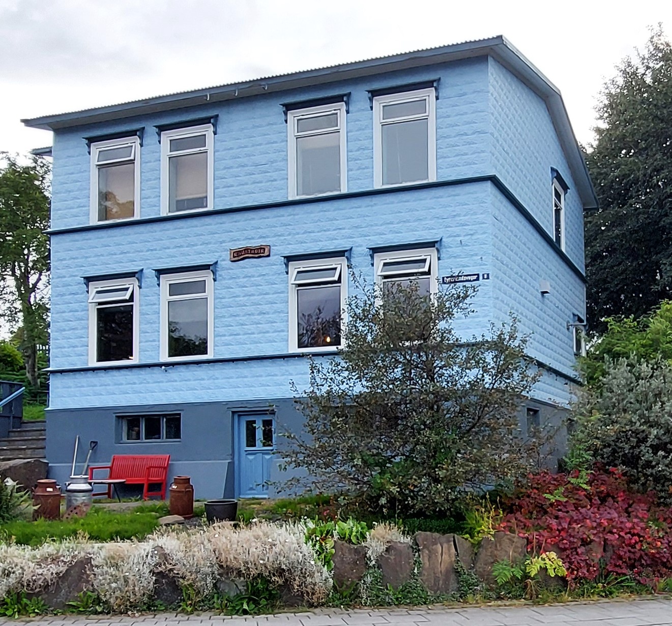
Akureyri is Iceland’s second biggest city after Reykjavik, but with a population of only about 20,000 it’s hardly a city, more a town and is adjacent to Eyjafjörður which is Iceland’s longest fjord. It has quirky traffic lights, imaginative waste bins and lovely houses which all add to its charm. However, we did not hang around this morning to explore, we had waterfalls to see !
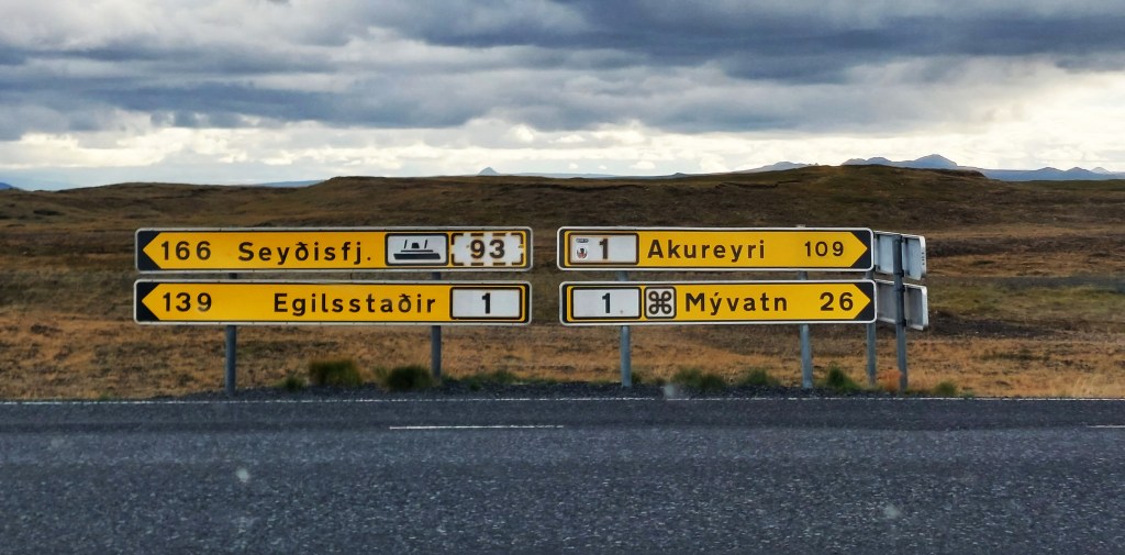
Avoiding the toll tunnel To the east of Akureryri is the Vadlaheidi tunnel on Route 1 which we wanted to avoid. [It’s expensive]. 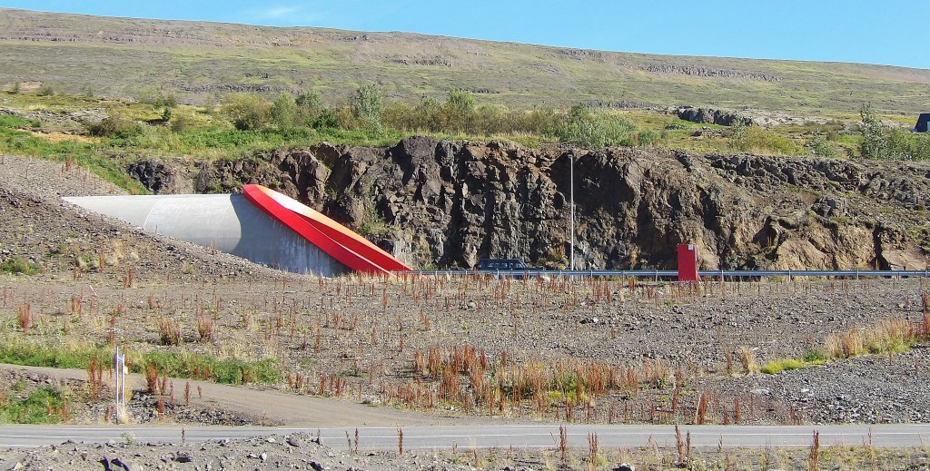 View of the tunnel from R83 View of the tunnel from R83The alternative route only takes about eleven minutes longer and has lovely views of the fjord. You don’t get much advance notice about the tunnel but we were prepared and did not get sucked in when we ventured out of the town.  As you leave Akureyri heading east, you will approach a roundabout prior to the tunnel. You can avoid the tunnel [and toll] if you take R83 [which turns into R84] to the left of the roundabout. Of course if you are approaching Akureyri from the east you need to turn right on to R84 before the tunnel. See the map above. The tunnel may be a good idea in the winter if the alternative route is closed due to adverse weather, but there’s no reason to use it on a nice summer day, unless you are in a very big rush. 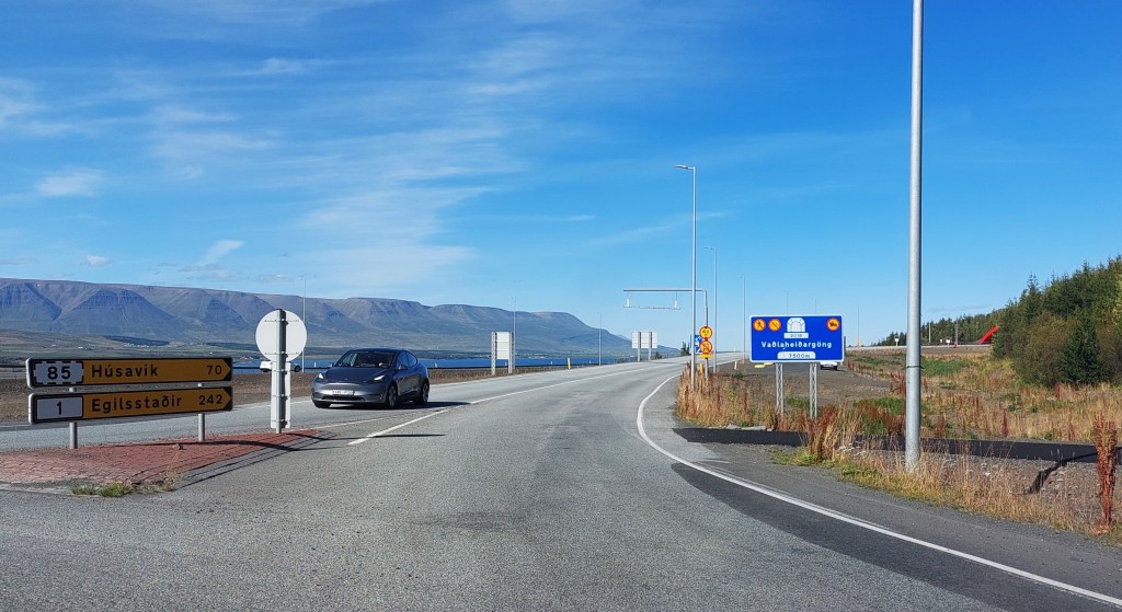 The sign before the roundabout The sign before the roundabout If you want to avoid the tunnel – follow the sign at 9pm If you want to avoid the tunnel – follow the sign at 9pm |
Goðafoss and Geitafoss

We got up early and headed east [avoiding the toll tunnel of course]. Goðafoss is a stunning waterfall next to the ring road and is an hour from Akureyri. It can get busy but we arrived there at around 9am, avoiding the crowds. There are two car parks, one either side of the falls. We parked at the first one and took our time taking in the splendour of the falls and then drove over the bridge to the other car park to get a different perspective.
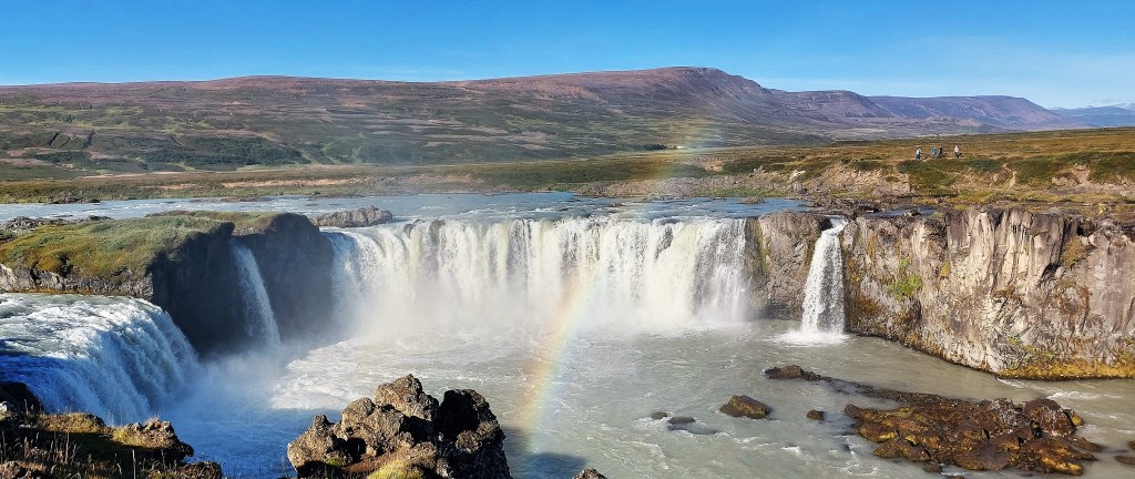
Geitafoss, a smaller [but very lovely] waterfall is even closer to the road, next to the bridge.
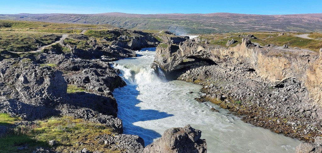
Aldeyjafoss
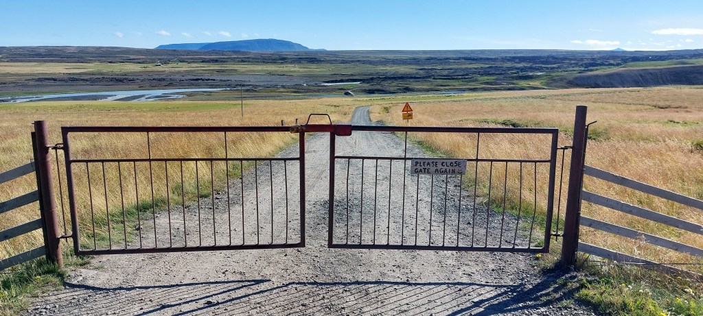
Our next desination was another waterfall – Aldeyjafoss, about 40km on a gravel road [R842] from Godafoss which took us around 50 minutes. The last few kilometres is an F road which is only suitable for a 4WD.
The road follows the Skjálfandafljót river, which is one of the longest rivers in Iceland. R842 from Godafoss is also the beginning of the well known Spregisandur Route which delves south deep into the highlands.
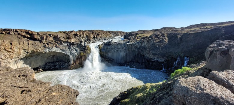
The waterfall is a few minutes walk from the parking area [which surprisingly had toilets] and it plunges into a stunning canyon lined with basalt columns. There were only a handful of vistors here making it a very different experience to Godafoss.
Hrafarjargafoss
We had one more waterfall that we wanted to see today – Hrafarjargafoss and that was a 15 minute drive further south along a very bumpy F road so we had to take it carefully.

We were completely alone here and had our picnic right next to the noisy falls, an incredible experience.
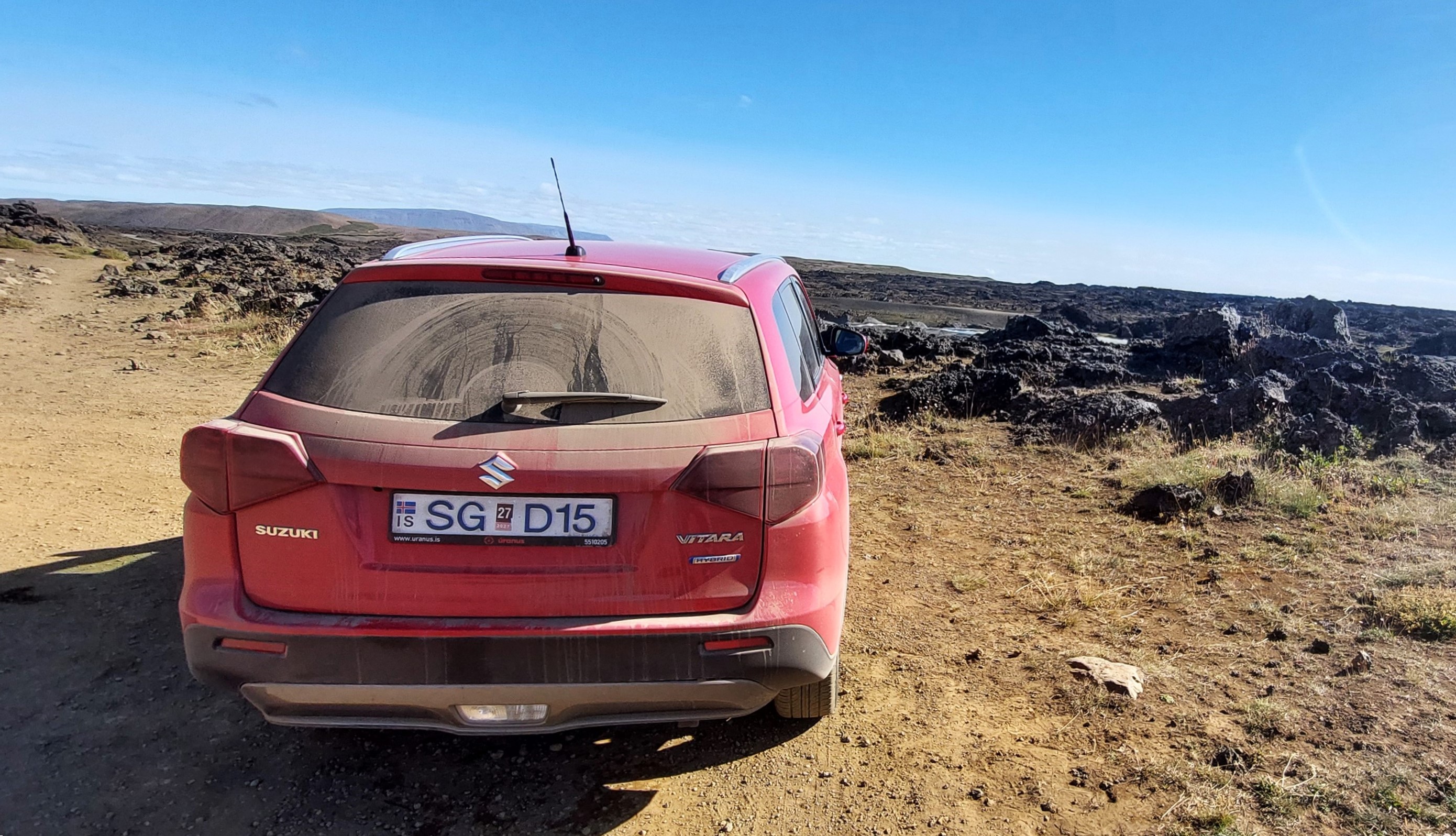
We then headed back to Akureyri, by now our car was a little bit grubby!

Back in Akureyri

It was mid afternoon by the time we arrived in Akureyri. We parked our car at our hostel and walked into the town to explore.
The Fairytale Garden
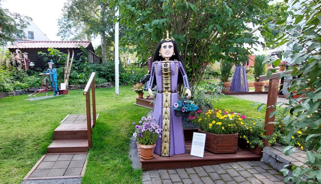
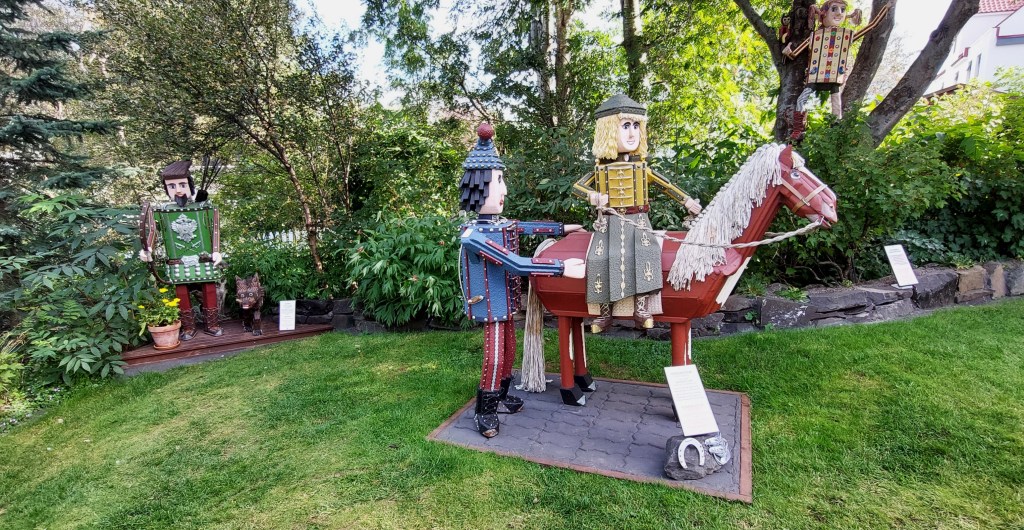
Leashia had seen the Fairytale Garden pop up on Google maps and we headed there first. The fairytale figures are created by folk artist Hreinn Halldórsson and are on display in the garden of his own home and were an absolute delight. It’s free but donations are welcome and there’s information about the figures in English.
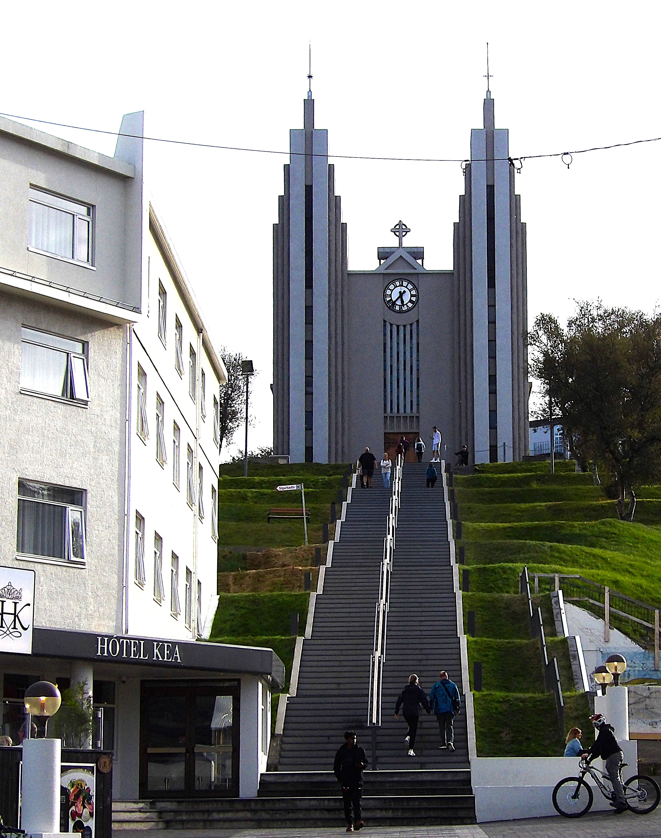
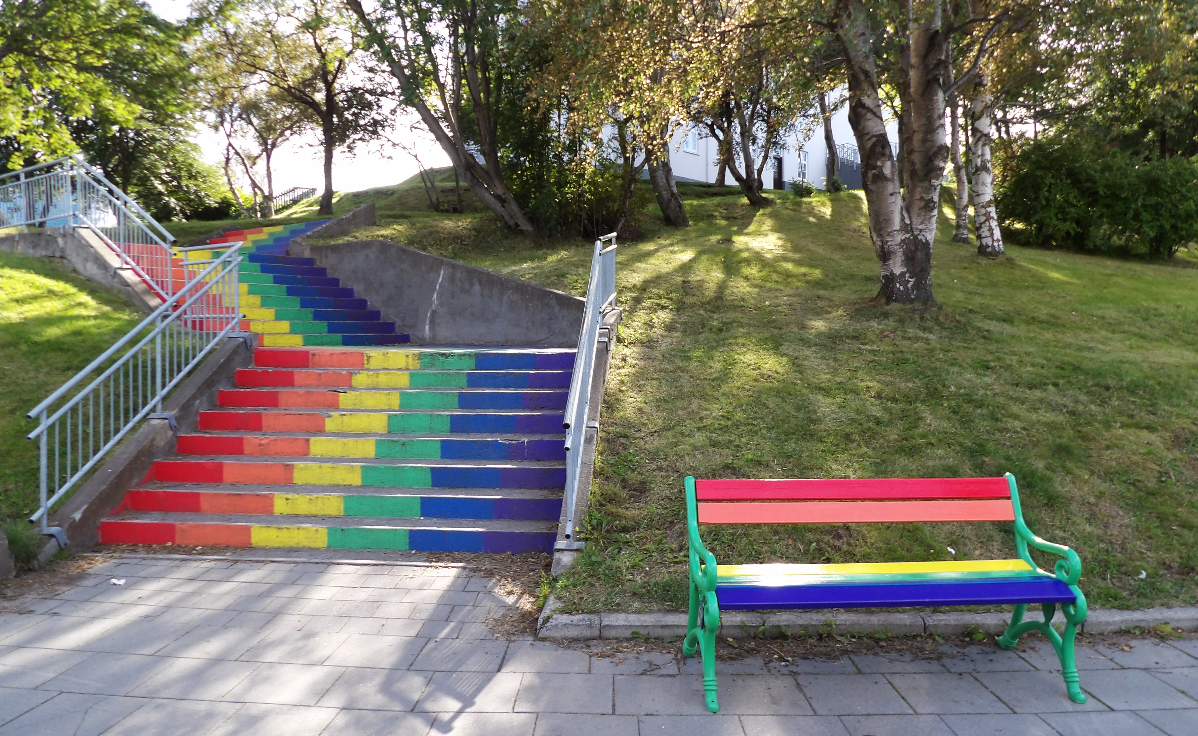
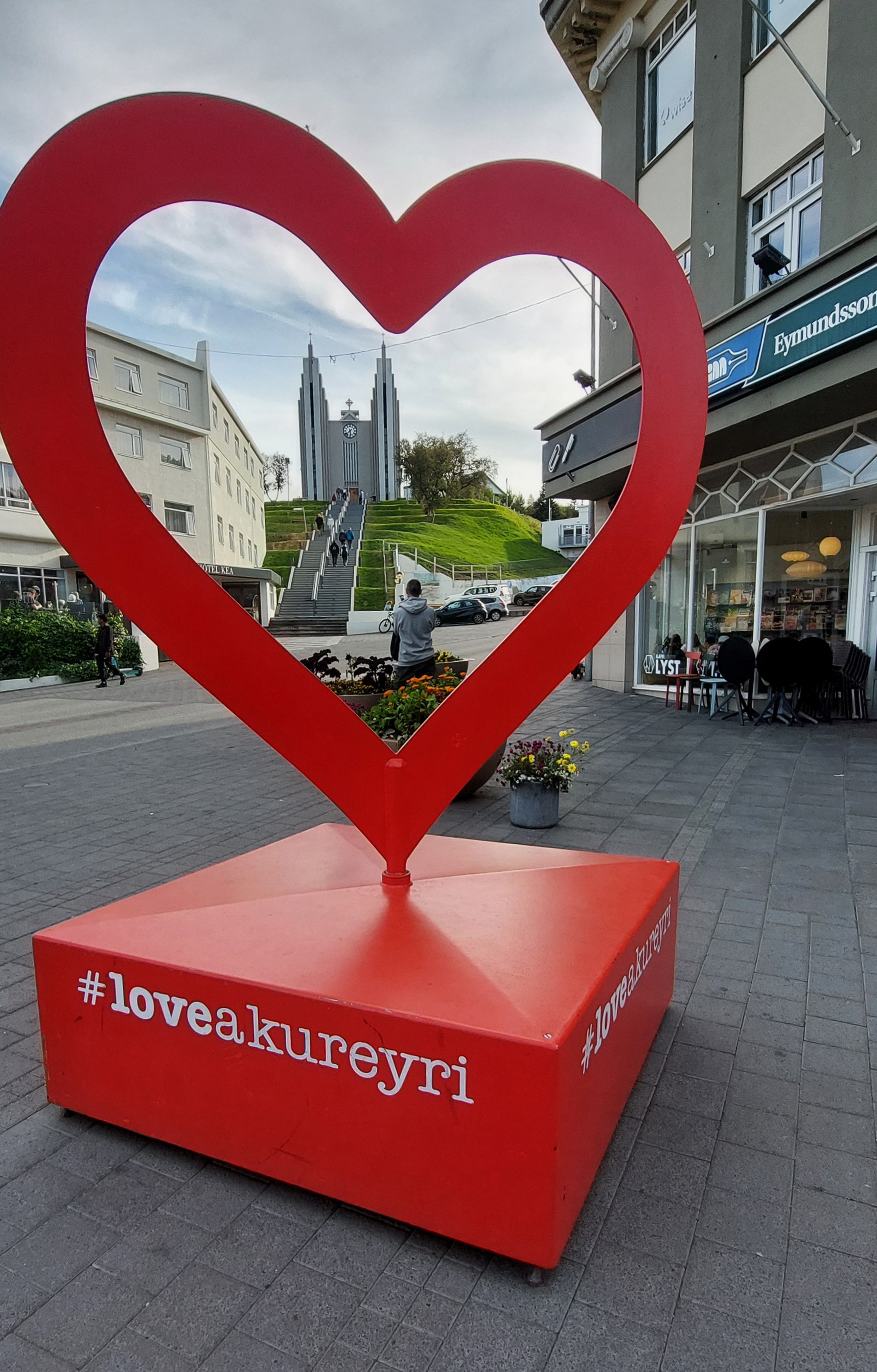
We wandered past Akureyrarkirkja which was bult in 1940 and was most impressive at the top of the steps. We chose not to visit the art museum as we had some serious relaxing to do.
Sundlaug Akureyrar.

Just up the hill from Akureyrarkirkja is the local pool. It was a lovely warm Saturday so it was busy but we were still able to relax and have a good time dipping in and out of the hotpots.
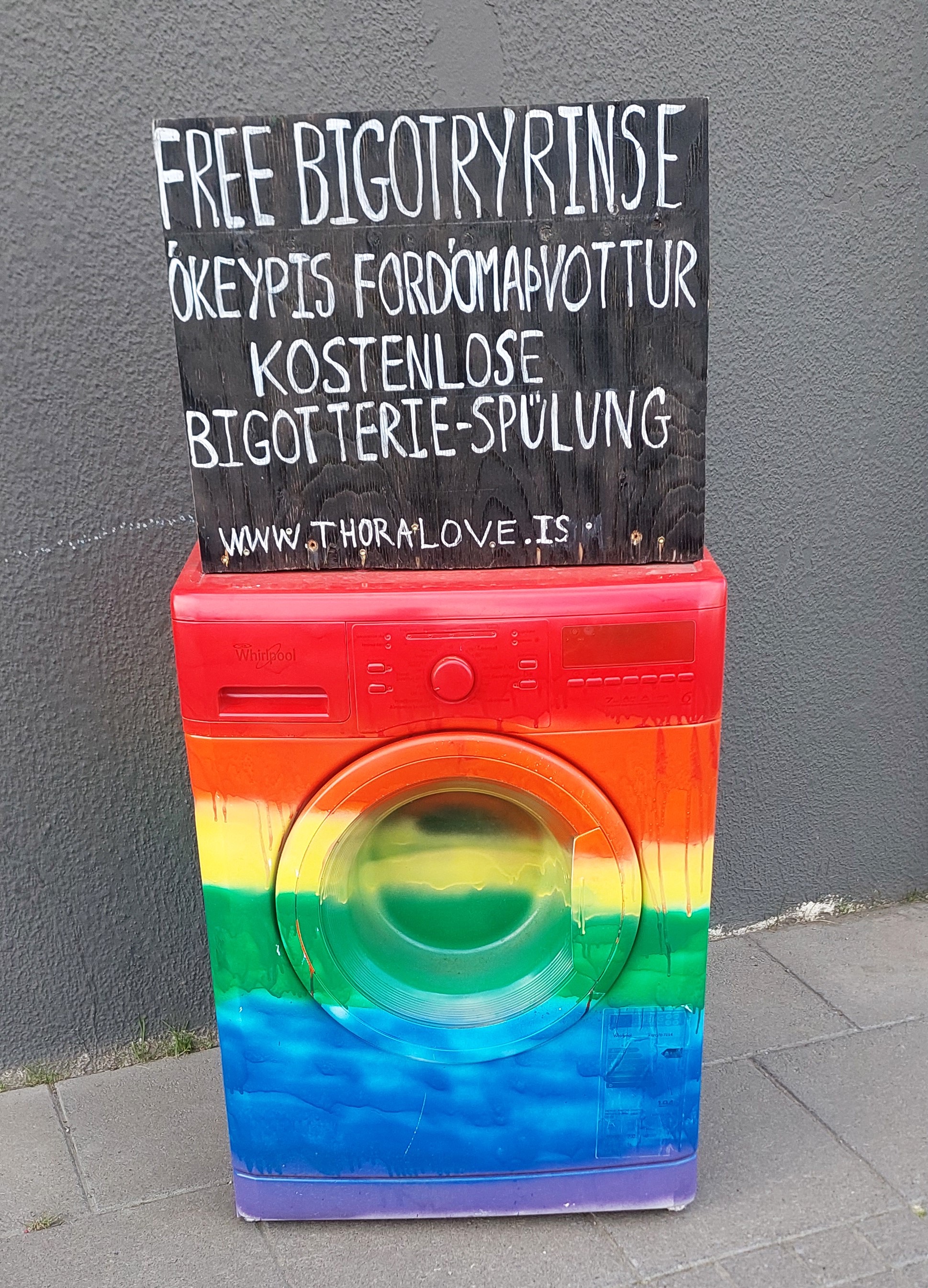


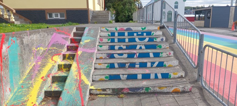
After a couple of hours at the pool we headed back down the hill. We had another mooch admiring the street art including a large mural of Hayley Mills, an elephant with a pram and colourful washing machines before settling into the R5 Bar for a wee drinky. This is where I sampled my first Húsavík Öl craft beer, [very acceptable]. We rounded the evening off with a satisfying meal at Greifinn which is a popular family friendly restaurant not far from our hostel. We didn’t go to bed late, we knew the next day was going to be full on!
Day 8 A day exploring Mývatn and Krafla
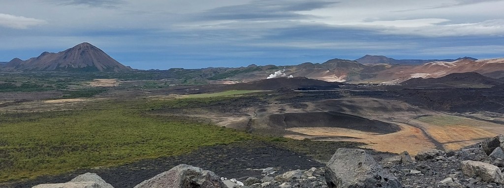
Today we planned to explore the Mývatn and Krafla area which lies to the east of Akureryri. It’s an active volcanic area to the north and east of Mývatn Lake. We got up early, and avoiding the tunnel headed for our first destination, a little known cave not far from town of Reykjahlið at the northern end of the lake.
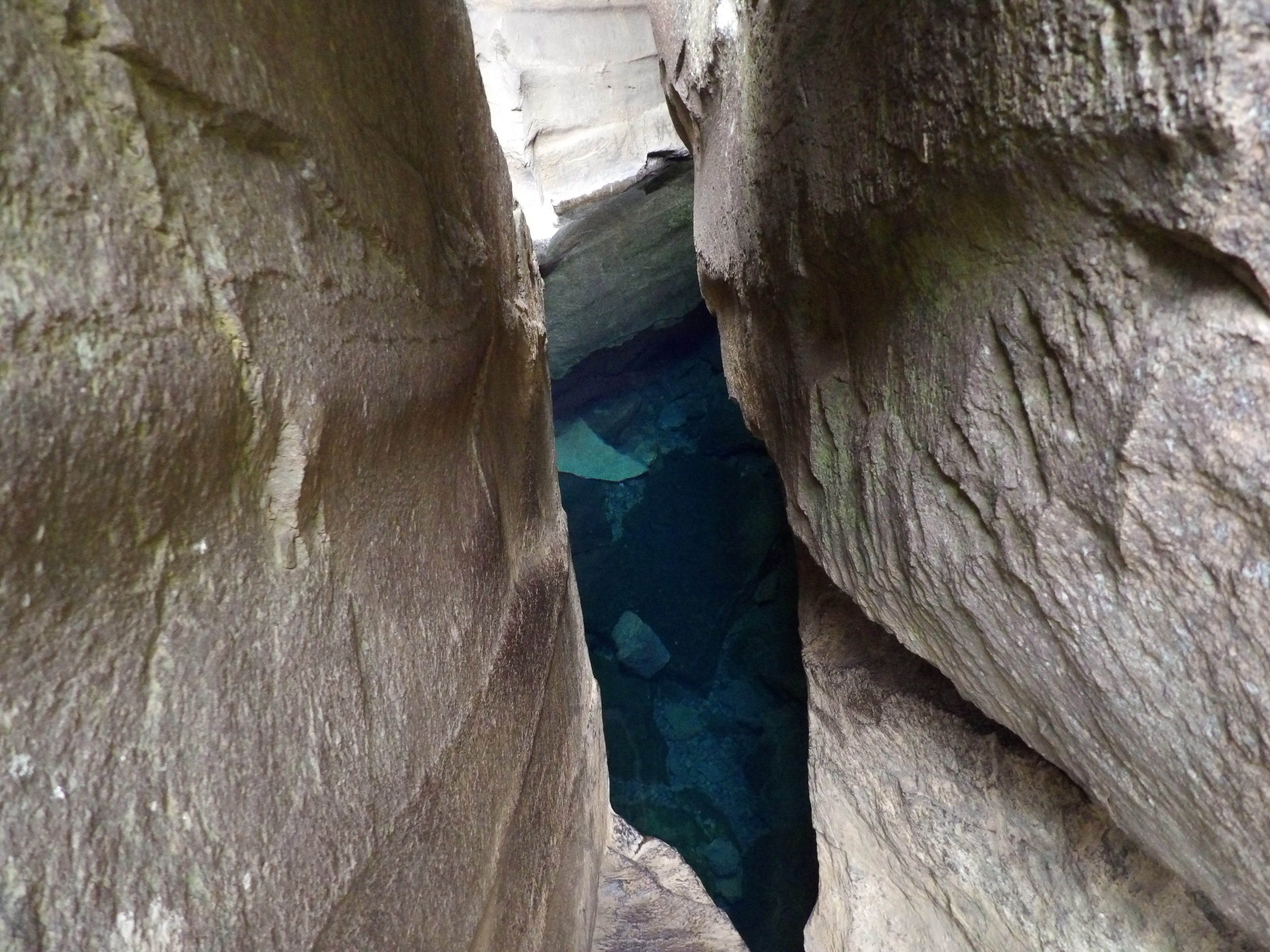
Stóragjá Cave

There’s a small layby on the road where you can park near the path that leads down to the cave which is in a narrow ravine. The cave contains a pool of crystal clear geothormal warm water. It may look inviting but it’s effectively a toilet, with no flush! There are a couple of ways into the water if you want to take the risk, via a rope or a ladder.


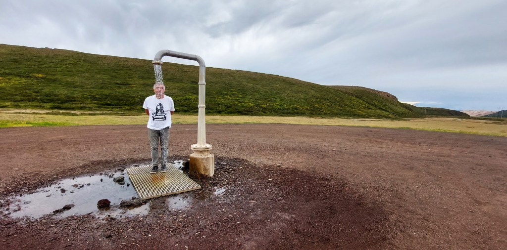
We continued along R1 before turning north on R863, stopping off at the Perpetual Shower, which is wonderfully bizarre but I didn’t get the urge to strip off, despite the water being nice and warm, it was a bit windy and chilly today.
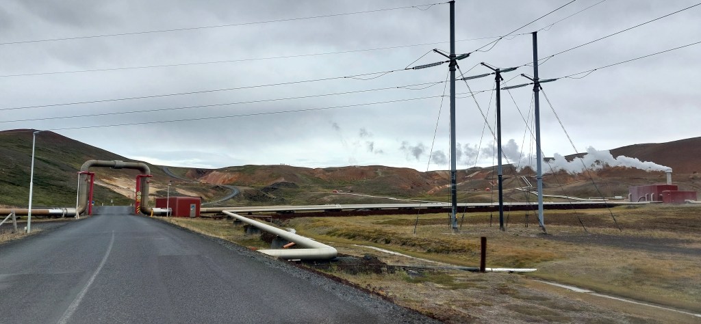
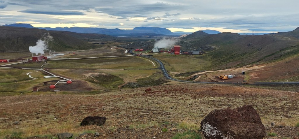
We then headed towards Krafla Power Station, under the pipes and on to Víti Crater which is in an active geothermal area of steaming vents and bubbling mud pools.
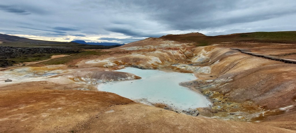
Víti Crater
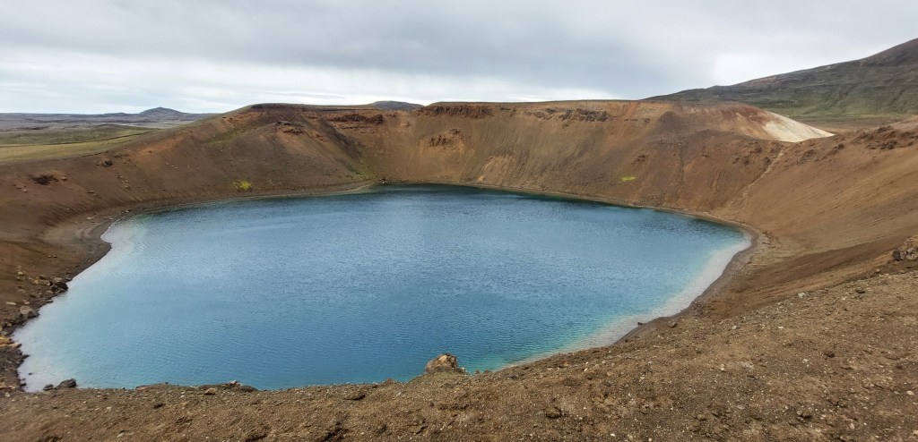
There is a fee to park by the crater but it covers parking at the three main sites in the Krafla area. The crater was formed by a massive explosion in 1724 and you can walk up the side of the crater and around the rim. At the centre of the crater is a pool of floodwater. The crater is well named – Víti means hell in Icelandic. The weather was still a bit drizzly so we had our picnic in the car overlooking the power station before continuing the short distance to Leirhnjúkur car park.
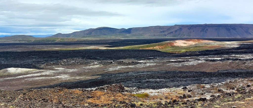
Leirhnjúkur Trail
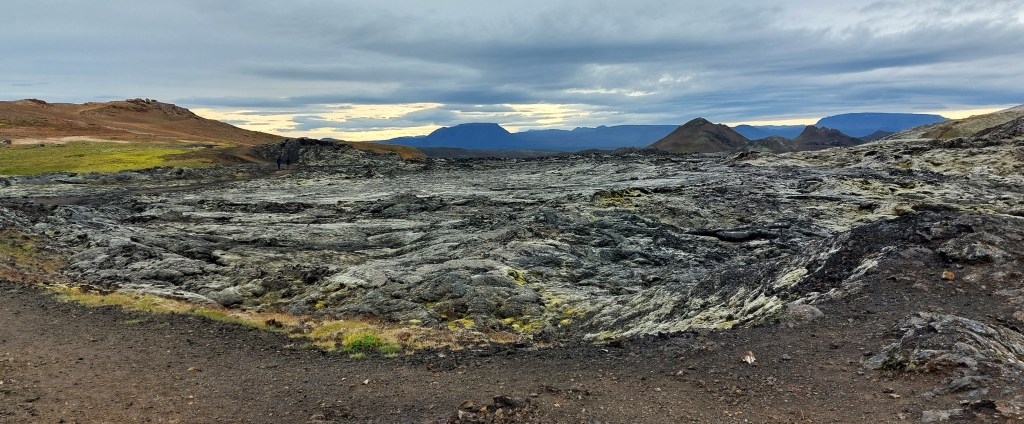
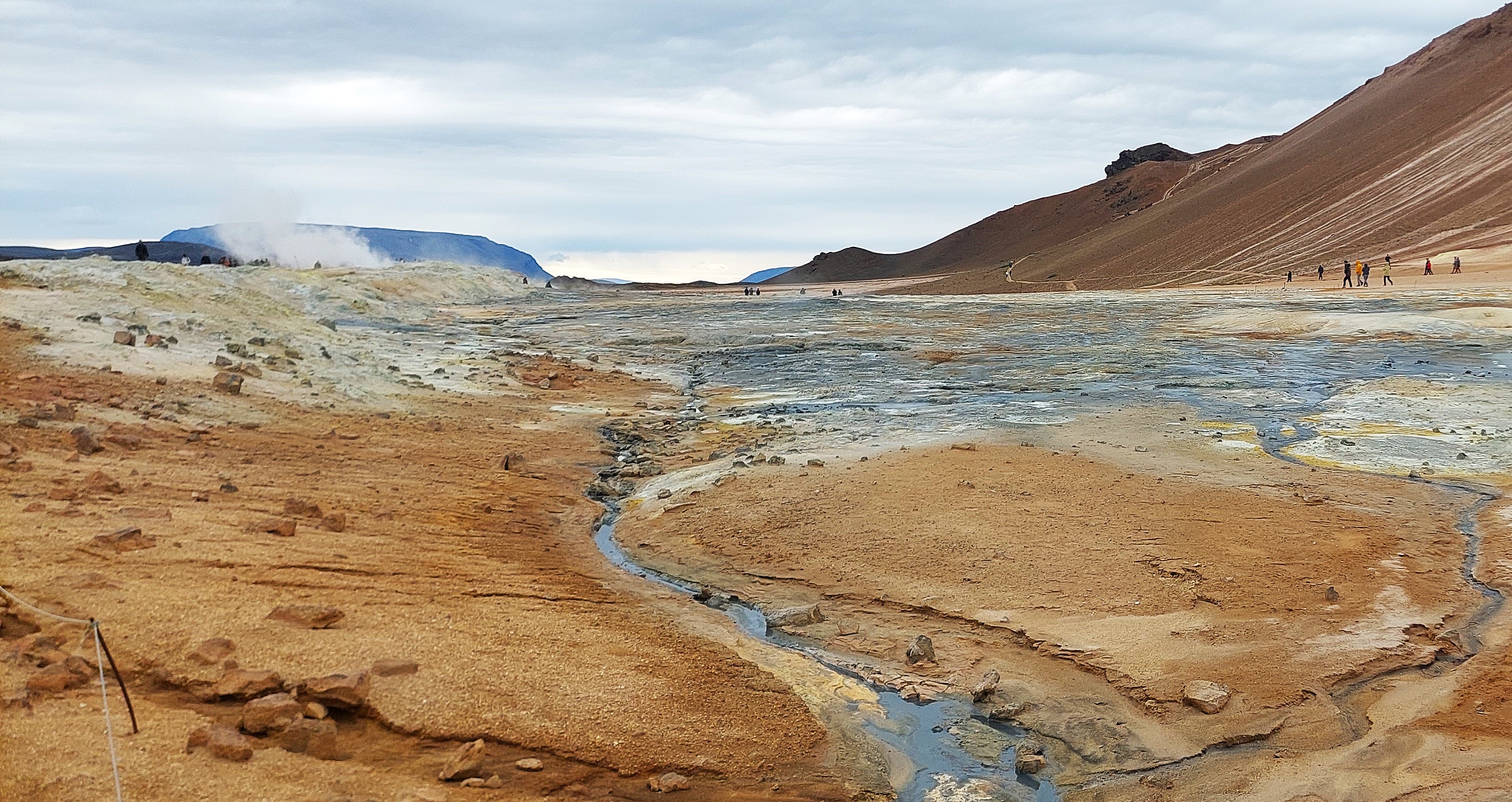
The Leirhnjúkur crater started to spew lava in an eruption in 1727 and the area is still active, with the last major event in 1975 known as the Krafla Fires. There’s a well marked trail past steaming vents and pools and earth stained yellow by sulphur. As we walked around the rhyolite hill [a silica rich volcanic rock] we could feel the heat emanating from the rocks around us.

The walk around the hill takes around an hour at a leisurely pace and the short walk to the top of the hill is worth it to take in the views. Some of the boarded path is in the need of repair so you need to watch where you are going.
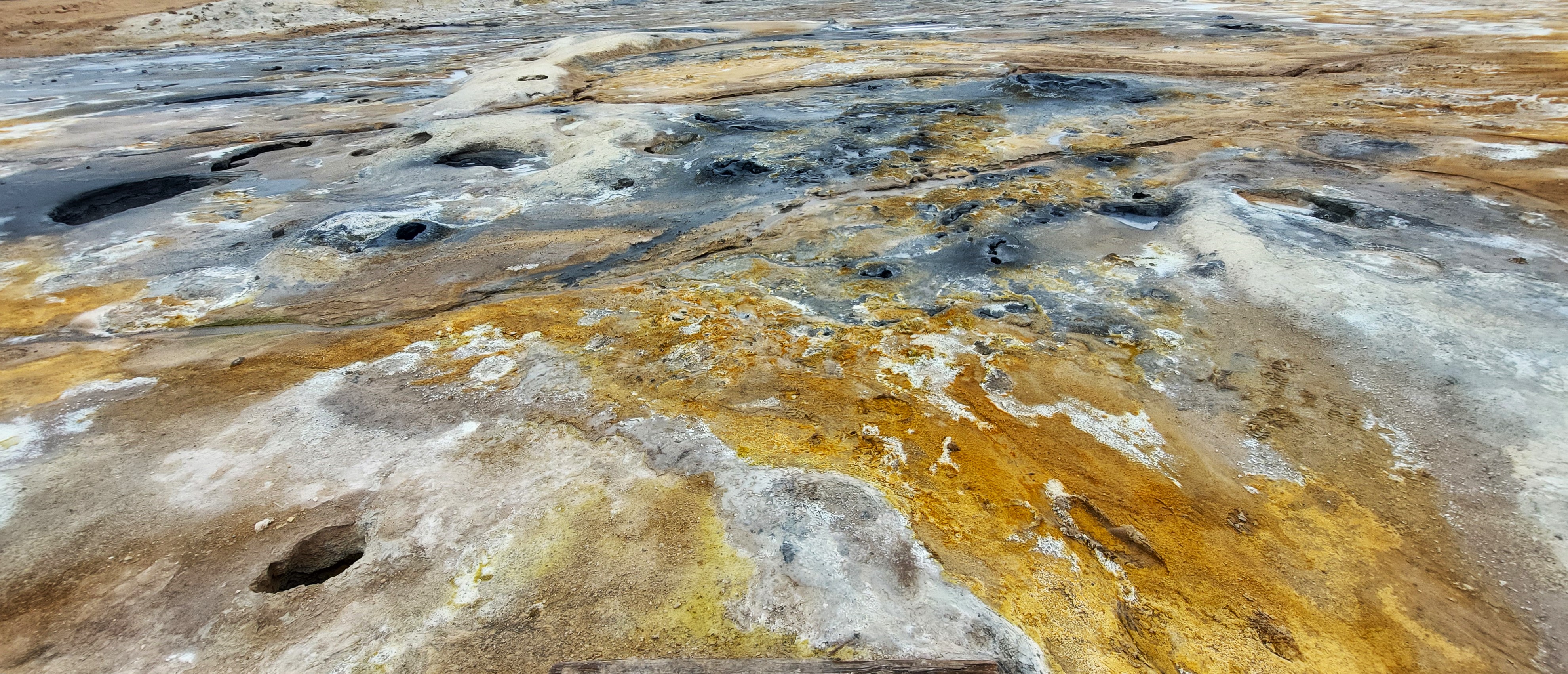
Hverir

The alien-like landscape of Hverir which is overlooked by Námafjall Ridge is next to R1 and its accessibility makes it a popular destination. Walking over the stinky bubbly hot mud pools on wooden boards and meandering through them is a incredible experience.

Grjótagjá Cave
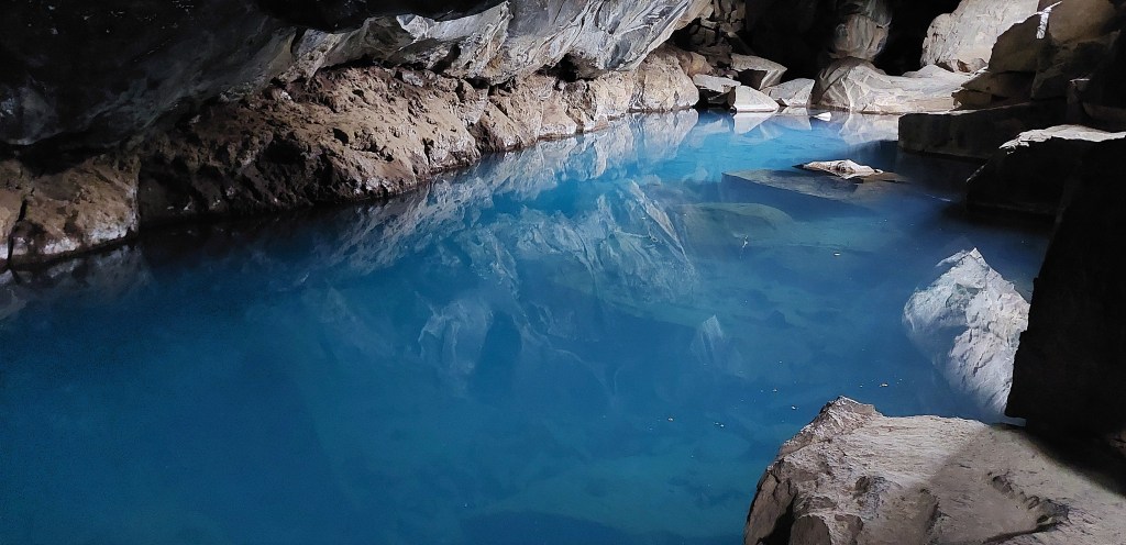
We headed west towards the lake to our next destination; Grjótagjá cave which has been a popular attraction since it appeared in an episode of Game of Thrones, [of which I’m not a fan]. It was busy when we arrived but clambering into the small cave filled with warm blue water was worth the effort. Bathing is not permitted here anymore.
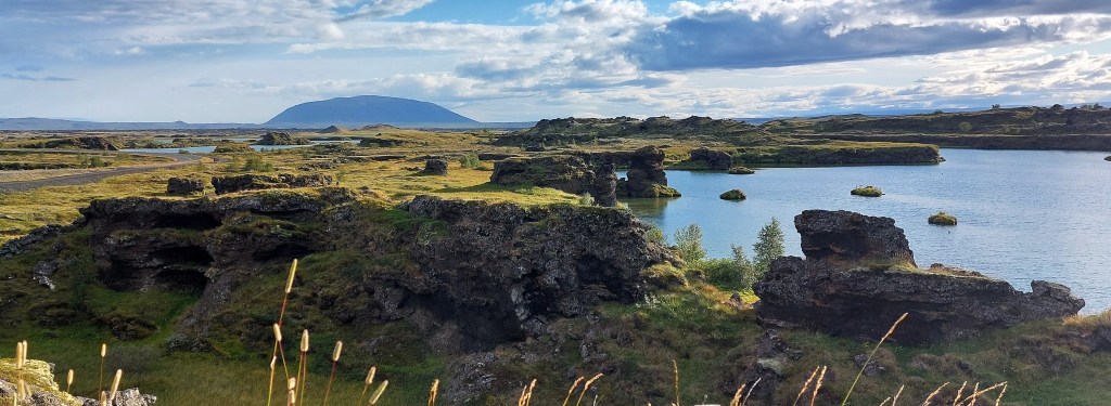
Hverfjall crater

We headed south towards Hverfjall, an imposing black crater formed by a huge eruption 2700 years ago. It was about 5pm by the time we got here so we took the crunchy path the the top but did not walk around the whole rim.
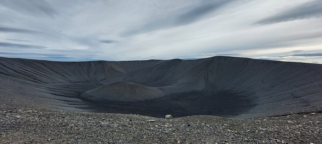
The view from the top of the crater of the surrounding countryside and the lake was fantastic. We then crunched our way back to the car park at the base of the crater to drive to another volcanic marvel.
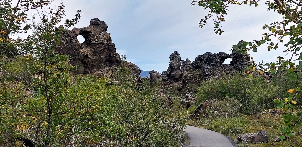
Dimmuborgir
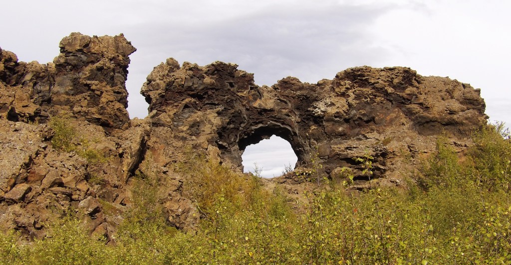

Dimmuborgir [which means Dark Castles] was a short drive from the crater. The interaction of the hot lava with the wet marshland caused the water to boil creating steaming jets that created the hollow pillars that remain. There’s a series of marked trails through the lava field of the spectacular shapes created over 2000 years ago. There’s a lovely cafe and toilets next to the car park.
Myvatn Lake
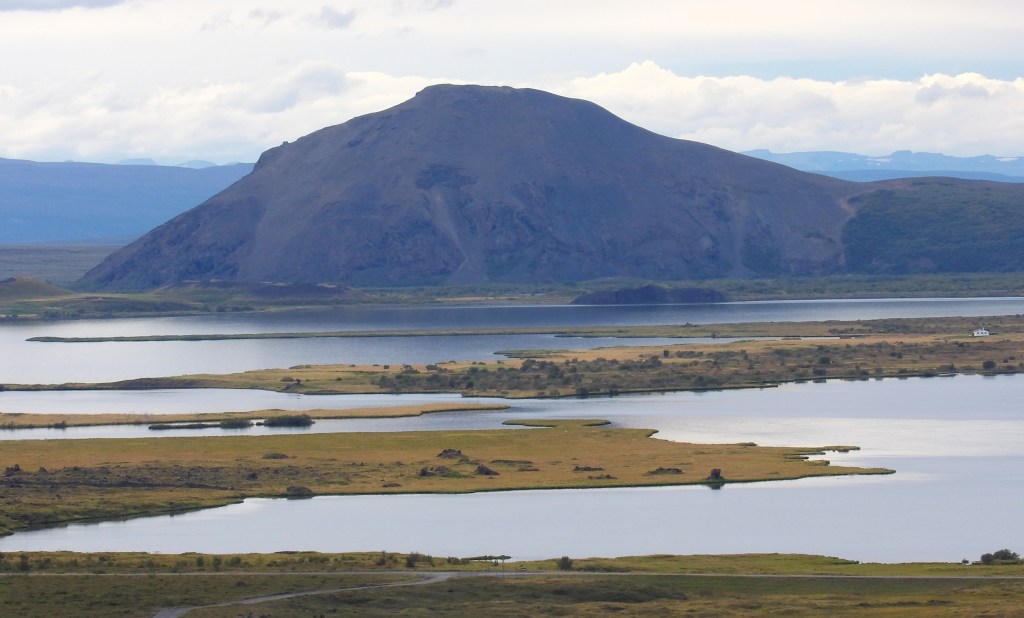
We had seen Myvatn Lake from up high at Hverfjall and we stopped off for a closer view as we drove past after visiting Dimmuborgir.
Skútustaðagígar pseudocraters

It was early evening by now and we were beginning to feel a bit tired [and peckish] but we were determined to get the most out of our day before returning to Akureyri. The pseudocraters are at the southern end of the lake and can be seen from the road. We stopped off to have a looky. They are dotted around like small hills and were formed by molten lava causing gas in the lake to explode.
Lystigarðurinn– Akureyri Botanical Garden
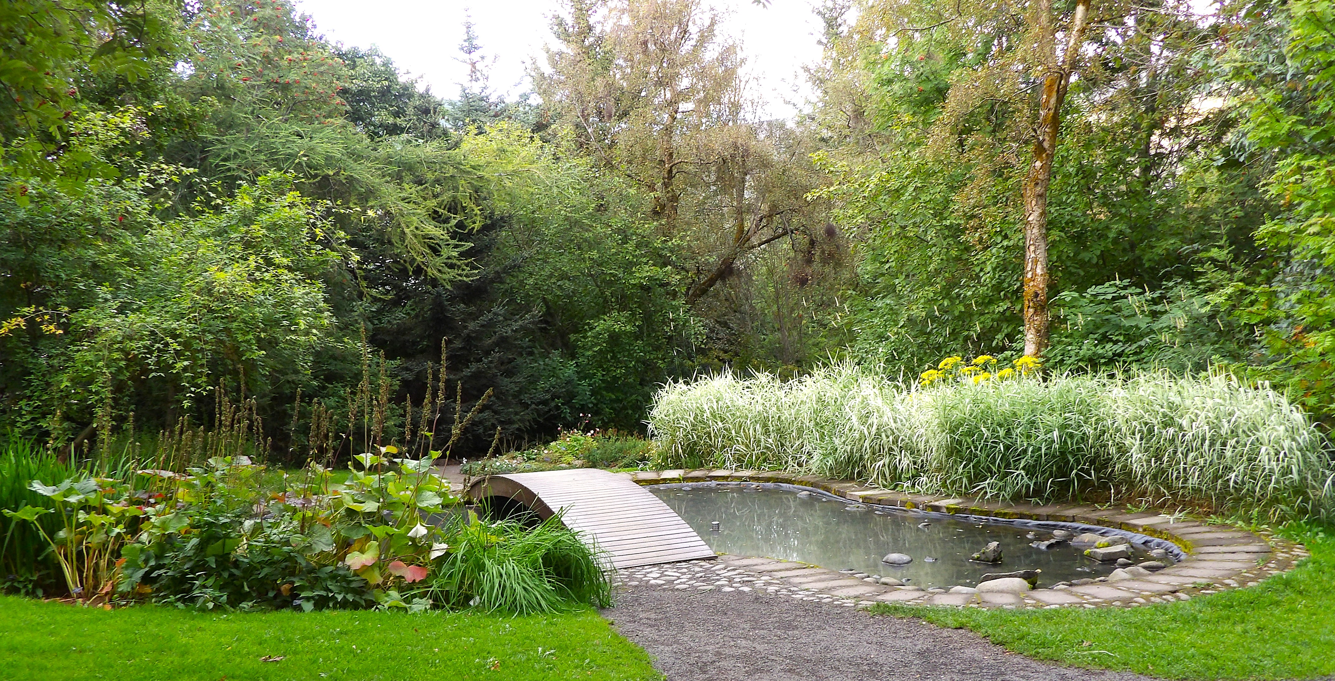
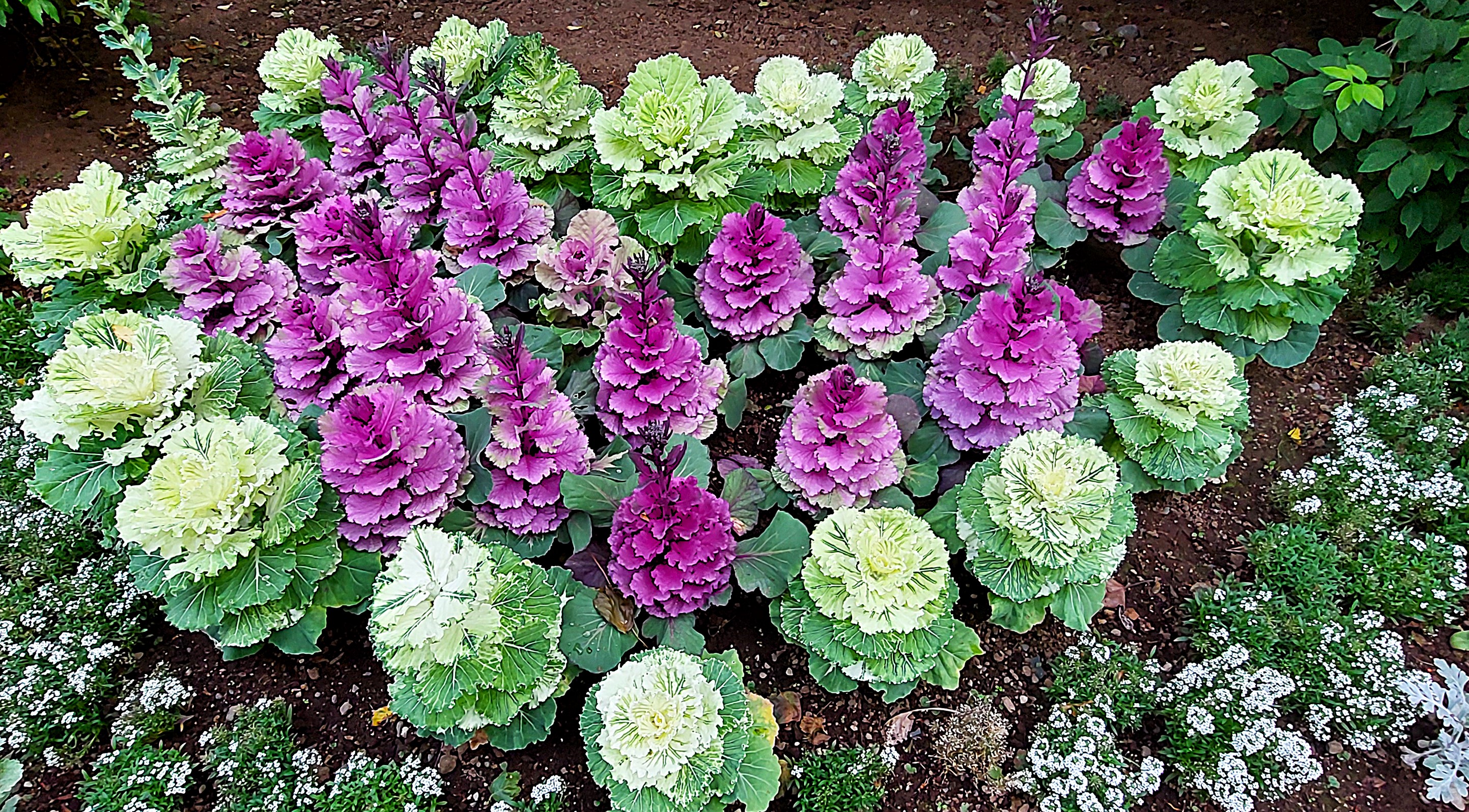
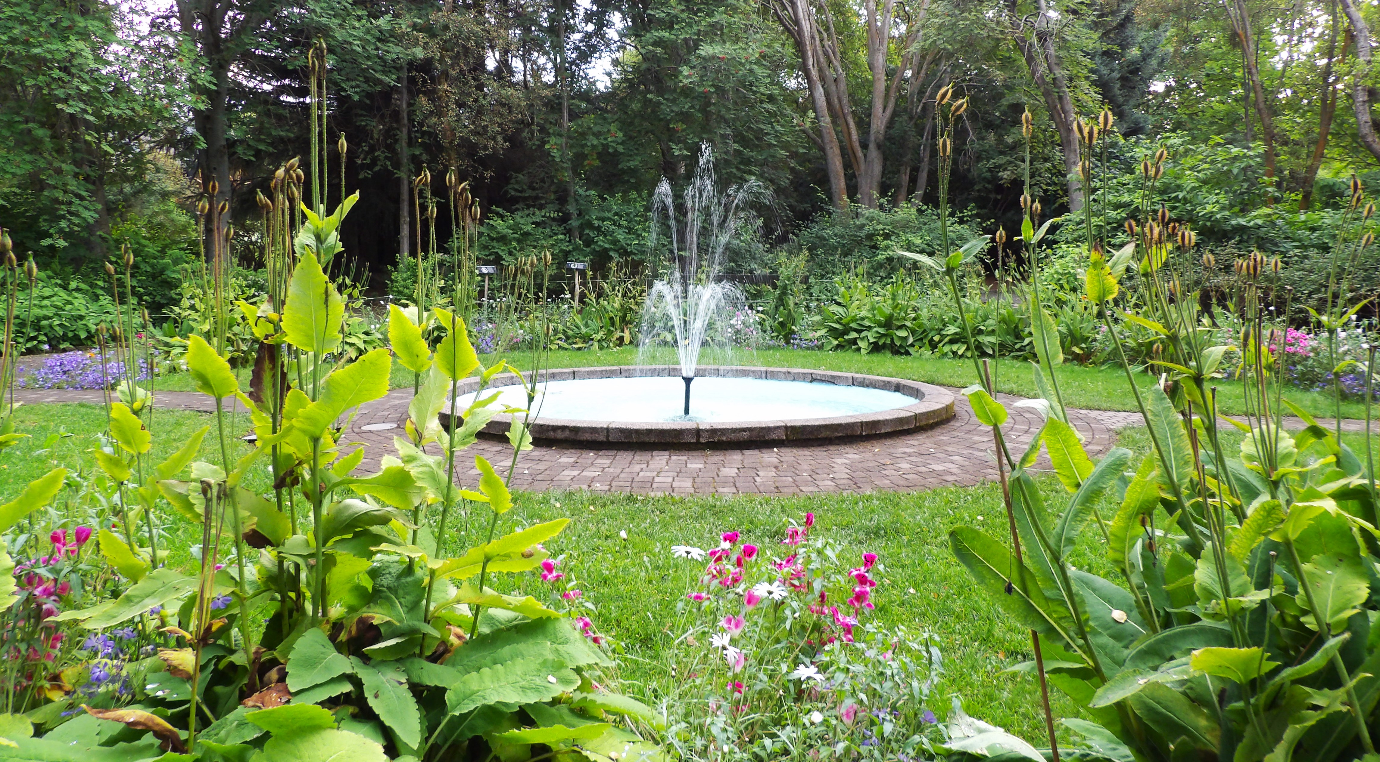
We were back in Akureryri around 7.30pm and as we passed the church noticed that the doors were open so I popped in to have a look before heading to the Botanical Garden which was nearby. My Lonely Planet guidebook states that these are the most northern botanical gardens in the world, but I don’t think that’s correct as I believe the one in Tromsø deep in the Arctic Circle is much further north. Whatever, the gardens were an absolute delight and even though we were exaustified and starving we were so pleased that we found the time to visit. It was a mild evening and there was hardly anyone around so it was a lovely tranquil experience wandering around the garden paths.

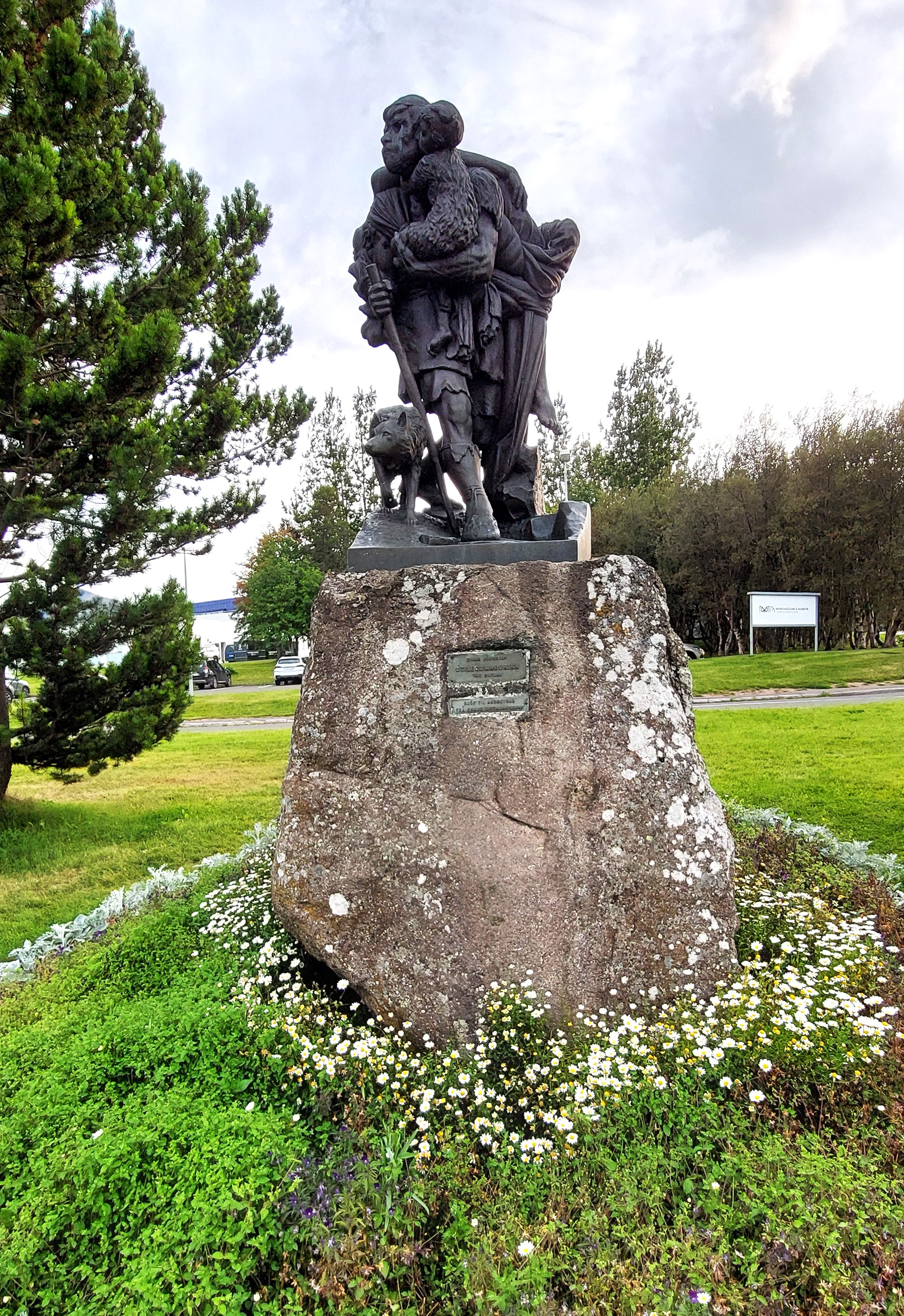
Just around the corner from the Botanical Garden were some lovely colourful buildings and a fine statue by Einar Jónsson called The Outlaw which we passed on our way back to our hostel.
The evening rounded off nicely with a pizza from Dominos [which was right by our hostel] washed down with a bottle of red wine. We fell into bed absolutely knackered- Woof- what an amazing day!

Day 9 Husavik
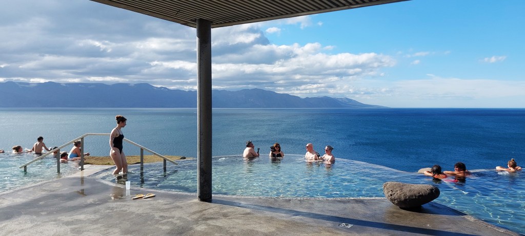
Our next destination was Husavik which is north east[ish] of Akureyri but we wanted to have a warm bath on the way. We avoided the toll tunnel for the last time [we must have saved a small fortune] and headed to the Mývatn Nature Baths, 45 minutes from Akureyri which we had booked for 11.30am.
Myvatn Nature Baths (Earth Lagoon)
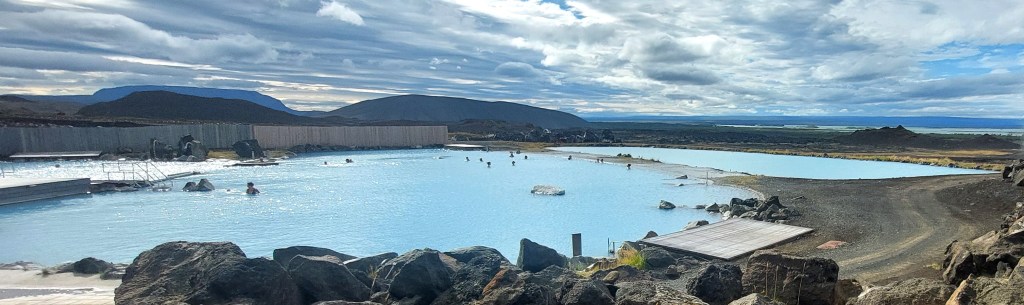
Cheaper than the Sky and Blue Lagoons, and much more laid back. The Nature Baths which are just off R1 to the east of Reykjahlíð was really wonderful. On our visit it was not busy, the weather was great and we really enjoyed doing bugger all in a wonderful setting. The baths are undergoing an expansion which I hope will not spoil what they are already offering, I suspect they know what they are doing. We had a tasty lunch in their cafe on the outside terrace, it transpired that this was our only non-picnic lunch on our entire trip!
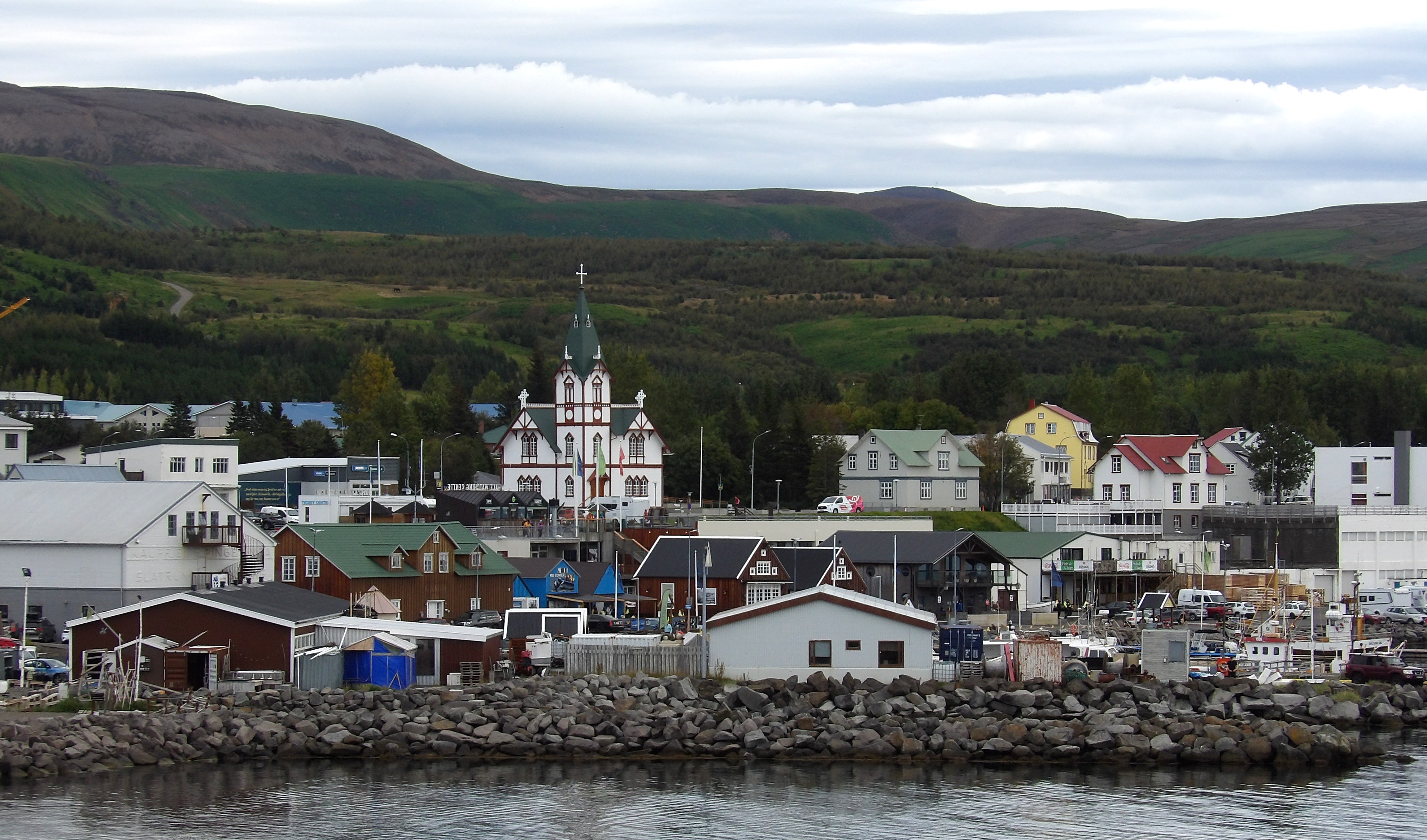
Husavik

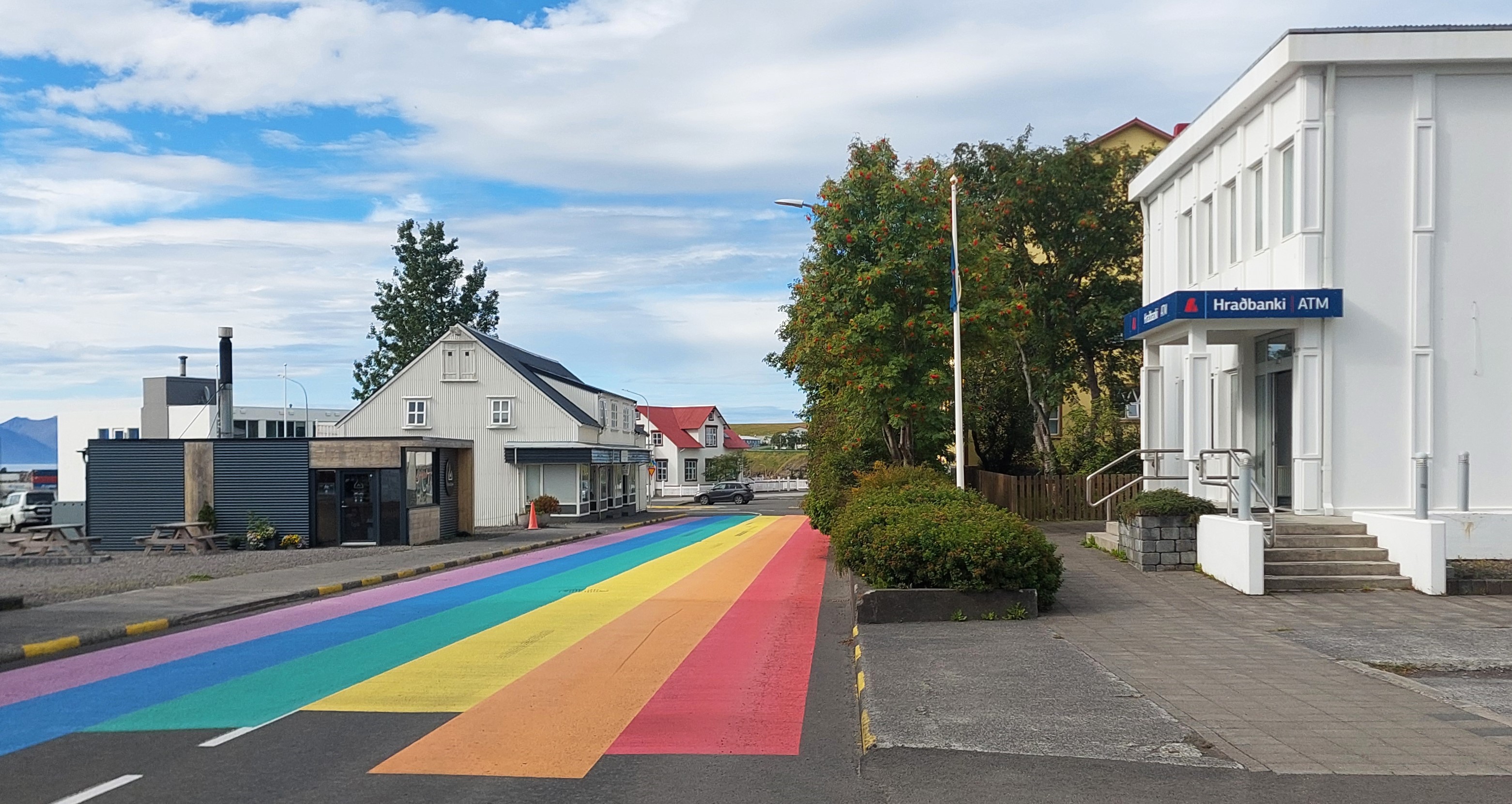
We arrived in Husavik mid afternoon and had a wander before checking into our accommodation. Husavik is a small pretty fishing town with views over Skjálfandi Bay onto the Greenland Sea and is where many tourists head for one reason – whales!
Húsavíkurkirkja


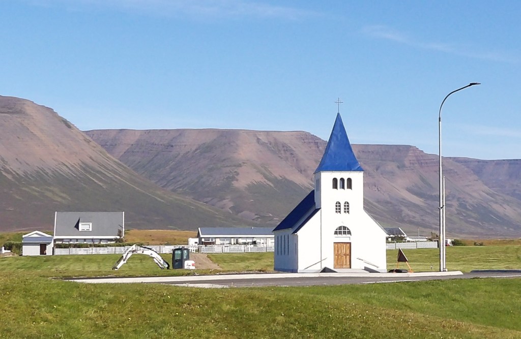
We sauntered along the colourful road that lead to Husavik’s wooden church which was built in 1907. It had an Alpine look about it, quite different from the other churches that we had seen so far on this trip.

Astronaut monument

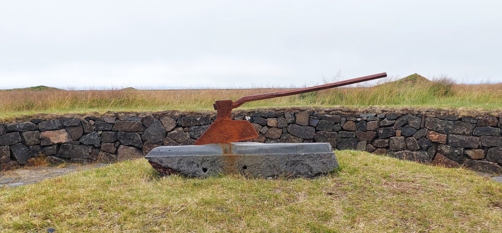
During a mooch to get our bearings we found the Apollo Astronaut Training Monument which was erected to commemorate NASA using the Husavik area in the 1960s as geology training for their budding astronauts. The views back over the town were lovely.
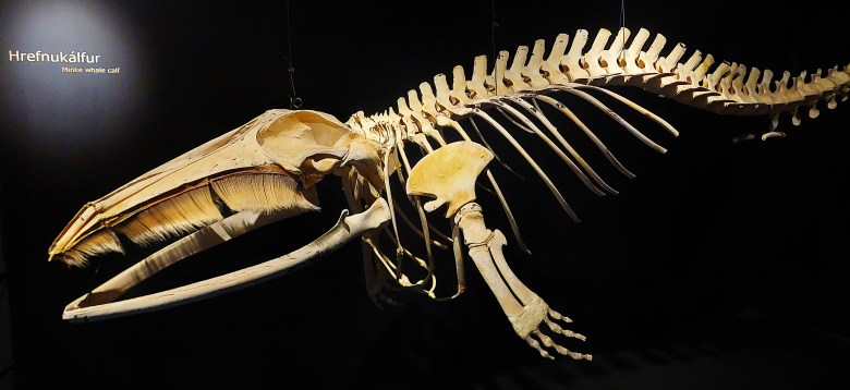
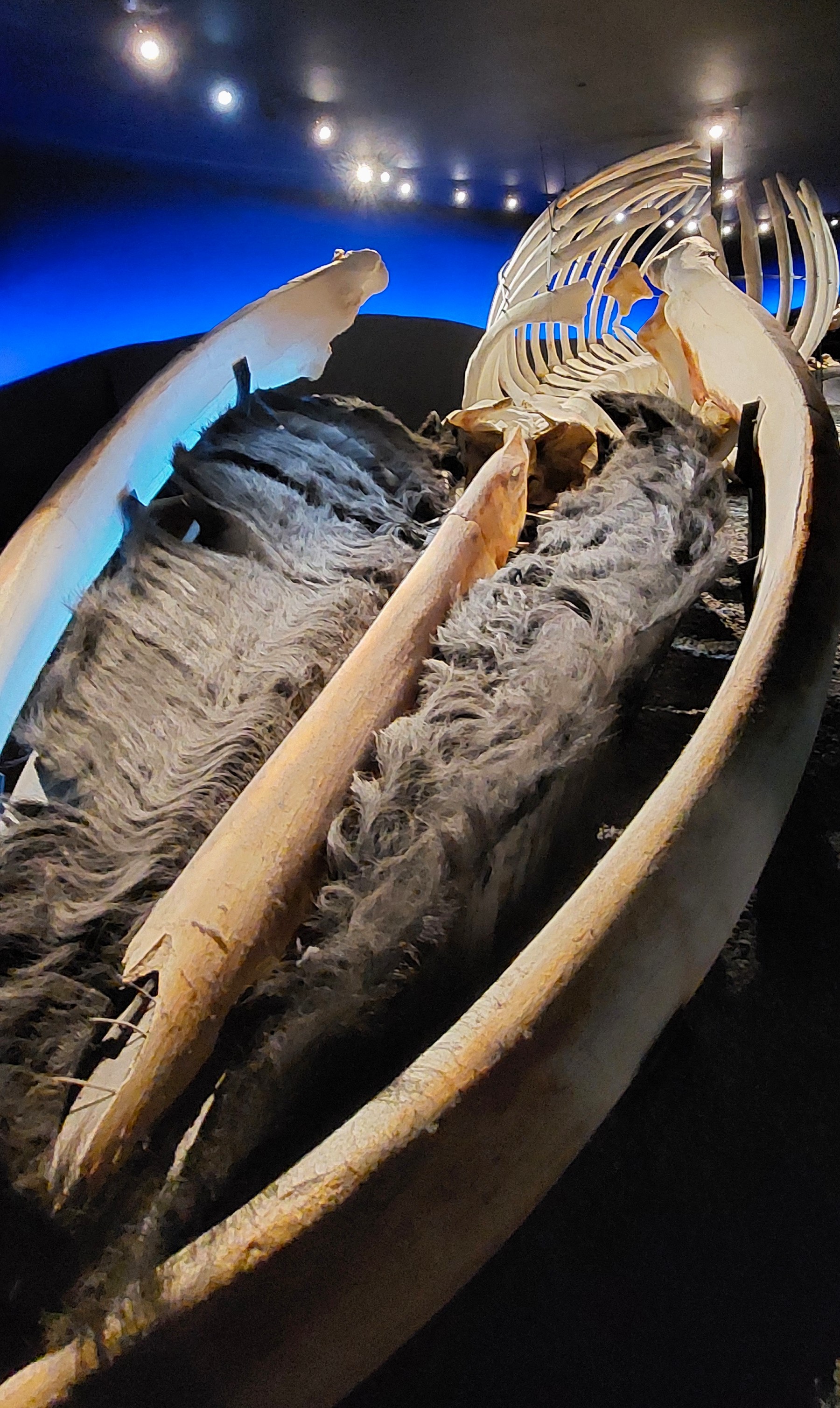
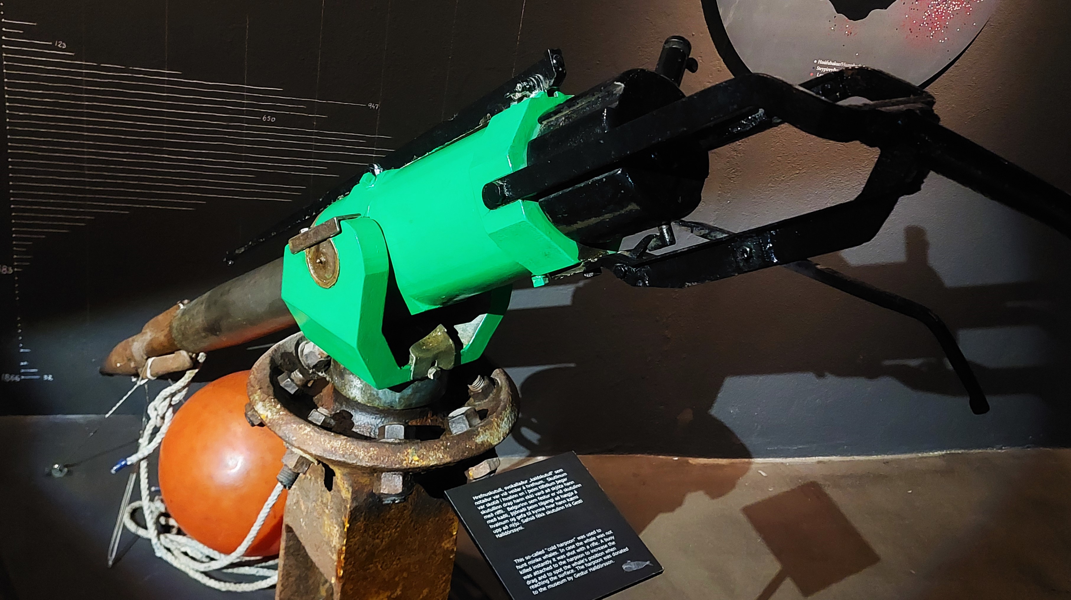
A few minutes away from the church by the harbour was The Husavik Whale Museum in an old slaughterhouse. As we had a whale tour booked with Gentle Giants the next day we got a 20% discount [yay!]. The museum was interesting and well laid out but it did lack the hands on interactive approach which many museums offer nowadays. The history of whaling in Iceland and ongoing conservation were covered. The etherereal short film was not for us, we would have preferred a fact filled documentary.
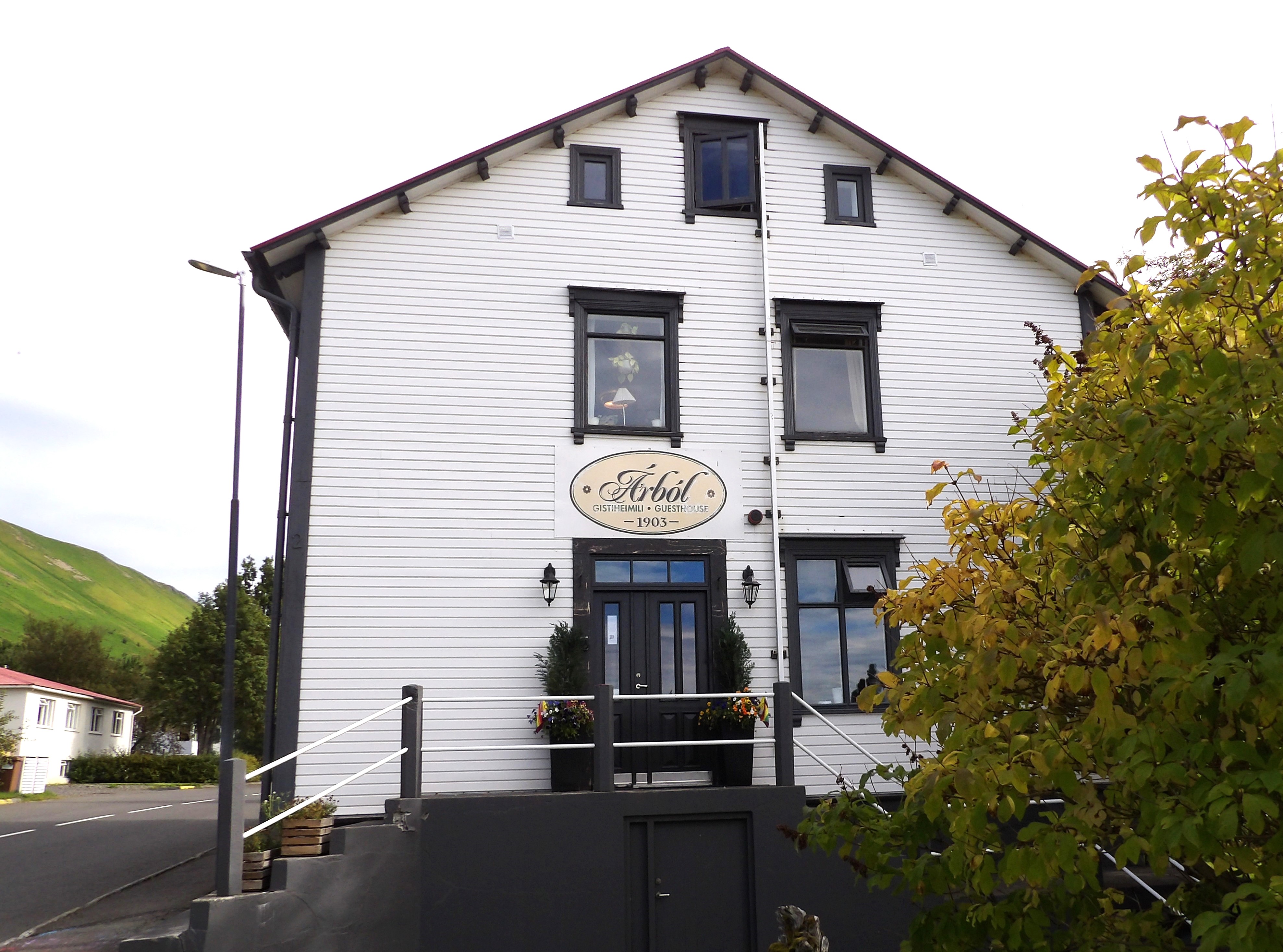
We popped into Vínbúðin for some wine and beer [just in cases] and checked into Árból Guesthouse which was to be our home for the next two nights and was next to Skrúðgarður, a lovely park which we intended to explore later. The host was very friendly and our room was homely. We loved our stay here.

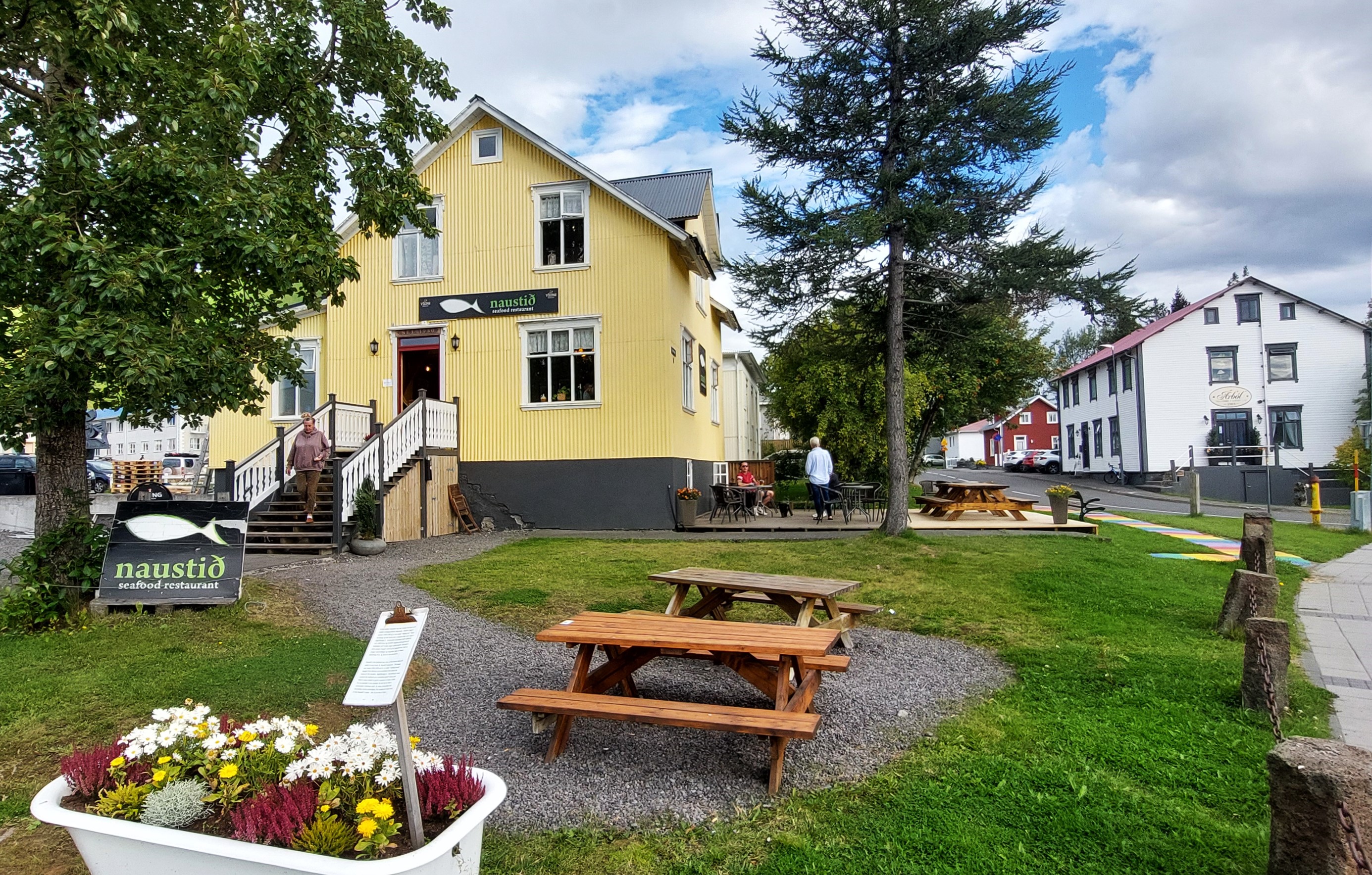
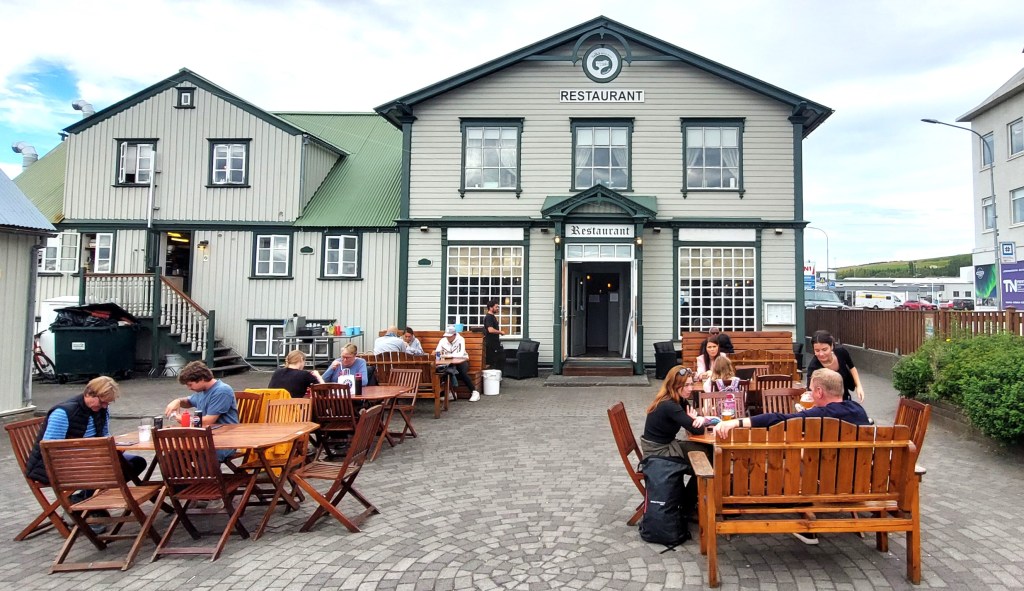
Our dinner was at Naustið, a fish restaurant which was just over the road from our guest house. The building was the site of the town’s first bathtub hence the bath in the garden. I chose the fish platter and Leashia the duck salad, both were excellent. Once again we got a discount as we had a tour booked with Gentle Giants, this time it was 10%.

Skrúðgarður
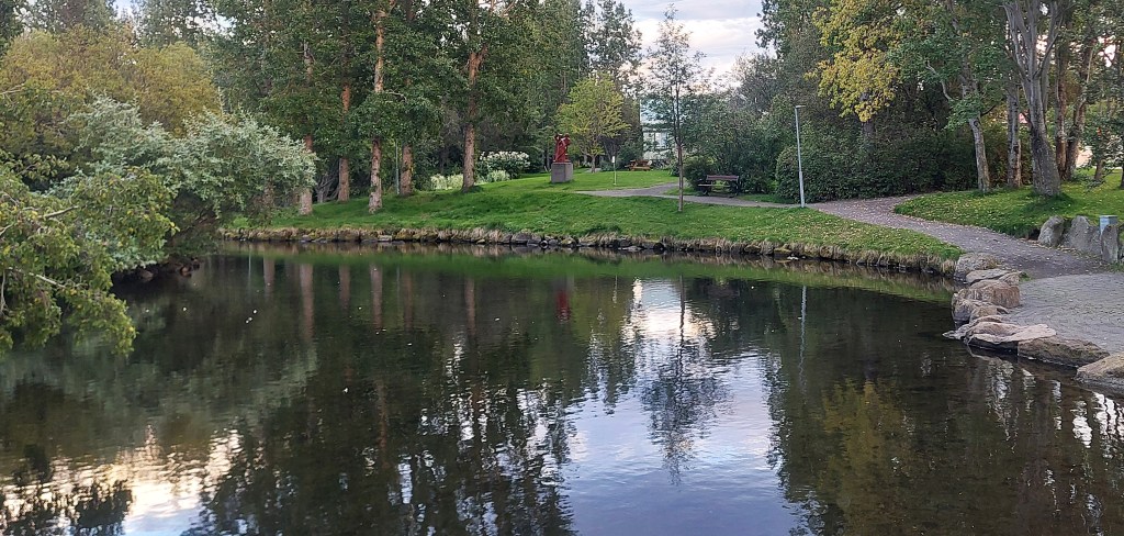
After dinner we took advantage of the long day and the mild evening to have a stroll through the pretty park next to our guesthouse before heading home. We had an early start the next day- we were going whale watching!
Day 10 Husavik
Breakfast was delivered to our room which was really lovely. We had to scoff it as we needed to get to the harbour by 8.05am for our whale watching trip which was due to depart at 8.45am.
Gentle Giants Whale Watching Tour

We checked in for our tour at the Gentle Giants office and waited at the harbour for the tour to start. We were given waterproof overalls and we settled at the front of the boat to get the best views. The tour was scheduled to last around three hours.

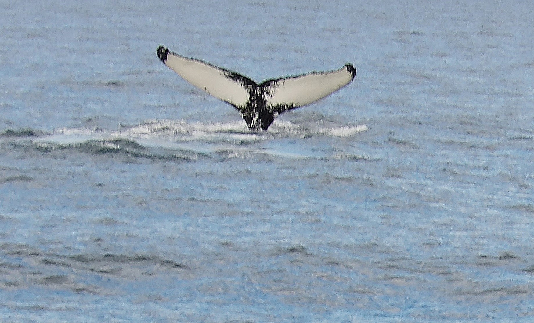

We were lucky and saw several humpback whales and a solitary dolphin. We did learn a couple of things on this tour: It’s very hard to take a photo of a whale when you are being tossed around on a boat and if you are at the front of the boat you are likely to get very wet, despite the waterproofs! It was lunchtime by the time we returned to shore so we opted to have a picnic in the park as it was such a lovely day and then head to the local pool for a dip.

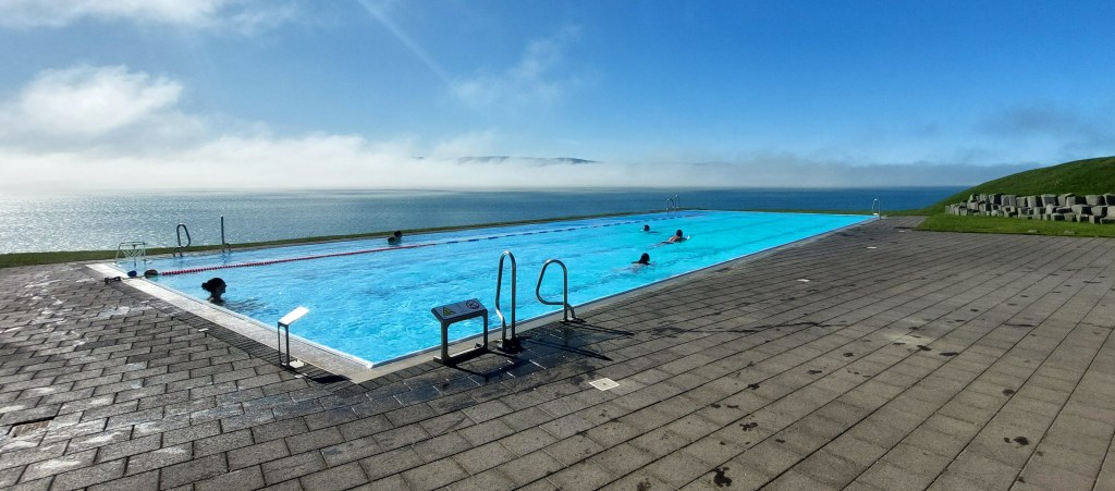
On our way to the pool we bumped into a couple who were staying at our guest house and they had just been to GeoSea and said we had to go, so that we did. GeoSea was a 20 minute walk on the northern edge of Husavik. We walked past Sundlaug, [see photo above] the local pool on the way.
Eurovision Exhibition
On our way to GeoSea we popped in to look at the Eurovision Exhibition which is behind the Jaja Ding Dong Cafe.

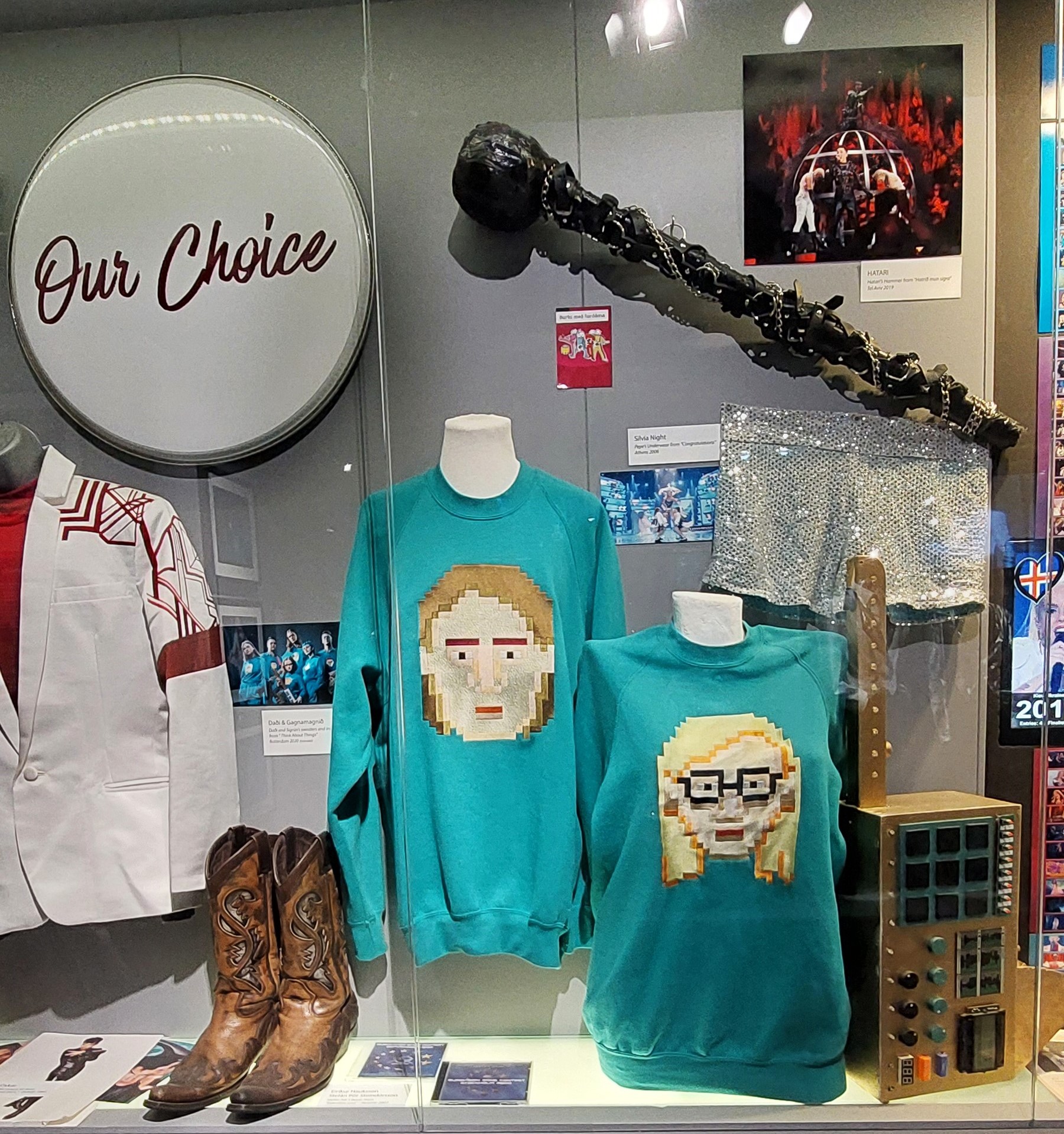
I’m not a huge fan of the Eurovision Song Contest [or the film!] but I do have a soft spot for Abba who won in 1974 in my home town of Brighton. I also like Icelandic singer Daði Freyr who would have won in 2020 but the contest was cancelled due to covid and costumes were on display from his wonderful video. The exhibition was about to close but we were permitted to have a quick look around for free which was most kind. It’s not a big exhibition but it was well laid out in a couple of rooms and had some great Eurovision mementos on display.
GeoSea has a prime location next to the lighthouse overlooking Skjálfandi Bay. It’s more expensive than the local pool of course, but cheaper than some lagoons I can mention. I got a 15% Gentle Giants discount which was most welcome. Leashia chose to have a coffee while I wallowed. The pool was busy but I was still able to relax and enjoy the view over the bay. I even saw whales in the bay from the main pool!

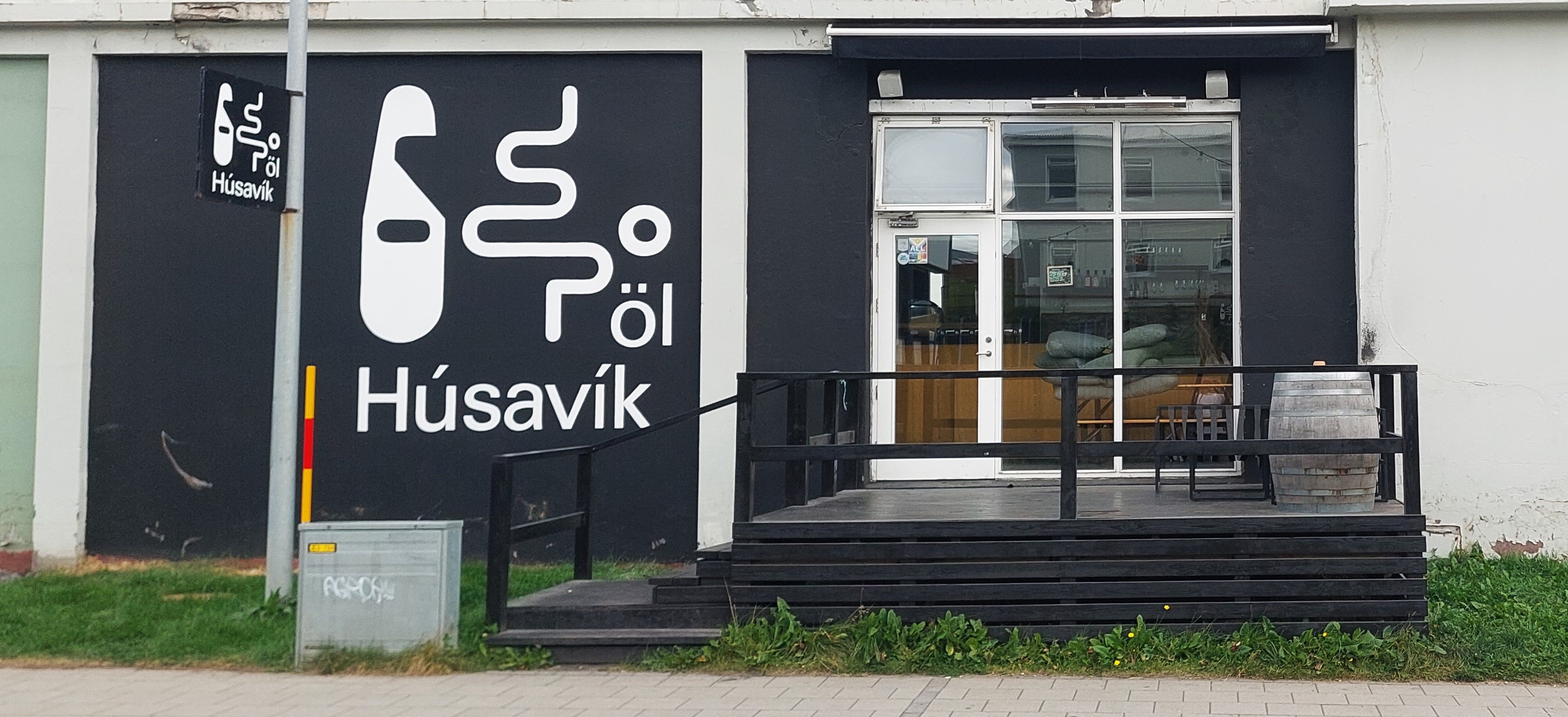
After GeoSea I felt all floppy so that meant a drinky was in order so we stopped for a wee bevvy on the terrace at Jaja Ding Dong on our way back into town. We passed by the local brewery- the Húsavík Öl Tap Room. I had enjoyed their beer in Akureyri and I love their design, however when I enquired about the t-shirt and found out it was going to cost me around 50 quid I thought better of it! We rounded off a most pleasant day with dinner at Salka which is near the harbour.
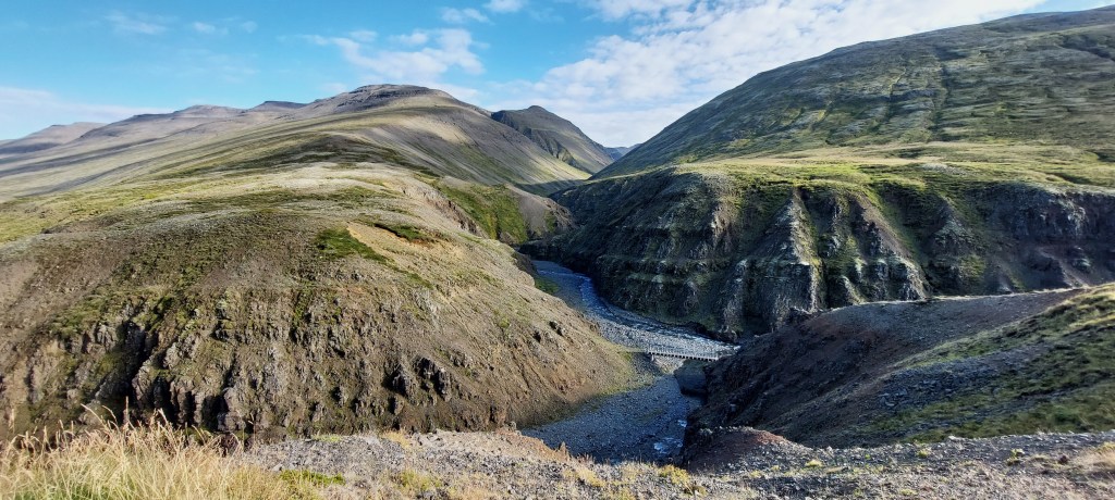
Day 11 Jökulsárgljúfur Canyon.
After another lovely breakfast that was delivered to our room we departed for Seydisfjordur on the east coast and driving non-stop would take us around three and half hours. However we had several stops planned as we wanted to explore Jökulsárgljúfur which is part of the Vatnajökull National Park.
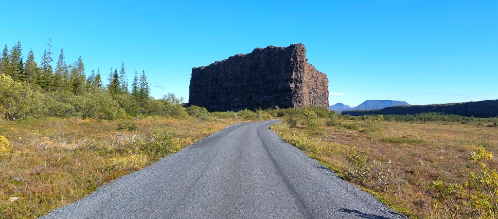
Jökulsárgljúfur
Jökulsárgljúfur Canyon was formed by Jökulsá á Fjöllum, Iceland’s second longest river and further shaped by volcanic activity. The canyon is about 25km long and starts at Ásbyrgi in the north and ends at Dettifoss in the south.
Our first stop was the Gljúfrastofa visitor centre near Ásbyrgi, just off R85 where we were given advice and a map of the canyon. It was a short drive from here to Botnstjörn, which is a pond at the bottom of a semi circular cliff in a pine forest – yes, contrary to popular myth, Iceland does have trees!

We then had to double back to get on to R862 which runs north/south along the western edge of the canyon.
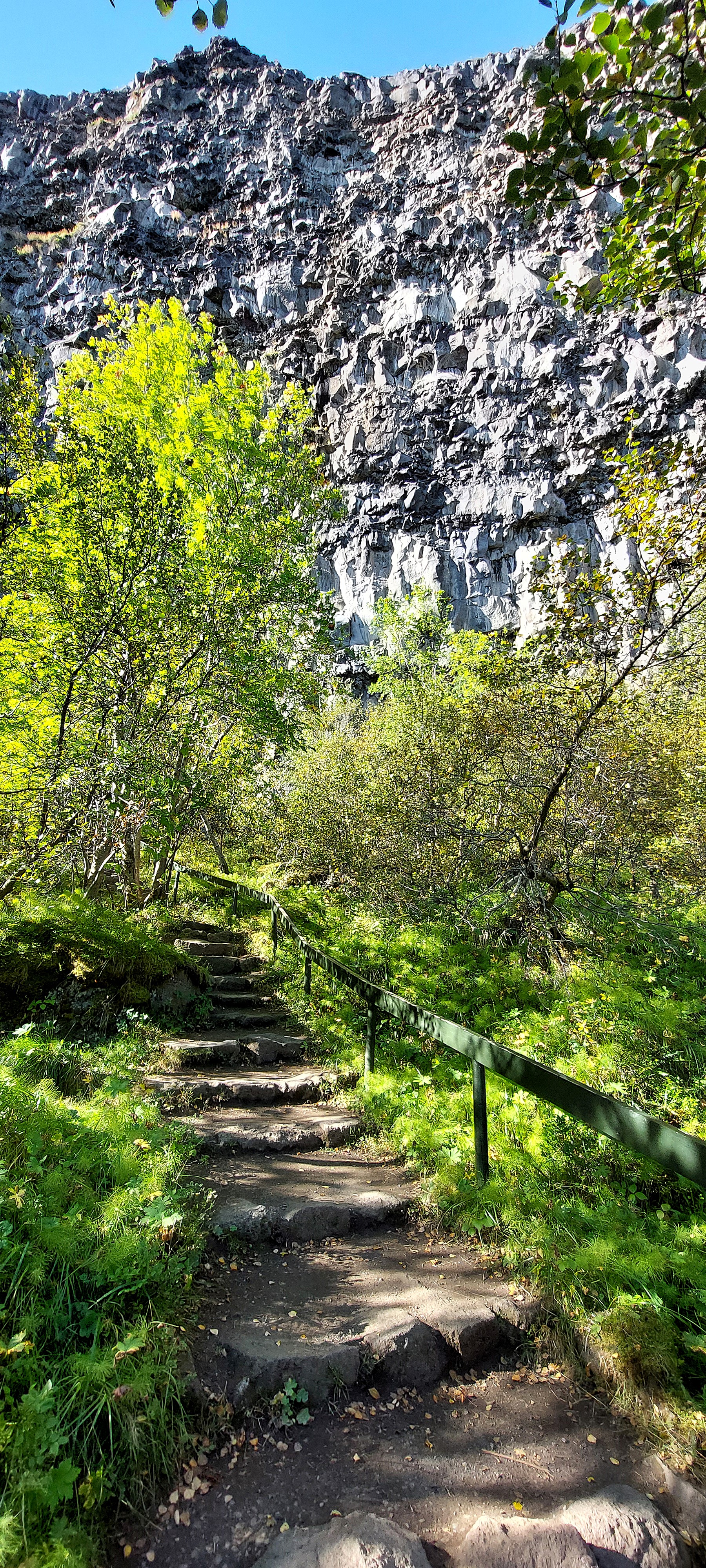
Vesturdalur
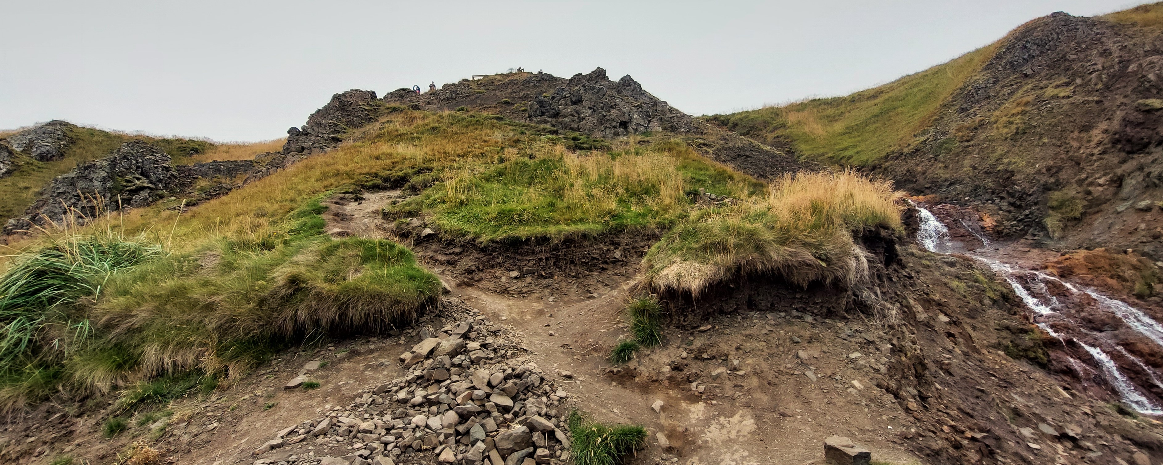
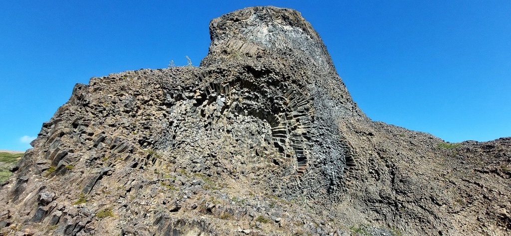
About halfway along the canyon are a couple of trails that we wanted to explore. Hljóðaklettar was a wonderful trail, although it was a bit of a scramble at times. We had the Jökulsá á Fjöllum river as company for some of the way as we weaved our way amongst bizarre basalt rock shapes caused by turbulent volcanic activity.
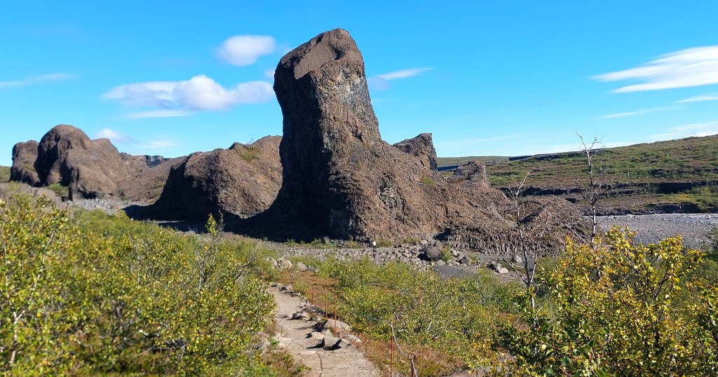
We had been blessed with another warm day so we had a picnic on a bench near a campsite which we had seen on the way here [there were also toilets]. We then returned to take the path to Karl og Kerling [which means old man and old woman]. These are two pillars along the canyon in the opposite direction to the first trail. We spent a wonderful couple of hours on the two walks before we moved on to our next destination.

Réttarfoss
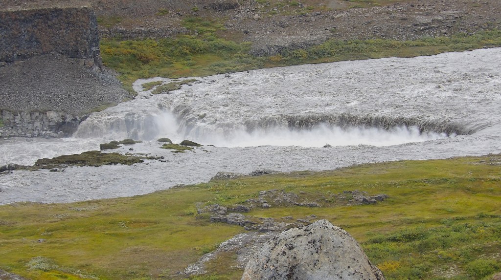
We headed south along the canyon and took a short detour off the main road to have a look at Réttarfoss from a viewing platform. This is in an area known as Hólmatungur and we would have loved to have been able to spend more time here, but it was already mid afternoon and we had plenty more to see and do before reaching Seydisfjordur.
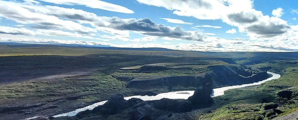
Dettifoss and Selfoss
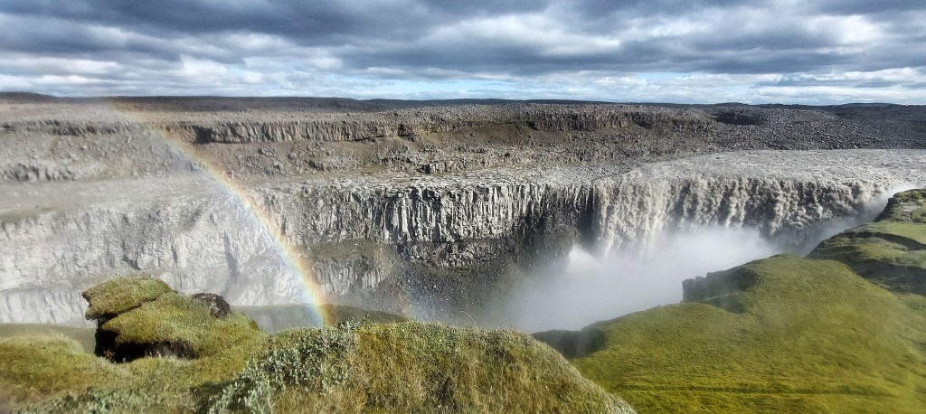
Probably the most well known of Iceland’s waterfalls in the north, Dettifoss is also the most powerful waterfall in Europe. It’s at the southern tip of Jökulsárgljúfur Canyon and the noise and sheer power of the falls are incredible. The car park has toilets and a food stall selling soup. There are several viewing points, you will need your waterproofs!
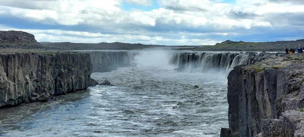
From Dettifoss there’s a short trail to Selfoss which is less well known and although it is smaller than Dettifoss it’s still bloody impressive!
If we had the time we would have loved to have seen Dettifoss from the eastern side for another perspective but we still had another two and half hours of driving ahead of us and it was already late afternoon so we decided to head for Seydisfjordur. I wasn’t too disappointed, it had been another incredible day.
The next leg of our journey continues HERE
Quick Links:
